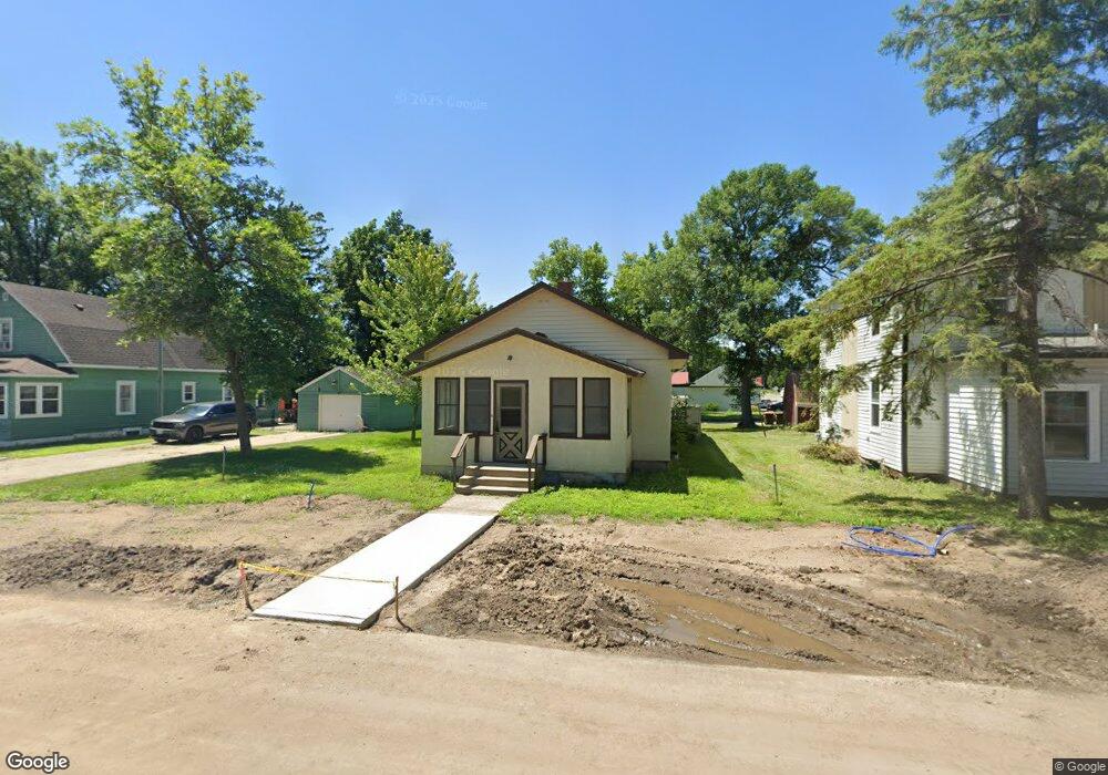
541 Lincoln Ave S South Haven, MN 55382
Estimated Value: $174,000 - $217,000
1
Bed
1
Bath
896
Sq Ft
$215/Sq Ft
Est. Value
About This Home
This home is located at 541 Lincoln Ave S, South Haven, MN 55382 and is currently estimated at $192,399, approximately $214 per square foot. 541 Lincoln Ave S is a home located in Wright County with nearby schools including Annandale Elementary School, Annandale Middle School, and Annandale Senior High School.
Ownership History
Date
Name
Owned For
Owner Type
Purchase Details
Closed on
Apr 7, 2025
Sold by
Meier Makayla and Meier Steven
Bought by
Lesnau Ayden
Current Estimated Value
Home Financials for this Owner
Home Financials are based on the most recent Mortgage that was taken out on this home.
Original Mortgage
$14,000
Outstanding Balance
$11,847
Interest Rate
7.6%
Mortgage Type
New Conventional
Estimated Equity
$180,552
Purchase Details
Closed on
Sep 5, 2018
Sold by
Asp Todd E and Asp Mary K
Bought by
Meier Steven and Meier Makayla
Home Financials for this Owner
Home Financials are based on the most recent Mortgage that was taken out on this home.
Original Mortgage
$108,007
Interest Rate
4.5%
Mortgage Type
FHA
Purchase Details
Closed on
May 6, 2011
Sold by
Mckeown William Glenn and Mckeown Debbie L
Bought by
Asp Todd E
Create a Home Valuation Report for This Property
The Home Valuation Report is an in-depth analysis detailing your home's value as well as a comparison with similar homes in the area
Home Values in the Area
Average Home Value in this Area
Purchase History
| Date | Buyer | Sale Price | Title Company |
|---|---|---|---|
| Lesnau Ayden | $191,000 | Title Mark | |
| Meier Steven | $110,000 | Sherburne Co Abstract & Ttl | |
| Asp Todd E | $81,000 | -- |
Source: Public Records
Mortgage History
| Date | Status | Borrower | Loan Amount |
|---|---|---|---|
| Open | Lesnau Ayden | $14,000 | |
| Open | Lesnau Ayden | $181,450 | |
| Previous Owner | Meier Steven | $108,007 |
Source: Public Records
Tax History Compared to Growth
Tax History
| Year | Tax Paid | Tax Assessment Tax Assessment Total Assessment is a certain percentage of the fair market value that is determined by local assessors to be the total taxable value of land and additions on the property. | Land | Improvement |
|---|---|---|---|---|
| 2025 | $1,508 | $146,400 | $25,000 | $121,400 |
| 2024 | $1,454 | $142,500 | $25,000 | $117,500 |
| 2023 | $1,598 | $133,100 | $19,300 | $113,800 |
| 2022 | $1,458 | $131,800 | $22,600 | $109,200 |
| 2021 | $1,412 | $112,000 | $17,400 | $94,600 |
| 2020 | $1,452 | $106,800 | $16,100 | $90,700 |
| 2019 | $1,562 | $102,300 | $0 | $0 |
| 2018 | $962 | $77,000 | $0 | $0 |
| 2017 | $980 | $43,000 | $0 | $0 |
| 2016 | $962 | $0 | $0 | $0 |
| 2015 | $946 | $0 | $0 | $0 |
| 2014 | -- | $0 | $0 | $0 |
Source: Public Records
Map
Nearby Homes
- 8537 Pittman Ave NW
- 10848 Porter Ave NW
- 10368 Oliver Ave NW
- 16698 109th St NW
- 10399 Reardon Ave NW
- 13934 101st St NW
- 13943 102nd St NW
- 0 80th St NW
- 7327 Quinn Ave NW
- 14XXX County Road 44
- TBD-XXC Pilger Ave NW
- 14264 74th St NW
- 7939 Lake John Dr
- 7620 Lake John Dr
- 7610 Lake John Dr
- 7560 Lake John Dr
- 6157 Quinn Ave NW
- 7550 Lake John Dr
- 7541 Lake John Dr
- 13496 Campfire Cir
- 521 Lincoln Ave
- 440 Custer St
- 511 Lincoln Ave
- 540 Oak Ave N
- 540 Oak Ave S
- 550 Oak Ave N
- 550 Lincoln Ave
- 401 Grant St
- 520 Lincoln Ave
- 611 Lincoln Ave
- 441 Custer St
- 510 Lincoln Ave
- 600 Lincoln Ave
- 500 Highway 55
- 620 Oak Ave N
- 621 Lincoln Ave
- 451 Lincoln Ave S
- 451 Lincoln Ave
- 541 Fairhaven Ave
- 430 Oak Ave N