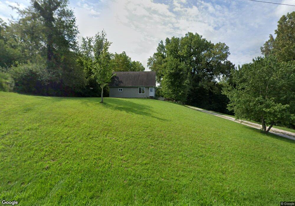
541 Spunky Ridge Rd Meredosia, IL 62665
Estimated Value: $168,000 - $184,779
Studio
--
Bath
--
Sq Ft
5
Acres
About This Home
This home is located at 541 Spunky Ridge Rd, Meredosia, IL 62665 and is currently estimated at $176,390. 541 Spunky Ridge Rd is a home located in Morgan County with nearby schools including Meredosia-Chambersburg Elementary School, Meredosia-Chambersburg Junior High School, and Meredosia-Chambersburg High School.
Ownership History
Date
Name
Owned For
Owner Type
Purchase Details
Closed on
Jan 14, 2008
Sold by
Kennedy Michael A
Bought by
Weber Joshua D
Current Estimated Value
Home Financials for this Owner
Home Financials are based on the most recent Mortgage that was taken out on this home.
Original Mortgage
$76,800
Outstanding Balance
$47,945
Interest Rate
5.95%
Mortgage Type
VA
Estimated Equity
$128,445
Purchase Details
Closed on
Jul 26, 2007
Sold by
Kirbach Christi A
Bought by
Kennedy Michael A
Home Financials for this Owner
Home Financials are based on the most recent Mortgage that was taken out on this home.
Original Mortgage
$39,300
Interest Rate
6.12%
Mortgage Type
New Conventional
Purchase Details
Closed on
Jul 18, 2005
Sold by
Kennedy Michael A
Bought by
Kennedy Michael A and Kirbach Christi A
Home Financials for this Owner
Home Financials are based on the most recent Mortgage that was taken out on this home.
Original Mortgage
$12,000
Interest Rate
6.75%
Mortgage Type
Purchase Money Mortgage
Create a Home Valuation Report for This Property
The Home Valuation Report is an in-depth analysis detailing your home's value as well as a comparison with similar homes in the area
Purchase History
| Date | Buyer | Sale Price | Title Company |
|---|---|---|---|
| Weber Joshua D | $75,000 | None Available | |
| Kennedy Michael A | -- | None Available | |
| Kennedy Michael A | -- | None Available |
Source: Public Records
Mortgage History
| Date | Status | Borrower | Loan Amount |
|---|---|---|---|
| Open | Weber Joshua D | $76,800 | |
| Previous Owner | Kennedy Michael A | $39,300 | |
| Previous Owner | Kennedy Michael A | $12,000 |
Source: Public Records
Tax History
| Year | Tax Paid | Tax Assessment Tax Assessment Total Assessment is a certain percentage of the fair market value that is determined by local assessors to be the total taxable value of land and additions on the property. | Land | Improvement |
|---|---|---|---|---|
| 2024 | $3,155 | $42,450 | $5,500 | $36,950 |
| 2023 | $3,162 | $38,590 | $5,000 | $33,590 |
| 2022 | $2,813 | $38,590 | $5,000 | $33,590 |
| 2021 | $3,098 | $39,750 | $5,000 | $34,750 |
| 2020 | $2,863 | $39,750 | $5,000 | $34,750 |
| 2019 | $2,955 | $39,410 | $5,000 | $34,410 |
| 2018 | $2,774 | $38,260 | $4,850 | $33,410 |
| 2017 | $2,636 | $37,500 | $4,750 | $32,750 |
| 2016 | $1,256 | $21,060 | $4,750 | $16,310 |
| 2015 | $997 | $17,700 | $3,990 | $13,710 |
| 2014 | $997 | $17,350 | $3,910 | $13,440 |
| 2013 | $939 | $17,350 | $3,910 | $13,440 |
Source: Public Records
Map
Nearby Homes
- 649 Arenzville Rd
- 314 Eagle Dr
- 318 Eagle Dr
- 0 Eagle Dr
- 201 Locust
- 207 Locust
- 1125 Eagle Dr
- 521 Pearl
- 142 S Green St
- 328 S Washington
- 313 Johnson Rd
- 2380 McKendree Chapel Rd
- 720 Morgan St
- 718 Superior St
- 615 Ash St
- 617 Railroad St
- 0 Island Ln
- 205 E Main St
- 2275 Concord Arenzville Rd
- 305 E Frederick St
Your Personal Tour Guide
Ask me questions while you tour the home.