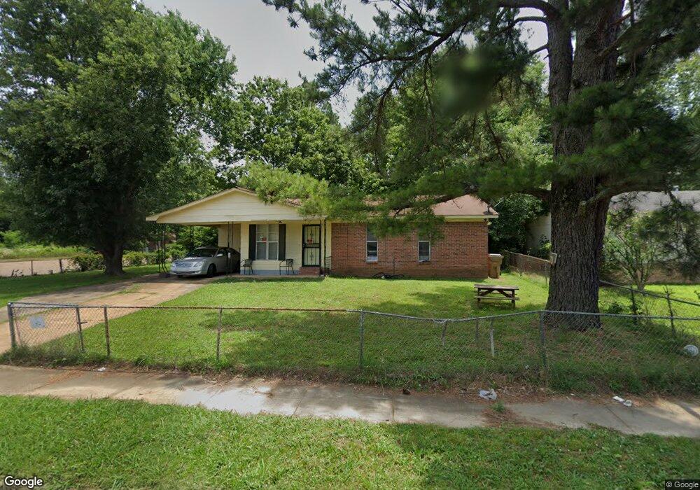
5410 Cedar Bluff Dr Memphis, TN 38127
Estimated Value: $81,000 - $106,000
3
Beds
2
Baths
1,152
Sq Ft
$81/Sq Ft
Est. Value
About This Home
This home is located at 5410 Cedar Bluff Dr, Memphis, TN 38127 and is currently estimated at $93,387, approximately $81 per square foot. 5410 Cedar Bluff Dr is a home located in Shelby County with nearby schools including Northaven Elementary School, Woodstock Middle School, and Trezevant High School.
Ownership History
Date
Name
Owned For
Owner Type
Purchase Details
Closed on
Jan 18, 2013
Sold by
Homes 4 U Llc
Bought by
Baxter Billy C and Baxter Barbara
Current Estimated Value
Purchase Details
Closed on
Oct 14, 2008
Sold by
Baxter Billy
Bought by
Homes 4 U Llc
Purchase Details
Closed on
Aug 18, 2006
Sold by
Wells Fargo Bank Na
Bought by
Baxter Billy
Purchase Details
Closed on
Jun 15, 2006
Sold by
Jones Marilyn Valentine and Jones Brian C
Bought by
Wells Fargo Bank Na and Option One Woodbridge Loan Trust 2003-2
Purchase Details
Closed on
May 22, 2001
Sold by
Valentine Dorothy
Bought by
Jones Marilyn Valentine
Create a Home Valuation Report for This Property
The Home Valuation Report is an in-depth analysis detailing your home's value as well as a comparison with similar homes in the area
Home Values in the Area
Average Home Value in this Area
Purchase History
| Date | Buyer | Sale Price | Title Company |
|---|---|---|---|
| Baxter Billy C | -- | None Available | |
| Homes 4 U Llc | -- | None Available | |
| Baxter Billy | $25,000 | Lehman Land Title Inc | |
| Wells Fargo Bank Na | $29,750 | None Available | |
| Jones Marilyn Valentine | -- | -- |
Source: Public Records
Tax History Compared to Growth
Tax History
| Year | Tax Paid | Tax Assessment Tax Assessment Total Assessment is a certain percentage of the fair market value that is determined by local assessors to be the total taxable value of land and additions on the property. | Land | Improvement |
|---|---|---|---|---|
| 2025 | $444 | $22,175 | $2,000 | $20,175 |
| 2024 | $444 | $13,100 | $1,475 | $11,625 |
| 2023 | $444 | $13,100 | $1,475 | $11,625 |
| 2022 | $444 | $13,100 | $1,475 | $11,625 |
| 2021 | $452 | $13,100 | $1,475 | $11,625 |
| 2020 | $363 | $8,975 | $1,475 | $7,500 |
| 2019 | $0 | $8,975 | $1,475 | $7,500 |
| 2018 | $363 | $8,975 | $1,475 | $7,500 |
| 2017 | $369 | $8,975 | $1,475 | $7,500 |
| 2016 | $440 | $10,075 | $0 | $0 |
| 2014 | $440 | $10,075 | $0 | $0 |
Source: Public Records
Map
Nearby Homes
- 5387 Cornstalk Cove
- 5371 Cedar Bluff Dr
- 5423 Breckenwood Dr
- 823 Bitter Creek Cove
- 5378 Beaverton Dr
- 5382 Beaverton Dr
- 5315 Braden Dr
- 5080 Breckenwood Dr
- 5096 Belfast Dr
- 5140 Blacksmith Dr
- 645 Mcwhirter Ave
- 5046 Breckenwood Dr
- 936 Chesterton Dr
- 5030 Breckenwood Dr
- 5072 Blacksmith Dr
- 980 N Circle Rd
- 766 Fite Rd
- 850 Carol Ann Cove
- 810 Northaven Dr
- 706 Northaven Dr
- 5404 Cedar Bluff Dr
- 5397 Cornstalk Cove
- 5401 Cornstalk Cove
- 5398 Cedar Bluff Dr
- 5409 Cedar Bluff Dr
- 5393 Cornstalk Cove
- 5392 Cedar Bluff Dr
- 5404 Cornstalk Cove
- 5403 Clinchport Cir
- 5386 Cedar Bluff Dr
- 5381 Cornstalk Cove
- 5399 Clinchport Cir
- 5402 Clinchport Cir
- 5400 Cornstalk Cove
- 976 Robertson Rd
- 5387 Cedar Bluff Dr
- 5396 Cornstalk Cove
- 5378 Cedar Bluff Dr
- 5392 Cornstalk Cove
- 5375 Cornstalk Cove