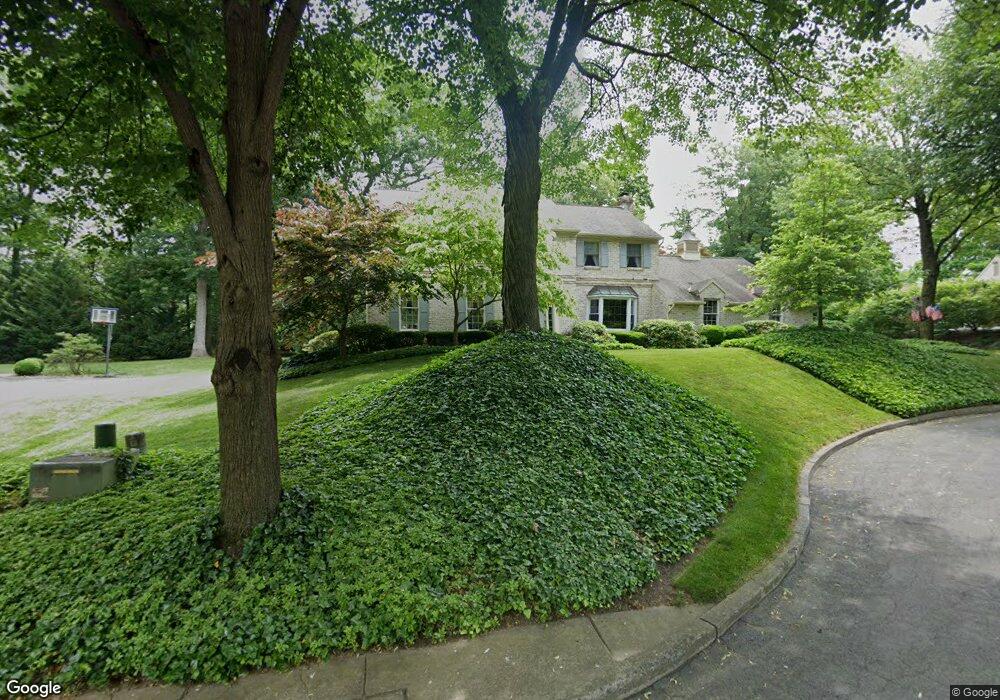
5410 Hanover Dr Allentown, PA 18106
Estimated Value: $509,000 - $596,000
4
Beds
3
Baths
2,784
Sq Ft
$197/Sq Ft
Est. Value
About This Home
This home is located at 5410 Hanover Dr, Allentown, PA 18106 and is currently estimated at $548,762, approximately $197 per square foot. 5410 Hanover Dr is a home located in Lehigh County with nearby schools including Wescosville Elementary School, Lower Macungie Middle School, and Emmaus High School.
Ownership History
Date
Name
Owned For
Owner Type
Purchase Details
Closed on
Sep 16, 2016
Sold by
Jackson Dennis M and Jackson Andrea M B
Bought by
Jackson Dennis M and Jackson Andrea M B
Current Estimated Value
Purchase Details
Closed on
Aug 29, 1997
Sold by
Jackson Dennis M and Jackson Andrea M
Bought by
Jackson Dennis M and Jackson Andrea M B
Purchase Details
Closed on
Feb 28, 1986
Sold by
Don Frederick Realtors Inc
Bought by
Jackson Dennis M and Jackson Andrea M
Purchase Details
Closed on
Dec 29, 1983
Bought by
Don Frederick Realtors Inc
Create a Home Valuation Report for This Property
The Home Valuation Report is an in-depth analysis detailing your home's value as well as a comparison with similar homes in the area
Home Values in the Area
Average Home Value in this Area
Purchase History
| Date | Buyer | Sale Price | Title Company |
|---|---|---|---|
| Jackson Dennis M | -- | Attorney | |
| Jackson Dennis M | -- | -- | |
| Jackson Dennis M | $169,000 | -- | |
| Don Frederick Realtors Inc | $22,000 | -- |
Source: Public Records
Tax History Compared to Growth
Tax History
| Year | Tax Paid | Tax Assessment Tax Assessment Total Assessment is a certain percentage of the fair market value that is determined by local assessors to be the total taxable value of land and additions on the property. | Land | Improvement |
|---|---|---|---|---|
| 2025 | $7,210 | $282,400 | $39,800 | $242,600 |
| 2024 | $6,975 | $282,400 | $39,800 | $242,600 |
| 2023 | $6,836 | $282,400 | $39,800 | $242,600 |
| 2022 | $6,674 | $282,400 | $242,600 | $39,800 |
| 2021 | $6,532 | $282,400 | $39,800 | $242,600 |
| 2020 | $6,470 | $282,400 | $39,800 | $242,600 |
| 2019 | $6,360 | $282,400 | $39,800 | $242,600 |
| 2018 | $6,276 | $282,400 | $39,800 | $242,600 |
| 2017 | $6,167 | $282,400 | $39,800 | $242,600 |
| 2016 | -- | $282,400 | $39,800 | $242,600 |
| 2015 | -- | $282,400 | $39,800 | $242,600 |
| 2014 | -- | $282,400 | $39,800 | $242,600 |
Source: Public Records
Map
Nearby Homes
- 5300 Hanover Dr
- 997 Village Round Unit K
- 997K Village Round Unit 104K
- 5524 Stonecroft Ln
- 5673 Wedge Ln
- 5619 Stonecroft Ln
- 5475 Hamilton Blvd Unit 7
- 5736 Greens Dr
- 1385 Brookside Rd
- 4881 Spruce Rd
- 5133 Meadow Ln
- 5280 Townsquare Dr
- 1675 Hamlet Dr
- 4626 N Hedgerow Dr
- 1270 Minesite Rd
- 6179 Fairway Ln
- 1045 Barnside Rd
- 6007 Timberknoll Dr
- 6126 Palomino Dr
- 5175 Meadowview Dr
- 5420 Hanover Dr
- 5400 Hanover Dr
- 1155 Jaime Cir
- 5405 Andrea Dr
- 5411 Hanover Dr
- 5421 Hanover Dr
- 1197 Shiloh Rd
- 1197 Shiloh Rd Unit 2
- 1142 Jaime Cir
- 5401 Hanover Dr
- 5391 Andrea Dr
- 5394 Hanover Dr
- 5415 Andrea Dr
- 1192 Shiloh Rd
- 5391 Hanover Dr
- 5384 Hanover Dr
- 5371 Andrea Dr
- 1151 Jaime Cir
- 1213 Shiloh Rd
- 1138 Jaime Cir