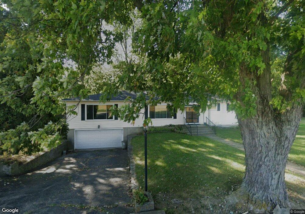
5411 River Rd Springfield, OH 45502
Estimated Value: $179,000 - $355,000
2
Beds
1
Bath
1,848
Sq Ft
$147/Sq Ft
Est. Value
About This Home
This home is located at 5411 River Rd, Springfield, OH 45502 and is currently estimated at $271,305, approximately $146 per square foot. 5411 River Rd is a home located in Clark County with nearby schools including Northwestern Elementary School, Northwestern Junior/Senior High School, and Emmanuel Christian Academy.
Ownership History
Date
Name
Owned For
Owner Type
Purchase Details
Closed on
Jul 28, 2021
Sold by
Stone Paul and Stone Penelope
Bought by
Terry Paulette Gaines and Stone Ozetta Jean
Current Estimated Value
Purchase Details
Closed on
Feb 20, 2017
Sold by
Mcconnell Leathia Katherine and Mcconnell Leathia Kathryn
Bought by
Stone Ozetta Jean and Terry Paulette Gaines
Purchase Details
Closed on
Apr 1, 1980
Sold by
Stone Paul and Stone Penelope
Bought by
Terry Paulette Gaines
Create a Home Valuation Report for This Property
The Home Valuation Report is an in-depth analysis detailing your home's value as well as a comparison with similar homes in the area
Purchase History
| Date | Buyer | Sale Price | Title Company |
|---|---|---|---|
| Terry Paulette Gaines | -- | None Available | |
| Stone Ozetta Jean | -- | None Available | |
| Terry Paulette Gaines | -- | -- |
Source: Public Records
Tax History
| Year | Tax Paid | Tax Assessment Tax Assessment Total Assessment is a certain percentage of the fair market value that is determined by local assessors to be the total taxable value of land and additions on the property. | Land | Improvement |
|---|---|---|---|---|
| 2025 | $2,645 | $80,220 | $18,180 | $62,040 |
| 2024 | $2,542 | $64,630 | $15,100 | $49,530 |
| 2023 | $2,542 | $64,630 | $15,100 | $49,530 |
| 2022 | $2,632 | $64,630 | $15,100 | $49,530 |
| 2021 | $2,199 | $50,220 | $11,530 | $38,690 |
| 2020 | $2,220 | $50,220 | $11,530 | $38,690 |
| 2019 | $2,200 | $50,220 | $11,530 | $38,690 |
| 2018 | $1,969 | $45,180 | $10,480 | $34,700 |
| 2017 | $2,440 | $45,178 | $10,479 | $34,699 |
| 2016 | $1,931 | $45,178 | $10,479 | $34,699 |
| 2015 | $1,900 | $44,615 | $10,479 | $34,136 |
| 2014 | $1,899 | $44,615 | $10,479 | $34,136 |
| 2013 | $1,886 | $44,615 | $10,479 | $34,136 |
Source: Public Records
Map
Nearby Homes
- 0 Moorefield Rd
- 4242 Upper Valley Pike
- 1461 W County Line Rd
- 335 Willow Rd
- 593 Hiser Ave
- 4211 Grey Stone Crossing
- 937 Willow Rd
- 4741 Cullen Ave
- 4328 Pine Tree Place
- 6250 Willowdale Rd
- 4343 Burchill St
- 4802 Willowbrook Dr
- 5564 Ridgewood Rd W
- 1469 Victorian Way
- 1495 Victorian Way
- 5646 Springfield-Urbana Pike Unit Lot 30
- 5646 Springfield-Urbana Pike Unit 96
- 5646 Springfield-Urbana Pike Unit Lot 90
- 5646 Springfield-Urbana Pike Unit Lot 61
- 5646 Springfield-Urbana Pike Unit Lot 127
- 5281 River Rd
- 0 Tremont City Rd Unit 1015114
- 0 Tremont City Rd Unit 1015115
- 0 Tremont City Rd Unit 221045822
- 1531 Tremont City Rd
- 4823 River Rd
- 1571 Tremont City Rd
- 1619 Tremont City Rd
- 5302 Upper Valley Pike
- 5502 Upper Valley Pike
- 1665 Tremont City Rd
- 5373 Upper Valley Pike
- 1701 Tremont City Rd
- 5185 Upper Valley Pike
- 1721 Tremont City Rd
- 1733 Tremont City Rd
- 5441 Upper Valley Pike
- 115 E Main St
- 208 Main St
- 202 E Main St
Your Personal Tour Guide
Ask me questions while you tour the home.