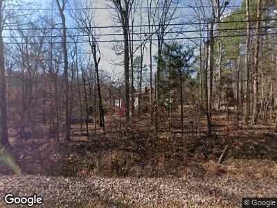
5415 Craig Rd Durham, NC 27712
Estimated Value: $470,000 - $594,000
5
Beds
3
Baths
2,688
Sq Ft
$189/Sq Ft
Est. Value
About This Home
This home is located at 5415 Craig Rd, Durham, NC 27712 and is currently estimated at $507,314, approximately $188 per square foot. 5415 Craig Rd is a home located in Durham County with nearby schools including Eno Valley Elementary, George L Carrington Middle, and Northern High School.
Ownership History
Date
Name
Owned For
Owner Type
Purchase Details
Closed on
Jan 31, 2001
Sold by
Smith Jeff E
Bought by
Harris Robert M and Harris Gladys
Current Estimated Value
Home Financials for this Owner
Home Financials are based on the most recent Mortgage that was taken out on this home.
Original Mortgage
$75,937
Interest Rate
7.02%
Mortgage Type
VA
Create a Home Valuation Report for This Property
The Home Valuation Report is an in-depth analysis detailing your home's value as well as a comparison with similar homes in the area
Home Values in the Area
Average Home Value in this Area
Purchase History
| Date | Buyer | Sale Price | Title Company |
|---|---|---|---|
| Harris Robert M | $165,000 | -- |
Source: Public Records
Mortgage History
| Date | Status | Borrower | Loan Amount |
|---|---|---|---|
| Open | Harris Robert Murray | $345,800 | |
| Closed | Harris Robert M | $216,300 | |
| Closed | Harris Robert M | $41,610 | |
| Closed | Harris Robert M | $35,000 | |
| Closed | Harris Robert M | $128,000 | |
| Previous Owner | Harris Robert M | $75,937 |
Source: Public Records
Tax History Compared to Growth
Tax History
| Year | Tax Paid | Tax Assessment Tax Assessment Total Assessment is a certain percentage of the fair market value that is determined by local assessors to be the total taxable value of land and additions on the property. | Land | Improvement |
|---|---|---|---|---|
| 2024 | $2,336 | $270,864 | $57,312 | $213,552 |
| 2023 | $2,215 | $270,871 | $57,318 | $213,553 |
| 2022 | $1,903 | $244,495 | $57,318 | $187,177 |
| 2021 | $1,690 | $244,495 | $57,318 | $187,177 |
| 2020 | $1,655 | $244,495 | $57,318 | $187,177 |
| 2019 | $1,655 | $244,495 | $57,318 | $187,177 |
| 2018 | $1,635 | $228,027 | $41,710 | $186,317 |
| 2017 | $1,617 | $228,027 | $41,710 | $186,317 |
| 2016 | $1,909 | $270,603 | $41,710 | $228,893 |
| 2015 | $1,671 | $215,260 | $39,980 | $175,280 |
| 2014 | $1,671 | $215,260 | $39,980 | $175,280 |
Source: Public Records
Map
Nearby Homes
- 1310 Country Club Dr
- 5743 Craig Rd
- 2004 Stepping Stone Ln Unit 165
- 2020 Stepping Stone Ln Unit 161
- 2100 Stepping Stone Ln Unit 160
- 6208 Craig Rd
- 3035 Tavistock Dr
- 2418 Mont Haven Dr
- 119 November Dr
- 109 November Dr
- 111 November Dr
- 115 Perth Place
- 202 Brook Ln
- 216 Brook Ln
- 2222 Umstead Rd
- 5802 Lillie Dr
- 5632 Falkirk Dr
- 5021 Lansdowne Dr
- 5642 Falkirk Dr
- 5710 Russell Rd
