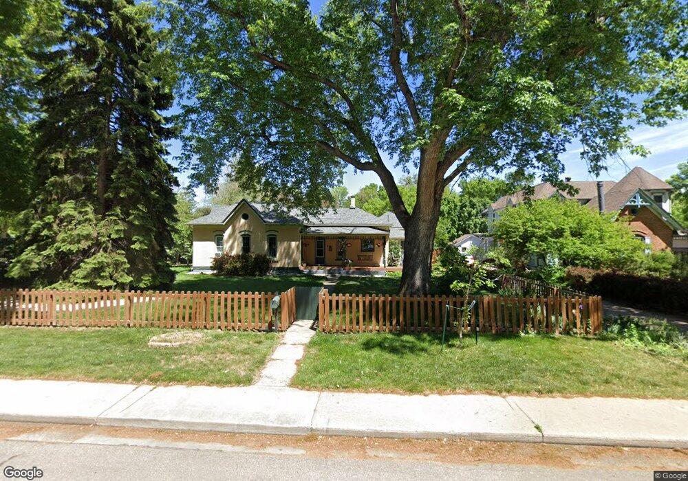
542 Collyer St Longmont, CO 80501
Kensington NeighborhoodEstimated Value: $706,000 - $806,000
3
Beds
2
Baths
1,748
Sq Ft
$428/Sq Ft
Est. Value
About This Home
This home is located at 542 Collyer St, Longmont, CO 80501 and is currently estimated at $748,677, approximately $428 per square foot. 542 Collyer St is a home located in Boulder County with nearby schools including Columbine Elementary School, Trail Ridge Middle School, and Skyline High School.
Ownership History
Date
Name
Owned For
Owner Type
Purchase Details
Closed on
Aug 2, 2016
Sold by
Hanceford Stephen H
Bought by
Denning Kelsey Blair
Current Estimated Value
Home Financials for this Owner
Home Financials are based on the most recent Mortgage that was taken out on this home.
Original Mortgage
$484,500
Outstanding Balance
$391,367
Interest Rate
3.87%
Mortgage Type
Adjustable Rate Mortgage/ARM
Estimated Equity
$357,310
Purchase Details
Closed on
Dec 20, 2006
Sold by
Bloemker Ryan S and Bloemker Lori A
Bought by
Hanceford Stephen H
Home Financials for this Owner
Home Financials are based on the most recent Mortgage that was taken out on this home.
Original Mortgage
$239,200
Interest Rate
6.27%
Mortgage Type
Purchase Money Mortgage
Purchase Details
Closed on
May 21, 2004
Sold by
Ravis Barbara M
Bought by
Bloemker Ryan S
Home Financials for this Owner
Home Financials are based on the most recent Mortgage that was taken out on this home.
Original Mortgage
$178,400
Interest Rate
4.75%
Mortgage Type
Purchase Money Mortgage
Purchase Details
Closed on
Jun 27, 1997
Sold by
Dalke Roger Alan
Bought by
Ravis Barbara M
Home Financials for this Owner
Home Financials are based on the most recent Mortgage that was taken out on this home.
Original Mortgage
$97,500
Interest Rate
7.93%
Purchase Details
Closed on
Aug 1, 1995
Sold by
Dalke Adele Elizabeth and Dalke Adele E
Bought by
Dalke Roger Alan
Purchase Details
Closed on
Jan 28, 1994
Sold by
Rothauge Fredy A
Bought by
Dalke Roger Alan
Home Financials for this Owner
Home Financials are based on the most recent Mortgage that was taken out on this home.
Original Mortgage
$120,000
Interest Rate
7.16%
Purchase Details
Closed on
Nov 19, 1993
Sold by
Rothauge Fredy A and Rothauge Susan A
Bought by
Rothauge Fredy A
Purchase Details
Closed on
Jun 14, 1984
Bought by
Blair Denning Kelsey and Jones Tyler Robert
Create a Home Valuation Report for This Property
The Home Valuation Report is an in-depth analysis detailing your home's value as well as a comparison with similar homes in the area
Home Values in the Area
Average Home Value in this Area
Purchase History
| Date | Buyer | Sale Price | Title Company |
|---|---|---|---|
| Denning Kelsey Blair | $510,000 | Land Title Guarantee | |
| Hanceford Stephen H | $299,000 | Land Title Guarantee Company | |
| Bloemker Ryan S | $223,000 | Ht | |
| Ravis Barbara M | $155,000 | First American Heritage Titl | |
| Dalke Roger Alan | -- | -- | |
| Dalke Roger Alan | $150,000 | -- | |
| Rothauge Fredy A | -- | -- | |
| Blair Denning Kelsey | $71,400 | -- |
Source: Public Records
Mortgage History
| Date | Status | Borrower | Loan Amount |
|---|---|---|---|
| Open | Denning Kelsey Blair | $484,500 | |
| Previous Owner | Hanceford Stephen H | $239,200 | |
| Previous Owner | Bloemker Ryan S | $178,400 | |
| Previous Owner | Ravis Barbara M | $97,500 | |
| Previous Owner | Dalke Roger Alan | $120,000 | |
| Closed | Bloemker Ryan S | $22,300 |
Source: Public Records
Tax History Compared to Growth
Tax History
| Year | Tax Paid | Tax Assessment Tax Assessment Total Assessment is a certain percentage of the fair market value that is determined by local assessors to be the total taxable value of land and additions on the property. | Land | Improvement |
|---|---|---|---|---|
| 2025 | $4,693 | $46,013 | $10,344 | $35,669 |
| 2024 | $4,693 | $46,013 | $10,344 | $35,669 |
| 2023 | $4,629 | $49,064 | $11,598 | $41,151 |
| 2022 | $4,082 | $41,255 | $8,145 | $33,110 |
| 2021 | $4,135 | $42,443 | $8,380 | $34,063 |
| 2020 | $3,683 | $37,917 | $9,367 | $28,550 |
| 2019 | $3,625 | $37,917 | $9,367 | $28,550 |
| 2018 | $3,437 | $36,187 | $9,792 | $26,395 |
| 2017 | $3,391 | $40,007 | $10,826 | $29,181 |
| 2016 | $2,601 | $27,215 | $7,960 | $19,255 |
| 2015 | $2,479 | $25,663 | $12,020 | $13,643 |
| 2014 | $2,397 | $25,663 | $12,020 | $13,643 |
Source: Public Records
Map
Nearby Homes
- 531 Atwood St
- 643 Collyer St
- 400 Emery St Unit 302
- 400 Emery St Unit 208
- 417 Emery St
- 428 Baker St
- 348 Collyer St Unit 105
- 727 Baker St
- 641 Martin St
- 736 Kimbark St
- 29 Marshall Place
- 823 Collyer St
- 820 Kimbark St Unit D
- 830 Emery St
- 836 Emery St
- 342 9th Ave
- 36 Reed Place
- 845 Martin St
- 409 Terry St Unit D
- 409 Terry St Unit B