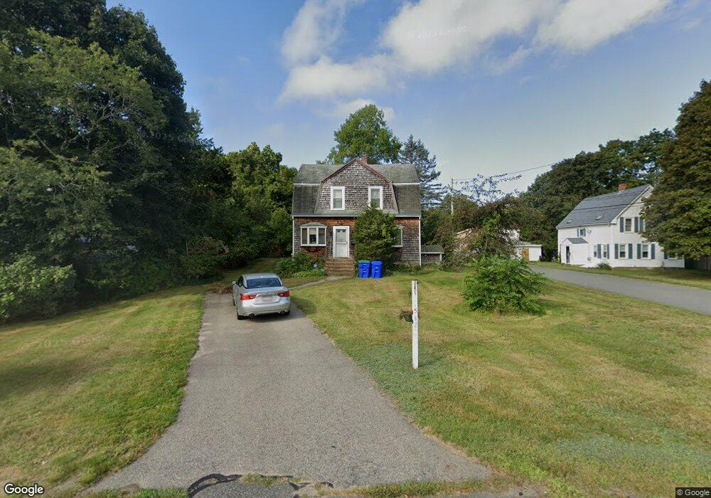
542 Liberty St Rockland, MA 02370
Estimated Value: $445,000 - $511,000
--
Bed
2
Baths
1,322
Sq Ft
$365/Sq Ft
Est. Value
About This Home
This home is located at 542 Liberty St, Rockland, MA 02370 and is currently estimated at $482,115, approximately $364 per square foot. 542 Liberty St is a home located in Plymouth County with nearby schools including Rockland Senior High School, Calvary Chapel Academy, and St Bridget School.
Create a Home Valuation Report for This Property
The Home Valuation Report is an in-depth analysis detailing your home's value as well as a comparison with similar homes in the area
Home Values in the Area
Average Home Value in this Area
Tax History Compared to Growth
Tax History
| Year | Tax Paid | Tax Assessment Tax Assessment Total Assessment is a certain percentage of the fair market value that is determined by local assessors to be the total taxable value of land and additions on the property. | Land | Improvement |
|---|---|---|---|---|
| 2025 | $5,577 | $408,000 | $217,800 | $190,200 |
| 2024 | $5,413 | $385,000 | $205,400 | $179,600 |
| 2023 | $5,529 | $363,300 | $198,400 | $164,900 |
| 2022 | $5,295 | $316,100 | $172,500 | $143,600 |
| 2021 | $4,870 | $281,800 | $156,800 | $125,000 |
| 2020 | $4,697 | $268,400 | $149,300 | $119,100 |
| 2019 | $4,584 | $255,800 | $142,200 | $113,600 |
| 2018 | $4,373 | $240,000 | $142,200 | $97,800 |
| 2017 | $4,274 | $231,300 | $142,200 | $89,100 |
| 2016 | $4,114 | $222,500 | $136,800 | $85,700 |
| 2015 | $4,055 | $213,100 | $127,800 | $85,300 |
| 2014 | $3,703 | $201,900 | $125,400 | $76,500 |
Source: Public Records
Map
Nearby Homes
- 507 Liberty St
- 83 Summit St
- 13 Dyer St Unit 13
- 14 Dyer St Unit 14
- 12 Dyer St Unit 12
- 63 Webster St
- 354 Webster St
- 45-47 Park St
- 436 E Water St
- 737-739 Union St
- 100 North Ave
- 775 Union St
- 1 Canterbury Ln
- 9 Juniper Cir
- 206-208 Hinghm St
- 35-37 Salem St
- 5 Juniper Cir
- 10 Horn Beam St Unit 299
- 6 Chestnut Cir
- 122 Reed St