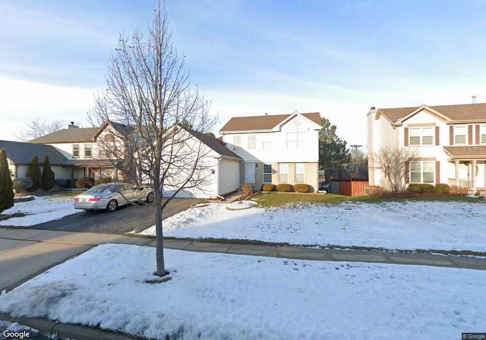
542 Maple Dr Streamwood, IL 60107
Estimated Value: $404,877 - $430,000
3
Beds
3
Baths
1,814
Sq Ft
$231/Sq Ft
Est. Value
About This Home
This home is located at 542 Maple Dr, Streamwood, IL 60107 and is currently estimated at $419,219, approximately $231 per square foot. 542 Maple Dr is a home located in Cook County with nearby schools including Heritage Elementary School, Tefft Middle School, and Streamwood High School.
Ownership History
Date
Name
Owned For
Owner Type
Purchase Details
Closed on
Jan 22, 2007
Sold by
Akurati Ramesh and Akurati Rajani
Bought by
Vasnani Dharam
Current Estimated Value
Home Financials for this Owner
Home Financials are based on the most recent Mortgage that was taken out on this home.
Original Mortgage
$240,000
Outstanding Balance
$143,024
Interest Rate
6.16%
Mortgage Type
Unknown
Estimated Equity
$276,195
Purchase Details
Closed on
Sep 16, 1998
Sold by
Lilly Michael and Lilly Mary
Bought by
Akurati Ramesh and Akurati Rajani
Home Financials for this Owner
Home Financials are based on the most recent Mortgage that was taken out on this home.
Original Mortgage
$180,500
Interest Rate
6.97%
Purchase Details
Closed on
Feb 10, 1997
Sold by
Lakewood Streams Ltd Partnership
Bought by
Lilly Michael
Home Financials for this Owner
Home Financials are based on the most recent Mortgage that was taken out on this home.
Original Mortgage
$199,700
Interest Rate
7.93%
Create a Home Valuation Report for This Property
The Home Valuation Report is an in-depth analysis detailing your home's value as well as a comparison with similar homes in the area
Home Values in the Area
Average Home Value in this Area
Purchase History
| Date | Buyer | Sale Price | Title Company |
|---|---|---|---|
| Vasnani Dharam | $312,500 | Republic Title Company | |
| Akurati Ramesh | $190,000 | -- | |
| Lilly Michael | $210,500 | -- |
Source: Public Records
Mortgage History
| Date | Status | Borrower | Loan Amount |
|---|---|---|---|
| Open | Vasnani Dharam | $240,000 | |
| Previous Owner | Akurati Ramesh | $180,500 | |
| Previous Owner | Lilly Michael | $199,700 |
Source: Public Records
Tax History Compared to Growth
Tax History
| Year | Tax Paid | Tax Assessment Tax Assessment Total Assessment is a certain percentage of the fair market value that is determined by local assessors to be the total taxable value of land and additions on the property. | Land | Improvement |
|---|---|---|---|---|
| 2024 | $8,904 | $32,000 | $4,774 | $27,226 |
| 2023 | $8,637 | $32,000 | $4,774 | $27,226 |
| 2022 | $8,637 | $32,000 | $4,774 | $27,226 |
| 2021 | $6,968 | $22,323 | $3,239 | $19,084 |
| 2020 | $6,931 | $22,323 | $3,239 | $19,084 |
| 2019 | $6,942 | $25,083 | $3,239 | $21,844 |
| 2018 | $7,835 | $25,617 | $2,898 | $22,719 |
| 2017 | $7,748 | $25,617 | $2,898 | $22,719 |
| 2016 | $7,509 | $25,617 | $2,898 | $22,719 |
| 2015 | $7,084 | $22,543 | $2,557 | $19,986 |
| 2014 | $7,895 | $22,543 | $2,557 | $19,986 |
| 2013 | $7,650 | $22,543 | $2,557 | $19,986 |
Source: Public Records
Map
Nearby Homes
- 128 Sycamore Ave
- 719 Lacy Ave
- 511 Freeman Ave
- 804 Bussey Ct
- 617 Arnold Ave
- 819 Robinson Ave
- 406 Library Ln
- 6988 Plumtree Ln
- 105 N Chase Ave
- 110 N Chase Ave
- 4018 Oxford Ct
- 4077 Club Tree Dr
- 7411 Astor Ave
- 434 Locksley Dr
- 406 Locksley Dr
- 3098 Lynnwood Ct
- 821 Surrey Dr
- 2040 Poplar Ave
- 2110 Cherry Ave
- 1019 Stratford Cir