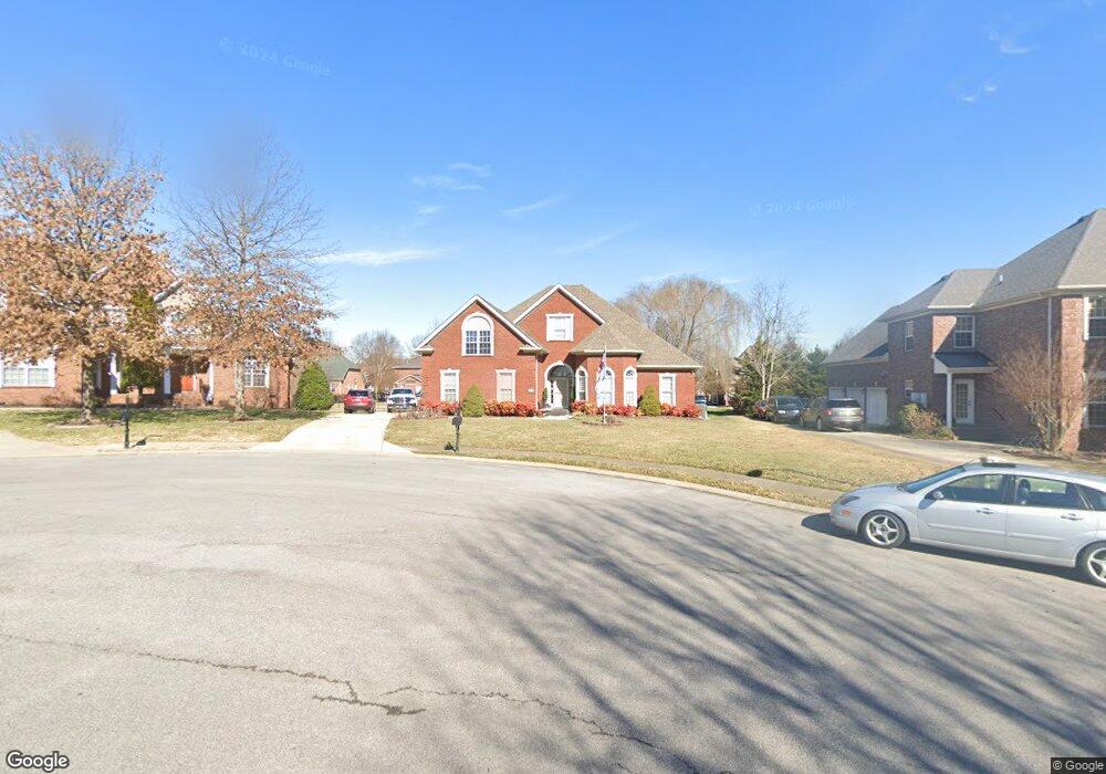
5422 Sherrington Rd Murfreesboro, TN 37128
Estimated Value: $700,823 - $782,000
5
Beds
5
Baths
4,252
Sq Ft
$172/Sq Ft
Est. Value
About This Home
This home is located at 5422 Sherrington Rd, Murfreesboro, TN 37128 and is currently estimated at $732,206, approximately $172 per square foot. 5422 Sherrington Rd is a home located in Rutherford County with nearby schools including Blackman Elementary School, Overall Creek Elementary School, and Blackman Middle School.
Ownership History
Date
Name
Owned For
Owner Type
Purchase Details
Closed on
May 13, 2005
Sold by
Superior Built Homes Llc
Bought by
Henegar Fred J and Henegar Debra A
Current Estimated Value
Home Financials for this Owner
Home Financials are based on the most recent Mortgage that was taken out on this home.
Original Mortgage
$350,000
Outstanding Balance
$182,023
Interest Rate
5.8%
Mortgage Type
Purchase Money Mortgage
Estimated Equity
$550,183
Create a Home Valuation Report for This Property
The Home Valuation Report is an in-depth analysis detailing your home's value as well as a comparison with similar homes in the area
Home Values in the Area
Average Home Value in this Area
Purchase History
| Date | Buyer | Sale Price | Title Company |
|---|---|---|---|
| Henegar Fred J | $394,900 | -- |
Source: Public Records
Mortgage History
| Date | Status | Borrower | Loan Amount |
|---|---|---|---|
| Open | Henegar Fred J | $350,000 |
Source: Public Records
Tax History Compared to Growth
Tax History
| Year | Tax Paid | Tax Assessment Tax Assessment Total Assessment is a certain percentage of the fair market value that is determined by local assessors to be the total taxable value of land and additions on the property. | Land | Improvement |
|---|---|---|---|---|
| 2025 | $4,160 | $147,050 | $16,875 | $130,175 |
| 2024 | $4,160 | $147,050 | $16,875 | $130,175 |
| 2023 | $2,759 | $147,050 | $16,875 | $130,175 |
| 2022 | $2,377 | $147,050 | $16,875 | $130,175 |
| 2021 | $2,365 | $106,550 | $16,875 | $89,675 |
| 2020 | $2,365 | $106,550 | $16,875 | $89,675 |
| 2019 | $2,365 | $106,550 | $16,875 | $89,675 |
| 2018 | $3,249 | $106,550 | $0 | $0 |
| 2017 | $3,481 | $89,550 | $0 | $0 |
| 2016 | $3,481 | $89,550 | $0 | $0 |
| 2015 | $3,481 | $89,550 | $0 | $0 |
| 2014 | $2,227 | $89,550 | $0 | $0 |
| 2013 | -- | $89,500 | $0 | $0 |
Source: Public Records
Map
Nearby Homes
- 2108 Olmstead Ct
- 5227 Starnes Dr
- 4814 Saint Ives Dr
- 5408 Middlebury Dr
- 5350 Tony Lama Ln
- 1232 Stockwell Dr
- 1235 Timber Creek Dr
- 5309 Perlou Ln
- 5108 Saint Ives Dr
- 629 Brinkley Rd
- 5313 Eiffel Ct
- 5443 Cloister Dr
- 4826 Trevino Ct
- 548 Brinkley Rd
- 827 Stovers Glen Dr
- 814 Stovers Glen
- 802 Licinius Ln
- 5050 Creekside Dr
- 826 Licinius Ln
- 4670 Forsman Ct
- 5418 Sherrington Rd
- 5426 Sherrington Rd
- 5421 Cavendish Dr
- 5414 Sherrington Rd
- 5425 Cavendish Dr
- 5427 Sherrington Rd
- 5702 Colchester Ct
- 5429 Cavendish Dr
- 5413 Cavendish Dr
- 5419 Sherrington Rd
- 5410 Sherrington Rd
- 5423 Sherrington Rd
- 5415 Sherrington Rd
- 5706 Colchester Ct
- 5433 Cavendish Dr
- 5703 Colchester Ct
- 5409 Cavendish Dr
- 5411 Sherrington Rd
- 5437 Cavendish Dr
- 1135 Olmstead Dr