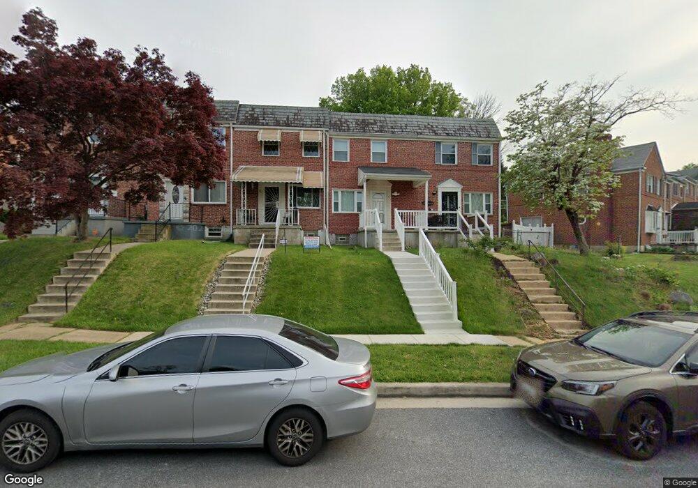
5423 Masefield Rd Baltimore, MD 21229
Estimated Value: $209,358 - $233,000
--
Bed
1
Bath
1,024
Sq Ft
$221/Sq Ft
Est. Value
About This Home
This home is located at 5423 Masefield Rd, Baltimore, MD 21229 and is currently estimated at $226,590, approximately $221 per square foot. 5423 Masefield Rd is a home located in Baltimore County with nearby schools including Edmondson Heights Elementary School, Southwest Academy, and Woodlawn High School.
Ownership History
Date
Name
Owned For
Owner Type
Purchase Details
Closed on
Jan 19, 2006
Sold by
Holl and Phyllis
Bought by
Holland Phyllis
Current Estimated Value
Purchase Details
Closed on
Jan 18, 2006
Sold by
Holl
Bought by
Holland Phyllis
Purchase Details
Closed on
Sep 19, 2005
Sold by
Holl
Bought by
Holland Phyllis
Purchase Details
Closed on
Jun 27, 1995
Sold by
Wieder Diane
Bought by
Holland Phyllis
Home Financials for this Owner
Home Financials are based on the most recent Mortgage that was taken out on this home.
Original Mortgage
$71,500
Interest Rate
7.82%
Purchase Details
Closed on
Aug 2, 1989
Sold by
Crowe Helen G
Bought by
Wieder Diane F
Create a Home Valuation Report for This Property
The Home Valuation Report is an in-depth analysis detailing your home's value as well as a comparison with similar homes in the area
Home Values in the Area
Average Home Value in this Area
Purchase History
| Date | Buyer | Sale Price | Title Company |
|---|---|---|---|
| Holland Phyllis | $47,000 | -- | |
| Holland Phyllis | $47,000 | -- | |
| Holland Phyllis | $47,000 | -- | |
| Holland Phyllis | $71,500 | -- | |
| Wieder Diane F | $65,000 | -- |
Source: Public Records
Mortgage History
| Date | Status | Borrower | Loan Amount |
|---|---|---|---|
| Previous Owner | Holland Phyllis | $71,500 |
Source: Public Records
Tax History Compared to Growth
Tax History
| Year | Tax Paid | Tax Assessment Tax Assessment Total Assessment is a certain percentage of the fair market value that is determined by local assessors to be the total taxable value of land and additions on the property. | Land | Improvement |
|---|---|---|---|---|
| 2025 | $1,624 | $144,500 | -- | -- |
| 2024 | $1,624 | $139,600 | $48,000 | $91,600 |
| 2023 | $986 | $134,367 | $0 | $0 |
| 2022 | $654 | $129,133 | $0 | $0 |
| 2021 | $1,246 | $123,900 | $48,000 | $75,900 |
| 2020 | $1,456 | $120,167 | $0 | $0 |
| 2019 | $1,411 | $116,433 | $0 | $0 |
| 2018 | $622 | $112,700 | $44,200 | $68,500 |
| 2017 | $1,835 | $110,233 | $0 | $0 |
| 2016 | $1,542 | $107,767 | $0 | $0 |
| 2015 | $1,542 | $105,300 | $0 | $0 |
| 2014 | $1,542 | $105,300 | $0 | $0 |
Source: Public Records
Map
Nearby Homes
- 961 Saint Agnes Ln
- 5427 Channing Rd
- 1201 Saint Agnes Ln
- 5408 Addington Rd
- 5466 Addington Rd
- 1143 Granville Rd
- 5501 W Forest Park Ave
- 1515 Langford Rd
- 1523 Clairidge Rd
- 1638 N Forest Park Ave
- 1525 Clairidge Rd
- 5201 Old Frederick Rd
- 1112 Gregory Ave
- 1405 Ingleside Ave
- 617 North Bend
- 5901 Sunset Ave
- 1715 Langford Rd
- 5902 Prince George St
- 1024 Wedgewood Rd
- 5903 Hilltop Ave
- 5421 Masefield Rd
- 5425 Masefield Rd
- 5419 Masefield Rd
- 5417 Masefield Rd
- 973 Saint Agnes Ln
- 5415 Masefield Rd
- 971 Saint Agnes Ln
- 5413 Masefield Rd
- 969 Saint Agnes Ln
- 5411 Masefield Rd
- 967 Saint Agnes Ln
- 5518 Channing Rd
- 5516 Channing Rd
- 5520 Channing Rd
- 5409 Masefield Rd
- 5514 Channing Rd
- 965 Saint Agnes Ln
- 5522 Channing Rd
- 5524 Channing Rd
- 5512 Channing Rd