Estimated Value: $257,712 - $286,000
3
Beds
2
Baths
1,032
Sq Ft
$263/Sq Ft
Est. Value
About This Home
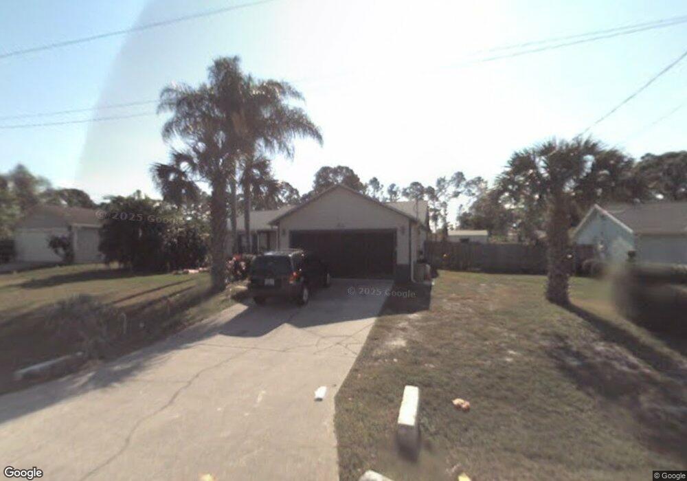
This home is located at 5425 Curtis Blvd, Cocoa, FL 32927 and is currently estimated at $271,428, approximately $263 per square foot. 5425 Curtis Blvd is a home located in Brevard County with nearby schools including Enterprise Elementary School, Space Coast Junior/Senior High School, and Sculptor Charter School.
Ownership History
Date
Name
Owned For
Owner Type
Purchase Details
Closed on
May 8, 2001
Sold by
Callanan David P
Bought by
Callahan David P and Callahan Tammy S
Current Estimated Value
Purchase Details
Closed on
May 8, 2000
Sold by
Callahan David P
Bought by
Callahan David P and Callahan Tammy S
Purchase Details
Closed on
Jun 8, 1998
Sold by
Callahan Sharron K
Bought by
Callahan David P
Purchase Details
Closed on
Jan 31, 1994
Sold by
Snarski Patricia M and Callahan David L
Bought by
Vaughncallahan Sharron Kay
Home Financials for this Owner
Home Financials are based on the most recent Mortgage that was taken out on this home.
Original Mortgage
$57,000
Interest Rate
7.1%
Create a Home Valuation Report for This Property
The Home Valuation Report is an in-depth analysis detailing your home's value as well as a comparison with similar homes in the area
Home Values in the Area
Average Home Value in this Area
Purchase History
| Date | Buyer | Sale Price | Title Company |
|---|---|---|---|
| Callahan David P | -- | -- | |
| Callahan David P | -- | -- | |
| Callahan David P | -- | -- | |
| Vaughncallahan Sharron Kay | $55,500 | -- |
Source: Public Records
Mortgage History
| Date | Status | Borrower | Loan Amount |
|---|---|---|---|
| Previous Owner | Vaughncallahan Sharron Kay | $57,000 |
Source: Public Records
Tax History Compared to Growth
Tax History
| Year | Tax Paid | Tax Assessment Tax Assessment Total Assessment is a certain percentage of the fair market value that is determined by local assessors to be the total taxable value of land and additions on the property. | Land | Improvement |
|---|---|---|---|---|
| 2025 | $973 | $76,230 | -- | -- |
| 2024 | $955 | $74,090 | -- | -- |
| 2023 | $955 | $71,940 | $0 | $0 |
| 2022 | $899 | $69,850 | $0 | $0 |
| 2021 | $903 | $67,820 | $0 | $0 |
| 2020 | $870 | $66,890 | $0 | $0 |
| 2019 | $818 | $65,390 | $0 | $0 |
| 2018 | $784 | $58,420 | $0 | $0 |
| 2017 | $787 | $57,220 | $0 | $0 |
| 2016 | $793 | $56,050 | $18,000 | $38,050 |
| 2015 | $798 | $55,670 | $15,000 | $40,670 |
| 2014 | $802 | $55,230 | $11,000 | $44,230 |
Source: Public Records
Map
Nearby Homes
- 6615 Dock Ave
- 6581 Bancroft Ave
- 00 Unknown
- 5575 Curtis Blvd
- 6760 Cairo Rd
- 4650 N Highway 1 Hwy
- 5715 Fairbridge St
- 5275 Holden Rd
- 5220 Holden Rd
- 5215 Holden Rd
- 5460 Holden Rd
- 5446 Jamaica Rd
- 6375 Cable Ave
- 0000 Grissom Pkwy
- 7065 Hundred Acre Dr
- 6620 Grissom Pkwy
- 6735 Grissom Pkwy
- 5049 Jamaica Rd
- 5130 Carter St
- 5720 Flint Rd
- 5415 Curtis Blvd
- 5435 Curtis Blvd
- 5405 Curtis Blvd
- 5430 Curtis Blvd
- 5370 Fruitport St
- 5360 Fruitport St
- 5380 Fruitport St
- 5455 Curtis Blvd
- 5350 Fruitport St
- 5395 Curtis Blvd
- 6565 Cedar Ave
- 6564 Cedar Ave
- 6550 Elliott Ave Unit 7
- 6550 Elliot
- 5340 Fruitport St
- 5465 Curtis Blvd
- 6555 Dock Ave
- 5385 Curtis Blvd
- 6560 Elliott Ave
- 5400 Flint Rd