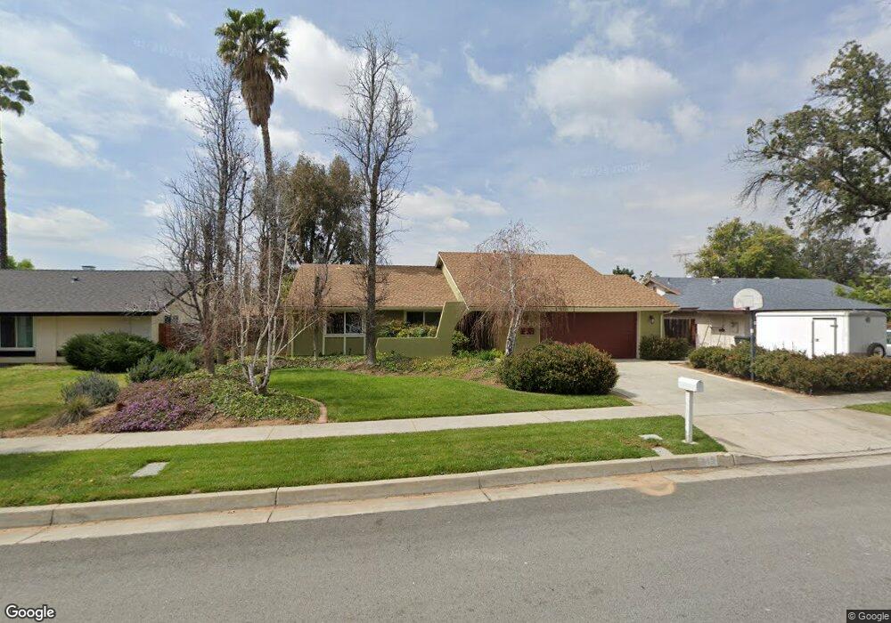
543 Adams St Redlands, CA 92374
North Redlands NeighborhoodEstimated Value: $559,000 - $588,365
4
Beds
2
Baths
1,399
Sq Ft
$411/Sq Ft
Est. Value
About This Home
This home is located at 543 Adams St, Redlands, CA 92374 and is currently estimated at $574,591, approximately $410 per square foot. 543 Adams St is a home located in San Bernardino County with nearby schools including Crafton Elementary School, Moore Middle School, and Redlands East Valley High School.
Ownership History
Date
Name
Owned For
Owner Type
Purchase Details
Closed on
Jan 31, 2022
Sold by
Roth Juliet M
Bought by
Juliet M Roth Trust
Current Estimated Value
Purchase Details
Closed on
Apr 14, 1999
Sold by
Sorensen James A
Bought by
Sorensen Juliet M
Create a Home Valuation Report for This Property
The Home Valuation Report is an in-depth analysis detailing your home's value as well as a comparison with similar homes in the area
Home Values in the Area
Average Home Value in this Area
Purchase History
| Date | Buyer | Sale Price | Title Company |
|---|---|---|---|
| Juliet M Roth Trust | -- | Albrektson & Shumate Llp | |
| Sorensen Juliet M | -- | -- |
Source: Public Records
Tax History Compared to Growth
Tax History
| Year | Tax Paid | Tax Assessment Tax Assessment Total Assessment is a certain percentage of the fair market value that is determined by local assessors to be the total taxable value of land and additions on the property. | Land | Improvement |
|---|---|---|---|---|
| 2025 | $1,875 | $165,956 | $42,953 | $123,003 |
| 2024 | $1,875 | $162,702 | $42,111 | $120,591 |
| 2023 | $1,871 | $159,511 | $41,285 | $118,226 |
| 2022 | $1,843 | $156,383 | $40,475 | $115,908 |
| 2021 | $1,874 | $153,316 | $39,681 | $113,635 |
| 2020 | $1,846 | $151,744 | $39,274 | $112,470 |
| 2019 | $1,793 | $148,769 | $38,504 | $110,265 |
| 2018 | $1,747 | $145,852 | $37,749 | $108,103 |
| 2017 | $1,731 | $142,992 | $37,009 | $105,983 |
| 2016 | $1,710 | $140,188 | $36,283 | $103,905 |
| 2015 | $1,697 | $138,082 | $35,738 | $102,344 |
| 2014 | $1,665 | $135,377 | $35,038 | $100,339 |
Source: Public Records
Map
Nearby Homes
- 312 Barrington Cir
- 210 Auburn Ct
- 626 N Dearborn St Unit 9
- 626 N Dearborn St Unit 192
- 626 N Dearborn St Unit 12
- 626 N Dearborn St Unit 134
- 313 N Dearborn St
- 0 E Colton Ave
- 1582 Lisa Ln
- 1575 Christopher Ln
- 914 N Dearborn St
- 1815 Montecito Ln
- 1721 E Colton Ave Unit 33
- 1721 E Colton Ave Unit 38
- 1721 E Colton Ave Unit 119
- 1721 E Colton Ave Unit 89
- 1721 E Colton Ave Unit 103
- 1721 E Colton Ave Unit 106
- 1721 E Colton Ave Unit 82
- 1562 E Citrus Ave
- 523 Adams St
- 563 Adams St
- 564 Jefferson St
- 524 Jefferson St
- 503 Adams St
- 542 Adams St
- 522 Adams St
- 504 Jefferson St
- 562 Adams St
- 461 Adams St
- 502 Adams St
- 1627 Independence Ave
- 462 Jefferson St
- 1625 Independence Ave
- 1629 Independence Ave
- 521 Westbrook Cir
- 427 Westbrook Cir
- 531 Westbrook Cir
- 464 Adams St
- 1623 Independence Ave