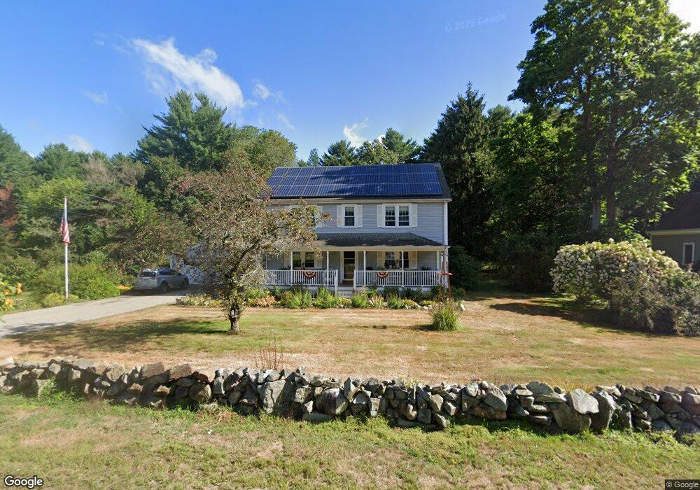
543 Circuit St Hanover, MA 02339
Estimated Value: $768,000 - $934,000
4
Beds
2
Baths
2,400
Sq Ft
$356/Sq Ft
Est. Value
About This Home
This home is located at 543 Circuit St, Hanover, MA 02339 and is currently estimated at $855,205, approximately $356 per square foot. 543 Circuit St is a home located in Plymouth County with nearby schools including Hanover High School and Calvary Chapel Academy.
Ownership History
Date
Name
Owned For
Owner Type
Purchase Details
Closed on
Nov 17, 2006
Sold by
Corkum Patricia M
Bought by
Corkum Patricia M and Robinson Sean D
Current Estimated Value
Home Financials for this Owner
Home Financials are based on the most recent Mortgage that was taken out on this home.
Original Mortgage
$186,500
Outstanding Balance
$110,610
Interest Rate
6.35%
Estimated Equity
$744,595
Create a Home Valuation Report for This Property
The Home Valuation Report is an in-depth analysis detailing your home's value as well as a comparison with similar homes in the area
Home Values in the Area
Average Home Value in this Area
Purchase History
| Date | Buyer | Sale Price | Title Company |
|---|---|---|---|
| Corkum Patricia M | -- | -- |
Source: Public Records
Mortgage History
| Date | Status | Borrower | Loan Amount |
|---|---|---|---|
| Open | Corkum Patricia M | $75,000 | |
| Open | Corkum Patricia M | $186,500 | |
| Previous Owner | Corkum Patricia M | $200,000 |
Source: Public Records
Tax History Compared to Growth
Tax History
| Year | Tax Paid | Tax Assessment Tax Assessment Total Assessment is a certain percentage of the fair market value that is determined by local assessors to be the total taxable value of land and additions on the property. | Land | Improvement |
|---|---|---|---|---|
| 2025 | $9,757 | $790,000 | $279,900 | $510,100 |
| 2024 | $9,507 | $740,400 | $279,900 | $460,500 |
| 2023 | $9,394 | $696,400 | $254,600 | $441,800 |
| 2022 | $9,641 | $632,200 | $241,900 | $390,300 |
| 2021 | $4,998 | $558,100 | $196,800 | $361,300 |
| 2020 | $9,031 | $553,700 | $208,400 | $345,300 |
| 2019 | $8,719 | $531,300 | $208,400 | $322,900 |
| 2018 | $8,129 | $499,300 | $208,400 | $290,900 |
| 2017 | $8,017 | $485,300 | $204,500 | $280,800 |
| 2016 | $7,762 | $460,400 | $185,900 | $274,500 |
| 2015 | $7,159 | $443,300 | $172,200 | $271,100 |
Source: Public Records
Map
Nearby Homes