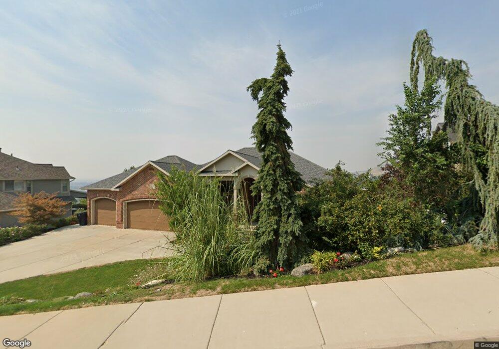
543 E Greystone Dr Farmington, UT 84025
Estimated Value: $1,162,000 - $1,817,000
6
Beds
6
Baths
6,488
Sq Ft
$218/Sq Ft
Est. Value
About This Home
This home is located at 543 E Greystone Dr, Farmington, UT 84025 and is currently estimated at $1,412,000, approximately $217 per square foot. 543 E Greystone Dr is a home located in Davis County with nearby schools including Farmington Elementary School, Farmington High, and Farmington Junior High School.
Ownership History
Date
Name
Owned For
Owner Type
Purchase Details
Closed on
Mar 14, 2016
Sold by
Steed Steven James
Bought by
Steed Steven J and Steed Judith E
Current Estimated Value
Purchase Details
Closed on
Sep 29, 2009
Sold by
Whitehead Walter C and Whitehead Michele E
Bought by
Gibson Trellis N
Home Financials for this Owner
Home Financials are based on the most recent Mortgage that was taken out on this home.
Original Mortgage
$417,000
Interest Rate
5.08%
Mortgage Type
New Conventional
Create a Home Valuation Report for This Property
The Home Valuation Report is an in-depth analysis detailing your home's value as well as a comparison with similar homes in the area
Home Values in the Area
Average Home Value in this Area
Purchase History
| Date | Buyer | Sale Price | Title Company |
|---|---|---|---|
| Steed Steven J | -- | Attorney | |
| Gibson Trellis N | -- | United Title Services Of Uta |
Source: Public Records
Mortgage History
| Date | Status | Borrower | Loan Amount |
|---|---|---|---|
| Previous Owner | Gibson Trellis N | $417,000 |
Source: Public Records
Tax History
| Year | Tax Paid | Tax Assessment Tax Assessment Total Assessment is a certain percentage of the fair market value that is determined by local assessors to be the total taxable value of land and additions on the property. | Land | Improvement |
|---|---|---|---|---|
| 2025 | $7,138 | $705,101 | $231,358 | $473,743 |
| 2024 | $6,656 | $665,501 | $231,358 | $434,143 |
| 2023 | $6,680 | $1,217,000 | $279,129 | $937,871 |
| 2022 | $6,352 | $657,250 | $152,826 | $504,424 |
| 2021 | $6,064 | $934,000 | $239,207 | $694,793 |
| 2020 | $5,827 | $875,000 | $206,131 | $668,869 |
| 2019 | $5,746 | $837,000 | $188,186 | $648,814 |
| 2018 | $5,421 | $778,000 | $184,001 | $593,999 |
| 2016 | $5,105 | $377,190 | $72,414 | $304,776 |
| 2015 | $5,049 | $354,035 | $72,414 | $281,621 |
| 2014 | $3,392 | $244,449 | $72,621 | $171,828 |
| 2013 | -- | $292,786 | $73,444 | $219,342 |
Source: Public Records
Map
Nearby Homes
- 359 E 700 S
- 431 E Greystone Dr
- 383 S 500 E
- 1597 S 200 E
- 1603 S 200 E
- 943 Creekside Ct
- 488 S 10 W
- 799 S Rice Rd
- 13 Sunset Dr Unit 202
- 334 E Cottrell Ln
- 106 S 100 E
- 213 S 75 W
- 12 N 200 E
- 23 W Cave Hollow Cir S
- 19 E 1500 S
- 442 W Randys Ct
- 170 N Main St
- 292 N Flag Rock Dr
- 587 S Daniel Dr Unit 817
- 554 W Cottle Ln
- 543 Greystone Dr
- 527 Greystone Dr
- 592 E 700 S
- 567 Greystone Dr
- 567 Greystone Dr Unit 110
- 556 Greystone Dr
- 556 Greystone Dr Unit 112
- 552 E 700 S
- 513 Greystone Dr Unit 107
- 538 Greystone Dr Unit 113
- 538 Greystone Dr
- 538 Greystone Dr
- 513 Greystone Dr
- 708 Woodland Dr
- 522 Greystone Dr Unit 114
- 542 Lakeview Way
- 534 Lakeview Way
- 522 Greystone Dr
- 522 Greystone Dr Unit 114
- 548 Lakeview Way
Your Personal Tour Guide
Ask me questions while you tour the home.