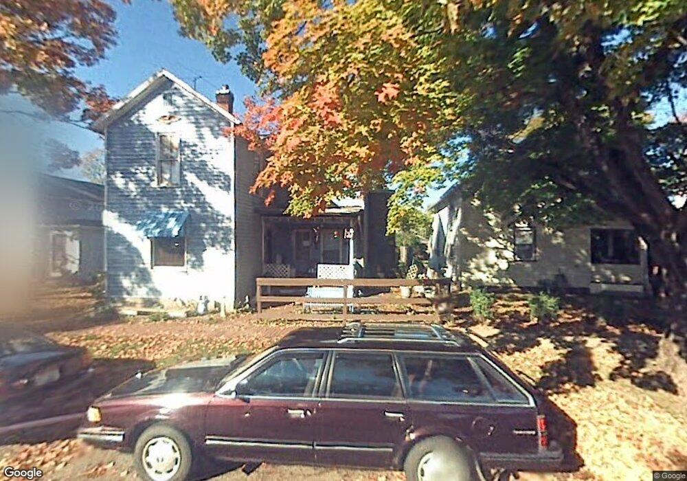
543 E Walnut St Lancaster, OH 43130
Estimated Value: $153,071 - $170,000
3
Beds
1
Bath
1,554
Sq Ft
$105/Sq Ft
Est. Value
About This Home
This home is located at 543 E Walnut St, Lancaster, OH 43130 and is currently estimated at $163,018, approximately $104 per square foot. 543 E Walnut St is a home located in Fairfield County with nearby schools including Thomas Ewing Junior High School, Lancaster High School, and St Mary Elementary School.
Ownership History
Date
Name
Owned For
Owner Type
Purchase Details
Closed on
Jan 19, 2010
Sold by
Smith Russell E and Smith Carrie S
Bought by
Smith Russell E and Smith Carrie S
Current Estimated Value
Purchase Details
Closed on
Aug 21, 1992
Sold by
Marren Rita Eileen
Bought by
Smith Russell E
Create a Home Valuation Report for This Property
The Home Valuation Report is an in-depth analysis detailing your home's value as well as a comparison with similar homes in the area
Home Values in the Area
Average Home Value in this Area
Purchase History
| Date | Buyer | Sale Price | Title Company |
|---|---|---|---|
| Smith Russell E | -- | Attorney | |
| Smith Russell E | $10,000 | -- |
Source: Public Records
Tax History
| Year | Tax Paid | Tax Assessment Tax Assessment Total Assessment is a certain percentage of the fair market value that is determined by local assessors to be the total taxable value of land and additions on the property. | Land | Improvement |
|---|---|---|---|---|
| 2025 | $2,103 | $40,040 | $15,540 | $24,500 |
| 2024 | $2,103 | $23,390 | $6,220 | $17,170 |
| 2023 | $853 | $23,390 | $6,220 | $17,170 |
| 2022 | $856 | $23,390 | $6,220 | $17,170 |
| 2021 | $795 | $20,350 | $6,220 | $14,130 |
| 2020 | $762 | $20,350 | $6,220 | $14,130 |
| 2019 | $725 | $20,350 | $6,220 | $14,130 |
| 2018 | $865 | $18,070 | $6,220 | $11,850 |
| 2017 | $865 | $23,070 | $6,220 | $16,850 |
| 2016 | $843 | $23,070 | $6,220 | $16,850 |
| 2015 | $845 | $22,440 | $6,220 | $16,220 |
| 2014 | $805 | $22,440 | $6,220 | $16,220 |
| 2013 | $805 | $22,440 | $6,220 | $16,220 |
Source: Public Records
Map
Nearby Homes
- 515 E Chestnut St
- 414 E Walnut St
- 545 E Main St
- 342 E Chestnut St
- 534 E Wheeling St
- 547 E Mulberry St
- 621 E Mulberry St
- 249 N Pearl Ave
- 154 E Main St
- 846 E Main St
- 641 King St
- 844 E Wheeling St
- 517 N Maple St
- 859 E Mulberry St
- 869 E Mulberry St
- 1106 E Walnut St
- 1113 E Locust St
- 810 4th St
- 0 N Columbus St
- 924 Woodland Ave
- 547 E Walnut St
- 539 E Walnut St
- 551 E Walnut St
- 533 E Walnut St
- 555 E Walnut St
- 224 Salyers Ct
- 529 E Walnut St
- 559 E Walnut St
- 300 Wheat St
- 550 E Walnut St
- 220 Salyers Ct
- 523 E Walnut St
- 569 South St Unit L0CUST
- 561 E Walnut St
- 306 Wheat St
- 554 E Walnut St
- 565 E Walnut St
- 530 E Walnut St
- 521 E Walnut St
- 219 S Mount Pleasant Ave
Your Personal Tour Guide
Ask me questions while you tour the home.