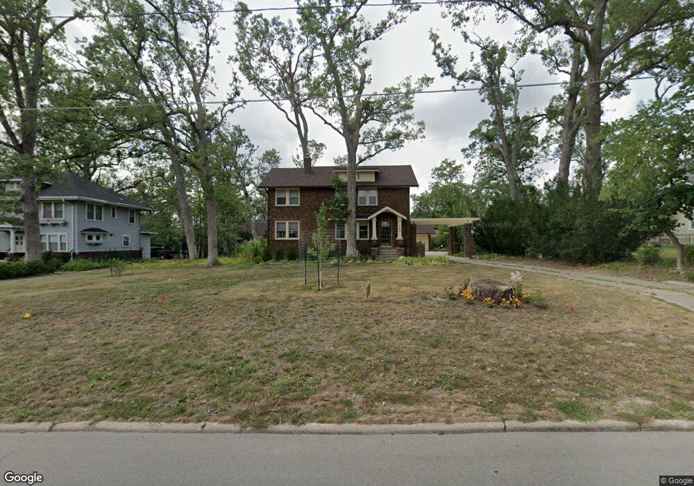
543 Forest Dr SE Cedar Rapids, IA 52403
Vernon Heights NeighborhoodEstimated Value: $307,000 - $404,000
4
Beds
2
Baths
2,158
Sq Ft
$155/Sq Ft
Est. Value
About This Home
This home is located at 543 Forest Dr SE, Cedar Rapids, IA 52403 and is currently estimated at $334,305, approximately $154 per square foot. 543 Forest Dr SE is a home located in Linn County with nearby schools including Grant Wood Elementary School, McKinley STEAM Academy, and George Washington High School.
Ownership History
Date
Name
Owned For
Owner Type
Purchase Details
Closed on
Jul 11, 2022
Sold by
Lynne Taylor Wendy
Bought by
Cox Curtis Lyle
Current Estimated Value
Home Financials for this Owner
Home Financials are based on the most recent Mortgage that was taken out on this home.
Original Mortgage
$218,925
Outstanding Balance
$208,354
Interest Rate
5.13%
Mortgage Type
New Conventional
Estimated Equity
$125,951
Purchase Details
Closed on
May 22, 2009
Sold by
Goldstein Gary E and Goldstein Katherine A
Bought by
Cox Curtis L and Taylor Wendy L
Home Financials for this Owner
Home Financials are based on the most recent Mortgage that was taken out on this home.
Original Mortgage
$180,000
Interest Rate
4.84%
Mortgage Type
Purchase Money Mortgage
Create a Home Valuation Report for This Property
The Home Valuation Report is an in-depth analysis detailing your home's value as well as a comparison with similar homes in the area
Home Values in the Area
Average Home Value in this Area
Purchase History
| Date | Buyer | Sale Price | Title Company |
|---|---|---|---|
| Cox Curtis Lyle | -- | None Listed On Document | |
| Cox Curtis L | $224,500 | None Available |
Source: Public Records
Mortgage History
| Date | Status | Borrower | Loan Amount |
|---|---|---|---|
| Open | Cox Curtis Lyle | $218,925 | |
| Previous Owner | Cox Curtis L | $180,000 |
Source: Public Records
Tax History
| Year | Tax Paid | Tax Assessment Tax Assessment Total Assessment is a certain percentage of the fair market value that is determined by local assessors to be the total taxable value of land and additions on the property. | Land | Improvement |
|---|---|---|---|---|
| 2025 | $4,160 | $298,400 | $79,800 | $218,600 |
| 2024 | $4,618 | $297,200 | $79,800 | $217,400 |
| 2023 | $4,618 | $252,500 | $72,100 | $180,400 |
| 2022 | $4,534 | $227,800 | $61,800 | $166,000 |
| 2021 | $4,926 | $227,800 | $61,800 | $166,000 |
| 2020 | $4,926 | $231,900 | $61,800 | $170,100 |
| 2019 | $4,588 | $221,400 | $61,800 | $159,600 |
Source: Public Records
Map
Nearby Homes
- 535 Forest Dr SE
- 705 Grant Wood Dr SE
- 1121 23rd St SE
- 2323 Upland Dr SE
- 700 Memorial Dr SE
- 520 22nd St SE
- 931 20th St SE
- 2300 4th Ave SE
- 1217 Memorial Dr SE
- 0 Higley Ave SE
- 1158 28th St SE
- 2700 Mount Vernon Rd SE
- 2729 14th Ave SE
- 1103 30th St SE
- 3008 Henderson Ave SE
- 1806 7th Ave SE
- 2005 Washington Ave SE
- 2451 Grande Ave SE
- 2039 Park Ave SE
- 1713 7th Ave SE
- 539 Forest Dr SE
- 549 Forest Dr SE
- 554 Knollwood Dr SE
- 550 Knollwood Dr SE
- 556 Knollwood Dr SE
- 552 Forest Dr SE
- 550 Forest Dr SE
- 554 Forest Dr SE
- 2310 Mount Vernon Rd SE
- 548 Forest Dr SE
- 546 Knollwood Dr SE
- 556 Forest Dr SE
- 563 Forest Dr SE
- 546 Forest Dr SE
- 558 Knollwood Dr SE
- 533 Forest Dr SE
- 558 Forest Dr SE
- 544 Forest Dr SE
- 560 Forest Dr SE
- 542 Forest Dr SE
Your Personal Tour Guide
Ask me questions while you tour the home.