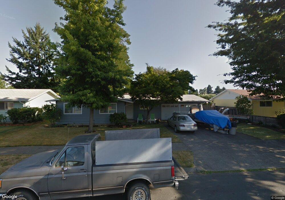
543 Heywood Ave Eugene, OR 97404
Santa Clara NeighborhoodEstimated Value: $341,000 - $370,783
3
Beds
1
Bath
1,128
Sq Ft
$318/Sq Ft
Est. Value
About This Home
This home is located at 543 Heywood Ave, Eugene, OR 97404 and is currently estimated at $359,196, approximately $318 per square foot. 543 Heywood Ave is a home located in Lane County with nearby schools including Spring Creek Elementary School, Madison Middle School, and North Eugene High School.
Ownership History
Date
Name
Owned For
Owner Type
Purchase Details
Closed on
Jul 13, 2004
Sold by
Douglass Linda S
Bought by
Vilanova Anthony Louis
Current Estimated Value
Home Financials for this Owner
Home Financials are based on the most recent Mortgage that was taken out on this home.
Original Mortgage
$85,000
Outstanding Balance
$42,302
Interest Rate
6.27%
Mortgage Type
Purchase Money Mortgage
Estimated Equity
$316,894
Purchase Details
Closed on
Oct 22, 1999
Sold by
Douglass Jay B
Bought by
Douglass Linda S
Home Financials for this Owner
Home Financials are based on the most recent Mortgage that was taken out on this home.
Original Mortgage
$75,500
Interest Rate
7.86%
Create a Home Valuation Report for This Property
The Home Valuation Report is an in-depth analysis detailing your home's value as well as a comparison with similar homes in the area
Home Values in the Area
Average Home Value in this Area
Purchase History
| Date | Buyer | Sale Price | Title Company |
|---|---|---|---|
| Vilanova Anthony Louis | $133,000 | Cascade Title Co | |
| Douglass Linda S | $14,500 | Cascade Title Co |
Source: Public Records
Mortgage History
| Date | Status | Borrower | Loan Amount |
|---|---|---|---|
| Open | Vilanova Anthony Louis | $85,000 | |
| Previous Owner | Douglass Linda S | $75,500 |
Source: Public Records
Tax History
| Year | Tax Paid | Tax Assessment Tax Assessment Total Assessment is a certain percentage of the fair market value that is determined by local assessors to be the total taxable value of land and additions on the property. | Land | Improvement |
|---|---|---|---|---|
| 2025 | $2,412 | $188,430 | -- | -- |
| 2024 | $2,399 | $182,942 | -- | -- |
| 2023 | $2,399 | $177,614 | $0 | $0 |
| 2022 | $2,255 | $172,441 | $0 | $0 |
| 2021 | $2,069 | $167,419 | $0 | $0 |
| 2020 | $2,108 | $162,543 | $0 | $0 |
| 2019 | $2,030 | $157,809 | $0 | $0 |
| 2018 | $1,854 | $148,750 | $0 | $0 |
| 2017 | $1,715 | $148,750 | $0 | $0 |
| 2016 | $1,598 | $144,417 | $0 | $0 |
| 2015 | $1,532 | $140,211 | $0 | $0 |
| 2014 | $1,431 | $136,127 | $0 | $0 |
Source: Public Records
Map
Nearby Homes
- 2563 York St
- 303 Lenore Loop
- 349 Irving Rd
- 2740 Stark St
- 401 Sterling Dr
- 2785 Alyndale Dr
- 200 Irving Rd
- 193 Santa Clara Ave
- 2488 Northampton
- 1755 Brentwood Ave
- 2937 Stark St
- 2989 Dahlia Ln
- 2923 Maranta St
- 1384 David Ave
- 1682 Hemlock St
- 835 Bobolink Ave
- 1880 Manihi Dr
- 2484 Crowther Dr
- 3007 River Rd
- 1725 Allea Dr
- 559 Heywood Ave
- 527 Heywood Ave
- 542 Durham Ave
- 552 Durham Ave
- 536 Durham Ave
- 575 Heywood Ave
- 544 Heywood Ave
- 511 Heywood Ave
- 560 Heywood Ave
- 528 Heywood Ave
- 574 Durham Ave
- 530 Durham Ave
- 576 Heywood Ave
- 512 Heywood Ave
- 495 Heywood Ave
- 2455 York St
- 541 Durham Ave
- 539 Ruby Ave
- 596 Durham Ave
- 565 Ruby Ave
Your Personal Tour Guide
Ask me questions while you tour the home.