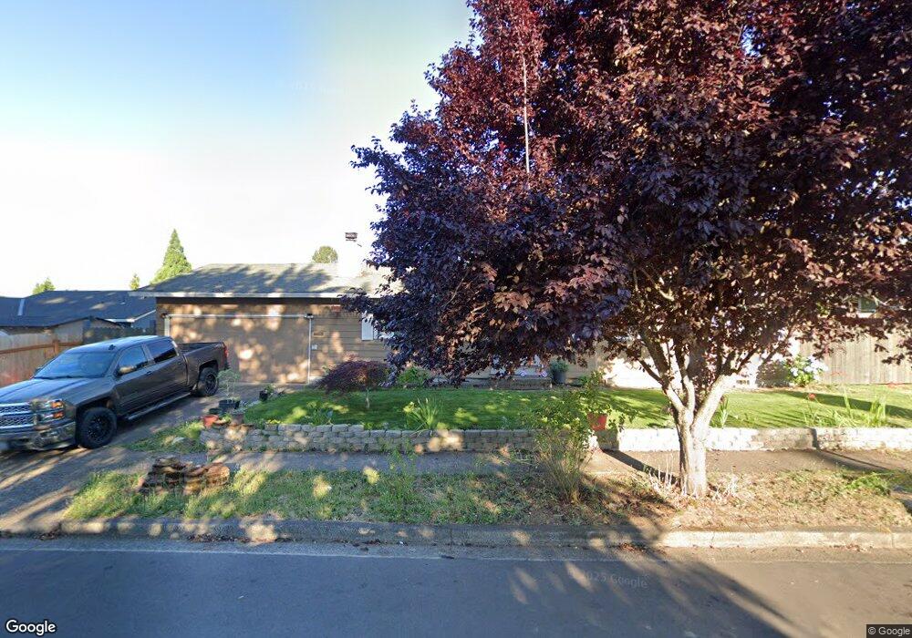
543 S 6th Ave Cornelius, OR 97113
Estimated Value: $410,000 - $457,000
3
Beds
2
Baths
1,120
Sq Ft
$382/Sq Ft
Est. Value
About This Home
This home is located at 543 S 6th Ave, Cornelius, OR 97113 and is currently estimated at $427,305, approximately $381 per square foot. 543 S 6th Ave is a home located in Washington County with nearby schools including Echo Shaw Elementary School, Neil Armstrong Middle School, and Tom McCall Upper Elementary School.
Ownership History
Date
Name
Owned For
Owner Type
Purchase Details
Closed on
May 31, 2002
Sold by
Brinkly David L and Brinkly Donnamae E
Bought by
Duarte Alfonso Lozano and Moya Maria Eliodora
Current Estimated Value
Home Financials for this Owner
Home Financials are based on the most recent Mortgage that was taken out on this home.
Original Mortgage
$133,898
Outstanding Balance
$55,824
Interest Rate
6.89%
Mortgage Type
FHA
Estimated Equity
$371,481
Purchase Details
Closed on
Dec 3, 1998
Sold by
Va
Bought by
Brinkly David L and Brinkly Donnamae E
Home Financials for this Owner
Home Financials are based on the most recent Mortgage that was taken out on this home.
Original Mortgage
$79,800
Interest Rate
6.69%
Create a Home Valuation Report for This Property
The Home Valuation Report is an in-depth analysis detailing your home's value as well as a comparison with similar homes in the area
Home Values in the Area
Average Home Value in this Area
Purchase History
| Date | Buyer | Sale Price | Title Company |
|---|---|---|---|
| Duarte Alfonso Lozano | $136,000 | Fidelity National Title Co | |
| Brinkly David L | -- | Transnation Title Insurance |
Source: Public Records
Mortgage History
| Date | Status | Borrower | Loan Amount |
|---|---|---|---|
| Open | Duarte Alfonso Lozano | $133,898 | |
| Previous Owner | Brinkly David L | $79,800 |
Source: Public Records
Tax History Compared to Growth
Tax History
| Year | Tax Paid | Tax Assessment Tax Assessment Total Assessment is a certain percentage of the fair market value that is determined by local assessors to be the total taxable value of land and additions on the property. | Land | Improvement |
|---|---|---|---|---|
| 2026 | $3,314 | $190,720 | -- | -- |
| 2025 | $3,314 | $185,170 | -- | -- |
| 2024 | $3,026 | $179,780 | -- | -- |
| 2023 | $3,026 | $174,550 | $0 | $0 |
| 2022 | $2,681 | $174,550 | $0 | $0 |
| 2021 | $2,650 | $164,540 | $0 | $0 |
| 2020 | $2,639 | $159,750 | $0 | $0 |
| 2019 | $2,582 | $155,100 | $0 | $0 |
| 2018 | $2,503 | $150,590 | $0 | $0 |
| 2017 | $2,425 | $146,210 | $0 | $0 |
| 2016 | $2,357 | $141,960 | $0 | $0 |
| 2015 | $2,218 | $137,830 | $0 | $0 |
| 2014 | $2,141 | $133,820 | $0 | $0 |
Source: Public Records
Map
Nearby Homes
- 332 S Tarrybrook Dr
- 253 S Tarrybrook Cir
- 1100 S Ivy St
- 1134 S Ginger St
- 1126 S Jasper St
- 1509 Centennial Cir
- 122 S 12th Ave
- 1504 Frontier Cir
- 1214 S 11th Place
- 4403 Wagon Wheel Cir
- 1506 Pioneer Cir
- 1402 Pioneer Way
- 4303 Settlers Loop
- 1701 S Alpine St
- 1832 Vine Ct
- 302 S 19th Ave
- 570 N 10th St Unit 29
- 570 N 10th Ave Unit 2
- 570 N 10th Ave Unit 6
- 570 N 10th Ave Unit 80