Estimated Value: $241,064 - $257,000
3
Beds
2
Baths
960
Sq Ft
$257/Sq Ft
Est. Value
About This Home
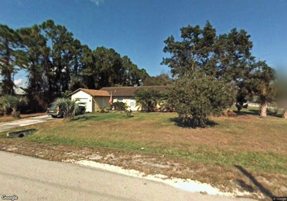
This home is located at 5430 Curtis Blvd, Cocoa, FL 32927 and is currently estimated at $247,016, approximately $257 per square foot. 5430 Curtis Blvd is a home located in Brevard County with nearby schools including Enterprise Elementary School, Space Coast Junior/Senior High School, and Sculptor Charter School.
Ownership History
Date
Name
Owned For
Owner Type
Purchase Details
Closed on
Aug 7, 2012
Sold by
Shuford Vernon E and Shuford Jean A
Bought by
Shuford Vernon E and Shuford Jean A
Current Estimated Value
Purchase Details
Closed on
Jun 30, 1998
Sold by
Com Educators Credit Union
Bought by
Shuford Vernon E and Shuford Jean A
Home Financials for this Owner
Home Financials are based on the most recent Mortgage that was taken out on this home.
Original Mortgage
$45,000
Interest Rate
7.04%
Purchase Details
Closed on
Jun 2, 1998
Sold by
Clerk Circuit Court
Bought by
Com Educators Credit Union
Home Financials for this Owner
Home Financials are based on the most recent Mortgage that was taken out on this home.
Original Mortgage
$45,000
Interest Rate
7.04%
Create a Home Valuation Report for This Property
The Home Valuation Report is an in-depth analysis detailing your home's value as well as a comparison with similar homes in the area
Home Values in the Area
Average Home Value in this Area
Purchase History
| Date | Buyer | Sale Price | Title Company |
|---|---|---|---|
| Shuford Vernon E | -- | None Available | |
| Shuford Vernon E | $50,000 | -- | |
| Com Educators Credit Union | -- | -- |
Source: Public Records
Mortgage History
| Date | Status | Borrower | Loan Amount |
|---|---|---|---|
| Previous Owner | Shuford Vernon E | $45,000 |
Source: Public Records
Tax History
| Year | Tax Paid | Tax Assessment Tax Assessment Total Assessment is a certain percentage of the fair market value that is determined by local assessors to be the total taxable value of land and additions on the property. | Land | Improvement |
|---|---|---|---|---|
| 2025 | $508 | $64,700 | -- | -- |
| 2024 | $494 | $62,880 | -- | -- |
| 2023 | $494 | $61,050 | $0 | $0 |
| 2022 | $479 | $59,280 | $0 | $0 |
| 2021 | $463 | $57,560 | $0 | $0 |
| 2020 | $425 | $56,770 | $0 | $0 |
| 2019 | $369 | $55,500 | $0 | $0 |
| 2018 | $364 | $53,670 | $0 | $0 |
| 2017 | $355 | $52,570 | $0 | $0 |
| 2016 | $349 | $51,490 | $18,000 | $33,490 |
| 2015 | $337 | $51,140 | $15,000 | $36,140 |
| 2014 | $337 | $50,740 | $11,000 | $39,740 |
Source: Public Records
Map
Nearby Homes
- 6615 Dock Ave
- 6450 Ember Ave
- 6581 Bancroft Ave
- 6481 La Brea Ave
- 6760 Cairo Rd
- 6438 Hudson Rd
- 00 Unknown
- 6815 Bryant Rd
- 5715 Fairbridge St
- 5095 Hogan Place
- 5555 Brandon St
- 5220 Holden Rd
- 7065 Hundred Acre Dr
- 5215 Holden Rd
- 6620 Grissom Pkwy
- 6375 Cable Ave
- 0000 Grissom Pkwy
- 6990 Bryant Rd
- 5221 Carrick Rd
- 5155 Mayflower St
- 6564 Cedar Ave
- 6576 Cedar Ave
- 6555 Dock Ave
- 5435 Curtis Blvd
- 6565 Dock Ave
- 6565 Cedar Ave
- 5425 Curtis Blvd
- 5455 Curtis Blvd
- 6577 Cedar Ave
- 5415 Curtis Blvd
- 6588 Cedar Ave
- 5465 Curtis Blvd
- 6550 Elliott Ave Unit 7
- 6550 Elliot
- 6585 Dock Ave
- 6575 Dock Ave
- 6589 Cedar Ave
- 5405 Curtis Blvd
- 6560 Elliott Ave
- 6570 Elliott Ave
Your Personal Tour Guide
Ask me questions while you tour the home.