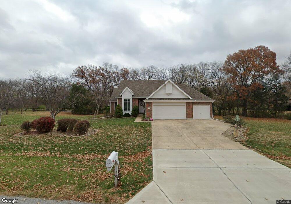
5435 Apache Dr Shawnee, KS 66226
Estimated Value: $455,430 - $505,000
3
Beds
3
Baths
1,766
Sq Ft
$277/Sq Ft
Est. Value
About This Home
This home is located at 5435 Apache Dr, Shawnee, KS 66226 and is currently estimated at $488,608, approximately $276 per square foot. 5435 Apache Dr is a home located in Johnson County with nearby schools including Belmont Elementary School, Mill Creek Middle School, and Mill Valley High School.
Ownership History
Date
Name
Owned For
Owner Type
Purchase Details
Closed on
May 17, 2001
Sold by
Unrein Scott A and Unrein Tina R
Bought by
Yarbrough Bruce L and Yarbrough Anita E
Current Estimated Value
Home Financials for this Owner
Home Financials are based on the most recent Mortgage that was taken out on this home.
Original Mortgage
$209,000
Outstanding Balance
$74,481
Interest Rate
7.07%
Estimated Equity
$414,127
Create a Home Valuation Report for This Property
The Home Valuation Report is an in-depth analysis detailing your home's value as well as a comparison with similar homes in the area
Home Values in the Area
Average Home Value in this Area
Purchase History
| Date | Buyer | Sale Price | Title Company |
|---|---|---|---|
| Yarbrough Bruce L | -- | Security Land Title Company |
Source: Public Records
Mortgage History
| Date | Status | Borrower | Loan Amount |
|---|---|---|---|
| Open | Yarbrough Bruce L | $209,000 |
Source: Public Records
Tax History
| Year | Tax Paid | Tax Assessment Tax Assessment Total Assessment is a certain percentage of the fair market value that is determined by local assessors to be the total taxable value of land and additions on the property. | Land | Improvement |
|---|---|---|---|---|
| 2025 | $6,151 | $53,659 | $12,100 | $41,559 |
| 2024 | $6,151 | $52,819 | $11,010 | $41,809 |
| 2023 | $5,823 | $49,507 | $11,010 | $38,497 |
| 2022 | $5,260 | $43,826 | $9,577 | $34,249 |
| 2021 | $4,926 | $39,456 | $8,204 | $31,252 |
| 2020 | $4,644 | $36,857 | $8,204 | $28,653 |
| 2019 | $4,728 | $36,984 | $7,938 | $29,046 |
| 2018 | $4,475 | $34,684 | $7,938 | $26,746 |
| 2017 | $4,409 | $33,339 | $6,897 | $26,442 |
| 2016 | $4,214 | $31,464 | $6,897 | $24,567 |
| 2015 | $4,132 | $30,326 | $6,897 | $23,429 |
| 2013 | -- | $27,462 | $6,897 | $20,565 |
Source: Public Records
Map
Nearby Homes
- 24460 W 54th St
- 5550 Clare Rd
- 24075 W 57th St
- 5587 Gleason Rd
- 24431 W 58th St
- 6018 Apache Dr
- 6039 Apache Dr
- 5740 Clare Rd
- 5660 Meadow Heights Dr
- 5129 Meadowlark Dr
- 23823 W 58th Terrace
- 23811 W 59th Terrace
- 6100 Barth Rd
- 23903 Clear Creek Pkwy
- 23827 W 59th Terrace
- 6101 Barth Rd
- 6114 Lewis Dr
- 23823 W 59th Terrace
- 6104 Barth Rd
- 6115 Lewis Dr
- 5425 Apache Dr
- 24356 W 55th St
- 5450 Apache Dr
- 24350 W 55th St
- 5420 Apache Dr
- 24460 W 55th St
- 24335 W 54th St
- 24455 W 54th St
- 5445 Arapahoe St
- 24540 W 55th St
- 24355 W 55th St
- 24475 W 55th St
- 24425 W 55th St
- 24560 W 55th St
- 24455 W 55th St
- 24525 W 55th St
- 24325 W 55th St
- 24360 W 54th St
- 5526 Apache Ct
- 5370 Apache Ct
Your Personal Tour Guide
Ask me questions while you tour the home.