544 Main St Cotuit, MA 02635
Cotuit NeighborhoodEstimated Value: $833,070 - $1,109,000
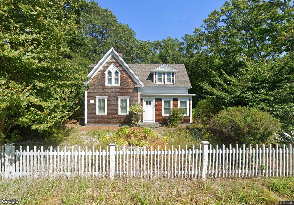
About This Home
This home is located at 544 Main St, Cotuit, MA 02635 and is currently estimated at $987,768, approximately $587 per square foot. 544 Main St is a home located in Barnstable County with nearby schools including West Villages Elementary School, Barnstable United Elementary School, and Barnstable Intermediate School.
Ownership History
We collect this data history from publicly available records. To have your information removed, we recommend requesting removal directly through your county’s website.
Purchase Details
Purchase Details
Home Values in the Area
Average Home Value in this Area
Purchase History
We collect this data history from publicly available records. To have your information removed, we recommend requesting removal directly through your county’s website.
| Date | Buyer | Sale Price | Title Company |
|---|---|---|---|
| -- | -- | ||
| $310,000 | -- |
Mortgage History
We collect this data history from publicly available records. To have your information removed, we recommend requesting removal directly through your county’s website.
| Date | Status | Borrower | Loan Amount |
|---|---|---|---|
| Previous Owner | $35,000 | ||
| Previous Owner | $105,600 | ||
| Previous Owner | $80,000 |
Tax History
We collect this data history from publicly available records. To have your information removed, we recommend requesting removal directly through your county’s website.
| Year | Tax Paid | Tax Assessment Tax Assessment Total Assessment is a certain percentage of the fair market value that is determined by local assessors to be the total taxable value of land and additions on the property. | Land | Improvement |
|---|---|---|---|---|
| 2025 | $6,692 | $801,400 | $397,700 | $403,700 |
| 2024 | $6,324 | $802,500 | $397,700 | $404,800 |
| 2023 | $5,991 | $715,800 | $370,600 | $345,200 |
| 2022 | $5,643 | $545,700 | $258,700 | $287,000 |
| 2021 | $94 | $522,900 | $283,300 | $239,600 |
| 2020 | $6,115 | $522,200 | $301,200 | $221,000 |
| 2019 | $1,722 | $511,600 | $314,300 | $197,300 |
| 2018 | $91 | $475,400 | $317,000 | $158,400 |
| 2017 | $5,638 | $477,800 | $317,000 | $160,800 |
| 2016 | $5,502 | $478,000 | $317,200 | $160,800 |
| 2015 | $5,709 | $495,600 | $304,300 | $191,300 |
Map
- 552 Main St
- 535 Main St
- 7 Oxford Dr
- 107 Abbey Gate Rd
- 134 School St
- 75 Trout Brook Rd
- 205 Little River Rd
- 33 Oyster Place Rd
- 174 Little River Rd
- 994 Main St
- 80 Roosevelt Rd
- 131 Dunrobin Rd
- 359 Santuit Rd
- 359 Santuit Rd
- 399 Santuit Rd
- 30 Wings Ln
- 1089 Main St
- 1081 Main St
- 30 Pleasant Park Dr
- 13 Cedar St
Ask me questions while you tour the home.