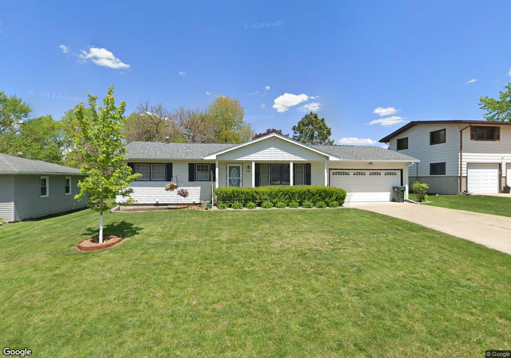
544 Martin Rd Waterloo, IA 50701
Estimated Value: $193,000 - $220,000
3
Beds
2
Baths
960
Sq Ft
$216/Sq Ft
Est. Value
About This Home
This home is located at 544 Martin Rd, Waterloo, IA 50701 and is currently estimated at $207,373, approximately $216 per square foot. 544 Martin Rd is a home located in Black Hawk County with nearby schools including Kingsley Elementary School, Hoover Middle School, and West High School.
Ownership History
Date
Name
Owned For
Owner Type
Purchase Details
Closed on
Mar 27, 2020
Sold by
Boyce Adam J and Boyce Sara
Bought by
Boyce Adam J and Boyce Sara
Current Estimated Value
Home Financials for this Owner
Home Financials are based on the most recent Mortgage that was taken out on this home.
Original Mortgage
$99,900
Outstanding Balance
$69,015
Interest Rate
3.4%
Mortgage Type
New Conventional
Estimated Equity
$138,358
Purchase Details
Closed on
Jul 13, 2017
Sold by
Estate Of Clarence H Beier
Bought by
Boyce Adam J
Home Financials for this Owner
Home Financials are based on the most recent Mortgage that was taken out on this home.
Original Mortgage
$120,900
Interest Rate
3.91%
Mortgage Type
New Conventional
Create a Home Valuation Report for This Property
The Home Valuation Report is an in-depth analysis detailing your home's value as well as a comparison with similar homes in the area
Home Values in the Area
Average Home Value in this Area
Purchase History
| Date | Buyer | Sale Price | Title Company |
|---|---|---|---|
| Boyce Adam J | -- | None Available | |
| Boyce Adam J | -- | None Available |
Source: Public Records
Mortgage History
| Date | Status | Borrower | Loan Amount |
|---|---|---|---|
| Open | Boyce Adam J | $99,900 | |
| Closed | Boyce Adam J | $120,900 |
Source: Public Records
Tax History Compared to Growth
Tax History
| Year | Tax Paid | Tax Assessment Tax Assessment Total Assessment is a certain percentage of the fair market value that is determined by local assessors to be the total taxable value of land and additions on the property. | Land | Improvement |
|---|---|---|---|---|
| 2025 | $3,386 | $186,690 | $26,720 | $159,970 |
| 2024 | $3,386 | $166,270 | $26,720 | $139,550 |
| 2023 | $3,018 | $166,270 | $26,720 | $139,550 |
| 2022 | $3,128 | $146,310 | $26,720 | $119,590 |
| 2021 | $2,946 | $146,310 | $26,720 | $119,590 |
| 2020 | $2,898 | $130,090 | $21,380 | $108,710 |
| 2019 | $2,898 | $130,090 | $21,380 | $108,710 |
| 2018 | $2,900 | $130,090 | $21,380 | $108,710 |
| 2017 | $2,792 | $130,090 | $21,380 | $108,710 |
| 2016 | $2,754 | $130,090 | $21,380 | $108,710 |
| 2015 | $2,754 | $130,090 | $21,380 | $108,710 |
| 2014 | $2,806 | $130,090 | $21,380 | $108,710 |
Source: Public Records
Map
Nearby Homes
- 608-610 Martin Rd
- 2564 Kate St
- 3024 W 4th St
- 0 Provision Pkwy
- 3105 Ansborough Ave
- 1132 W Ridgeway Ave
- Village West 2nd Addn Lot 2
- 0 Hwy 63 Land Unit NBR20254281
- 0 Hwy 63 Land Unit NBR20255994
- 250 Sheridan Rd
- 3329 Lincolnshire Rd
- 3335 Lincolnshire Rd
- 3325 Lincolnshire Rd
- 910 Campbell Ave
- 3508 Monticello Ave
- LOT W W Ridgeway Ave
- 1022 Hilltop Rd
- 3446 Kingswood Place
- Lot 4 Marnie Ave
- Lot 1 Marnie Ave
- 552 Martin Rd
- 536 Martin Rd
- 421 Meadowbrook Ln
- 429 Meadowbrook Ln
- 558 Martin Rd
- 415 Meadowbrook Ln
- 530 Martin Rd
- 435 Meadowbrook Ln
- 403 Meadowbrook Ln
- 543 Martin Rd
- 549 Martin Rd
- 537 Martin Rd
- 551 Martin Rd
- 443 Meadowbrook Ln
- 516 Martin Rd
- 571 Martin Rd
- 325 Meadowbrook Ln
- 420 Meadowbrook Ln
- 525 Martin Rd
- 428 Meadowbrook Ln