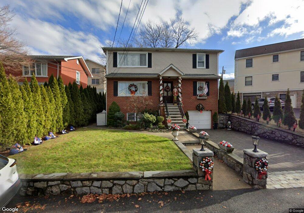
544 Mile Square Rd Yonkers, NY 10701
Dunwoodie NeighborhoodEstimated Value: $879,339 - $978,000
6
Beds
2
Baths
2,310
Sq Ft
$396/Sq Ft
Est. Value
About This Home
This home is located at 544 Mile Square Rd, Yonkers, NY 10701 and is currently estimated at $915,335, approximately $396 per square foot. 544 Mile Square Rd is a home located in Westchester County with nearby schools including Charter School of Educational Excellence, Bronx Charter School For Excellence 3, and St. John the Baptist Catholic Church.
Ownership History
Date
Name
Owned For
Owner Type
Purchase Details
Closed on
Sep 2, 1998
Sold by
Cacciatore Vincent and Cacciatore Patrice
Bought by
Didonato Raffaele and Didonato Maria
Current Estimated Value
Purchase Details
Closed on
Jan 18, 1996
Sold by
The Trustees Columbia University In The
Bought by
Didonato Ralph and Didonato Maria
Purchase Details
Closed on
Sep 14, 1995
Sold by
Licata Anthony and Licata Roseann
Bought by
Dagostino Ricardo and Dagostino Anita
Create a Home Valuation Report for This Property
The Home Valuation Report is an in-depth analysis detailing your home's value as well as a comparison with similar homes in the area
Home Values in the Area
Average Home Value in this Area
Purchase History
| Date | Buyer | Sale Price | Title Company |
|---|---|---|---|
| Didonato Raffaele | $113,000 | New York Title Research Corp | |
| Didonato Ralph | $87,000 | American Title Ins Co | |
| Dagostino Ricardo | $160,000 | First American Title Ins Co |
Source: Public Records
Tax History Compared to Growth
Tax History
| Year | Tax Paid | Tax Assessment Tax Assessment Total Assessment is a certain percentage of the fair market value that is determined by local assessors to be the total taxable value of land and additions on the property. | Land | Improvement |
|---|---|---|---|---|
| 2024 | $2,539 | $14,250 | $4,400 | $9,850 |
| 2023 | $2,526 | $14,250 | $4,400 | $9,850 |
| 2022 | $2,509 | $14,250 | $4,400 | $9,850 |
| 2021 | $11,257 | $14,250 | $4,400 | $9,850 |
| 2020 | $11,165 | $14,250 | $4,400 | $9,850 |
| 2019 | $13,338 | $14,250 | $4,400 | $9,850 |
| 2018 | $10,365 | $14,250 | $4,400 | $9,850 |
| 2017 | $0 | $14,250 | $4,400 | $9,850 |
| 2016 | $11,749 | $14,250 | $4,400 | $9,850 |
| 2015 | -- | $14,250 | $4,400 | $9,850 |
| 2014 | -- | $14,250 | $4,400 | $9,850 |
| 2013 | -- | $16,200 | $4,400 | $11,800 |
Source: Public Records
Map
Nearby Homes
- 20 Ashford Place
- 43 Dunston Ave
- 39 Dunston Ave
- 7 Elaine Terrace
- 30 College Place
- 900 Midland Ave Unit 2E
- 9 Brynwood Rd
- 41 Cowdrey St
- 98 University Ave
- 90 University Ave
- 86 University Ave
- 70 Cook Ave
- 419 Palmer Rd
- 466 Palmer Rd
- 1101 Midland Ave Unit 223
- 1101 Midland Ave Unit 403
- 194 Valentine St
- 174 Valentine St
- 46 Bryn Mawr Place
- 1096 Midland Ave
- 540 Mile Square Rd
- 239 Kingston Ave
- 229 Kingston Ave
- 534 Mile Square Rd
- 225 Kingston Ave
- 234 Kingston Ave
- 230 Kingston Ave
- 541 Mile Square Rd
- 238 Kingston Ave
- 528 Mile Square Rd
- 223 Kingston Ave
- 242 Kingston Ave Unit 2
- 242 Kingston Ave
- 226 Kingston Ave
- 545 Mile Square Rd
- 83 Brewster Ave
- 551 Mile Square Rd
- 219 Kingston Ave
- 553 Mile Square Rd
- 105 Brewster Ave