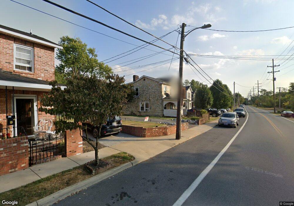
544 N Kent St Winchester, VA 22601
Estimated Value: $267,000 - $330,009
3
Beds
2
Baths
1,160
Sq Ft
$263/Sq Ft
Est. Value
About This Home
This home is located at 544 N Kent St, Winchester, VA 22601 and is currently estimated at $305,252, approximately $263 per square foot. 544 N Kent St is a home located in Winchester City with nearby schools including Virginia Avenue Charlotte Dehart Elementary School, Daniel Morgan Middle School, and John Handley High School.
Ownership History
Date
Name
Owned For
Owner Type
Purchase Details
Closed on
Jul 13, 2024
Sold by
Doleman Ethel Beatrice and Ferrel Ethel Beatrice
Bought by
Ferrel Ethel Beatrice
Current Estimated Value
Home Financials for this Owner
Home Financials are based on the most recent Mortgage that was taken out on this home.
Original Mortgage
$157,712
Outstanding Balance
$155,495
Interest Rate
6.13%
Mortgage Type
FHA
Estimated Equity
$149,757
Purchase Details
Closed on
Dec 15, 2008
Sold by
Habitat For Humanity Of Winchester Frede
Bought by
Doleman Ethel Beatrice
Home Financials for this Owner
Home Financials are based on the most recent Mortgage that was taken out on this home.
Original Mortgage
$126,645
Interest Rate
6.49%
Mortgage Type
Purchase Money Mortgage
Create a Home Valuation Report for This Property
The Home Valuation Report is an in-depth analysis detailing your home's value as well as a comparison with similar homes in the area
Home Values in the Area
Average Home Value in this Area
Purchase History
| Date | Buyer | Sale Price | Title Company |
|---|---|---|---|
| Ferrel Ethel Beatrice | -- | None Listed On Document | |
| Doleman Ethel Beatrice | $210,000 | None Available |
Source: Public Records
Mortgage History
| Date | Status | Borrower | Loan Amount |
|---|---|---|---|
| Open | Ferrel Ethel Beatrice | $157,712 | |
| Previous Owner | Doleman Ethel Beatrice | $126,645 |
Source: Public Records
Tax History Compared to Growth
Tax History
| Year | Tax Paid | Tax Assessment Tax Assessment Total Assessment is a certain percentage of the fair market value that is determined by local assessors to be the total taxable value of land and additions on the property. | Land | Improvement |
|---|---|---|---|---|
| 2025 | $2,364 | $297,300 | $35,000 | $262,300 |
| 2024 | $2,156 | $259,800 | $35,000 | $224,800 |
| 2023 | $2,156 | $259,800 | $35,000 | $224,800 |
| 2022 | $1,801 | $193,700 | $35,000 | $158,700 |
| 2021 | $1,801 | $193,700 | $35,000 | $158,700 |
| 2020 | $1,467 | $157,700 | $35,000 | $122,700 |
| 2019 | $1,467 | $157,700 | $35,000 | $122,700 |
| 2018 | $1,174 | $129,000 | $29,800 | $99,200 |
| 2017 | $1,024 | $129,000 | $29,800 | $99,200 |
| 2016 | $1,024 | $112,500 | $29,800 | $82,700 |
| 2015 | $1,024 | $112,500 | $29,800 | $82,700 |
| 2014 | $962 | $101,300 | $29,800 | $71,500 |
Source: Public Records
Map
Nearby Homes
- 553 Highland Ave
- 301 Liberty Ave
- 520 Highland Ave
- 510 N Loudoun St
- 580 N Braddock St
- 320 Highland Ave
- 411 N Loudoun St Unit 203
- 621 Butler Ave
- 506 Fairmont Ave
- 700 Watson Ave
- 513 van Fossen St
- 369 Charles St
- 290 Green St
- 103 Marlow Ct
- 613 Laurelwood Cir
- 505 Green St
- 501 National Ave
- 801 Fairmont Ave
- 132 Amherst St
- 121 N Washington St
- 542 N Kent St
- 546 N Kent St
- 538 N Kent St
- 2 N Kent St Unit 1 & 2
- 2 N Kent St Unit 2
- 2 N Kent St Unit 1
- 550 1/2 N Kent St
- 2 N Kent St
- 534 N Kent St
- 554 N Kent St
- 530 N Kent St
- 551 Fremont St
- 545 Fremont St
- 209 1/2 Liberty Ave
- 209 Liberty Ave
- 205 Liberty Ave
- 541 Fremont St
- 526 N Kent St
- 201 Liberty Ave
- 213 Liberty Ave