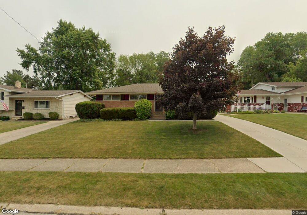
5441 Sherwood Dr Cleveland, OH 44126
Estimated Value: $269,514 - $292,000
3
Beds
2
Baths
1,221
Sq Ft
$231/Sq Ft
Est. Value
About This Home
This home is located at 5441 Sherwood Dr, Cleveland, OH 44126 and is currently estimated at $282,129, approximately $231 per square foot. 5441 Sherwood Dr is a home located in Cuyahoga County with nearby schools including Gilles-Sweet Elementary School, Lewis F Mayer Middle School, and Fairview High School.
Ownership History
Date
Name
Owned For
Owner Type
Purchase Details
Closed on
Feb 10, 2022
Sold by
Omalley Rachelle P
Bought by
Omalley Brian C
Current Estimated Value
Purchase Details
Closed on
Oct 21, 1997
Sold by
Sikon Robert A
Bought by
O'Malley Brian C and O'Malley Rachelle P
Home Financials for this Owner
Home Financials are based on the most recent Mortgage that was taken out on this home.
Original Mortgage
$101,200
Interest Rate
7.65%
Mortgage Type
New Conventional
Purchase Details
Closed on
Feb 27, 1992
Sold by
Clawson Dorothy R
Bought by
Sikon Mary K
Purchase Details
Closed on
Oct 3, 1990
Sold by
Clawson Bernard C
Bought by
Clawson Dorothy R
Purchase Details
Closed on
Mar 4, 1977
Sold by
Chamers Thos J and Chamers Viola M
Bought by
Clawson Bernard C
Purchase Details
Closed on
Jan 1, 1975
Bought by
Chamers Thos J and Chamers Viola M
Create a Home Valuation Report for This Property
The Home Valuation Report is an in-depth analysis detailing your home's value as well as a comparison with similar homes in the area
Home Values in the Area
Average Home Value in this Area
Purchase History
| Date | Buyer | Sale Price | Title Company |
|---|---|---|---|
| Omalley Brian C | -- | Shucofsky Joseph F | |
| O'Malley Brian C | $126,500 | -- | |
| Sikon Mary K | $102,000 | -- | |
| Clawson Dorothy R | -- | -- | |
| Clawson Bernard C | $49,000 | -- | |
| Chamers Thos J | -- | -- |
Source: Public Records
Mortgage History
| Date | Status | Borrower | Loan Amount |
|---|---|---|---|
| Previous Owner | O'Malley Brian C | $101,200 |
Source: Public Records
Tax History Compared to Growth
Tax History
| Year | Tax Paid | Tax Assessment Tax Assessment Total Assessment is a certain percentage of the fair market value that is determined by local assessors to be the total taxable value of land and additions on the property. | Land | Improvement |
|---|---|---|---|---|
| 2024 | $5,870 | $85,295 | $17,255 | $68,040 |
| 2023 | $5,368 | $66,720 | $15,160 | $51,560 |
| 2022 | $5,235 | $66,710 | $15,155 | $51,555 |
| 2021 | $5,346 | $66,710 | $15,160 | $51,560 |
| 2020 | $4,917 | $53,800 | $12,220 | $41,580 |
| 2019 | $4,372 | $153,700 | $34,900 | $118,800 |
| 2018 | $4,129 | $53,800 | $12,220 | $41,580 |
| 2017 | $4,072 | $46,240 | $10,120 | $36,120 |
| 2016 | $4,044 | $46,240 | $10,120 | $36,120 |
| 2015 | $3,892 | $46,240 | $10,120 | $36,120 |
| 2014 | $3,892 | $44,910 | $9,840 | $35,070 |
Source: Public Records
Map
Nearby Homes
- 5951 Rockport Ln
- 20930 Mastick Rd
- 22534 Bard Ave
- 22247 Mastick Rd
- 22503 Sandy Ln
- 22506 Sharon Ln
- 22045 Morton Ave
- 4464 W 224th St
- 4627 W 223rd St
- 22934 Mastick Rd Unit 102
- 21763 Hillsdale Ave
- 21437 Hillsdale Ave
- 4710 Grayton Rd
- 4720 Grayton Rd
- 4514 Orchard Rd
- 22895 Mastick Rd
- 4309 W 222nd St
- 22968 Maple Ridge Rd Unit 103
- 22976 Maple Ridge Rd Unit B 105
- 4401 Fairview Park
- 5421 Sherwood Dr
- 5461 Sherwood Dr
- 5481 Sherwood Dr
- 5401 Sherwood Dr
- 5330 Kings Hwy
- 21425 Kings Hwy
- 5381 Sherwood Dr
- 5501 Sherwood Dr
- 5420 Sherwood Dr
- 5400 Sherwood Dr
- 5460 Sherwood Dr
- 5361 Sherwood Dr
- 5521 Sherwood Dr
- 5320 Kings Hwy
- 5380 Sherwood Dr
- 21435 Kings Hwy
- 5341 Sherwood Dr
- 5320 Sherwood Dr
- 5460 Friar Cir
- 21720 Sherwood Dr