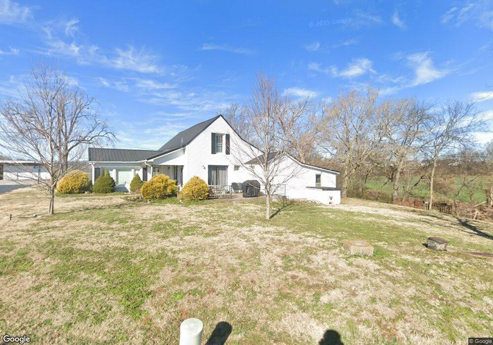
5448 Starks Rd Cross Plains, TN 37049
Estimated Value: $298,000 - $1,854,307
--
Bed
1
Bath
1,328
Sq Ft
$810/Sq Ft
Est. Value
About This Home
This home is located at 5448 Starks Rd, Cross Plains, TN 37049 and is currently estimated at $1,076,154, approximately $810 per square foot. 5448 Starks Rd is a home located in Robertson County with nearby schools including East Robertson Elementary School and East Robertson High School.
Ownership History
Date
Name
Owned For
Owner Type
Purchase Details
Closed on
Apr 30, 2019
Sold by
Stark Bryant and Stark Ronnie
Bought by
Stark Brothers Farm Llc
Current Estimated Value
Purchase Details
Closed on
Mar 4, 1999
Bought by
Bryant Stark
Purchase Details
Closed on
Mar 13, 1981
Bought by
Stark Elmore
Purchase Details
Closed on
Nov 23, 1956
Purchase Details
Closed on
Jan 20, 1955
Purchase Details
Closed on
Jul 26, 1947
Create a Home Valuation Report for This Property
The Home Valuation Report is an in-depth analysis detailing your home's value as well as a comparison with similar homes in the area
Home Values in the Area
Average Home Value in this Area
Purchase History
| Date | Buyer | Sale Price | Title Company |
|---|---|---|---|
| Stark Brothers Farm Llc | -- | None Available | |
| Bryant Stark | -- | -- | |
| Stark Elmore | -- | -- | |
| -- | -- | -- | |
| -- | -- | -- | |
| -- | -- | -- |
Source: Public Records
Tax History Compared to Growth
Tax History
| Year | Tax Paid | Tax Assessment Tax Assessment Total Assessment is a certain percentage of the fair market value that is determined by local assessors to be the total taxable value of land and additions on the property. | Land | Improvement |
|---|---|---|---|---|
| 2024 | $2,361 | $131,150 | $89,100 | $42,050 |
| 2023 | $2,361 | $131,150 | $89,100 | $42,050 |
| 2022 | $2,295 | $89,100 | $60,275 | $28,825 |
| 2021 | $2,295 | $89,100 | $60,275 | $28,825 |
| 2020 | $2,295 | $89,100 | $60,275 | $28,825 |
| 2019 | $2,295 | $89,100 | $60,275 | $28,825 |
| 2018 | $2,295 | $89,100 | $60,275 | $28,825 |
| 2017 | $2,554 | $82,800 | $49,075 | $33,725 |
| 2016 | $2,554 | $82,800 | $49,075 | $33,725 |
| 2015 | $2,451 | $82,800 | $49,075 | $33,725 |
| 2014 | $2,342 | $79,125 | $49,075 | $30,050 |
Source: Public Records
Map
Nearby Homes
- 8637 Tennessee 52
- 0 Jimson Rd
- 5127 Starks Rd
- 0 Payne Rd Extension Unit RTC2898325
- 8283 Highway 52
- 6485 Highland Rd
- 0 Bill Anderson Rd
- 4984 Somerville Rd
- 6016 Highland Rd
- 3019 Friendship Rd
- 8127 Pleasant Hill Rd
- 8044 Pleasant Hill Rd
- 5300 Highway 31 W
- 6400 Williams Rd
- 6400 Williams Rd
- 135 Old Highway 52 W
- 2671 Friendship Rd
- 0 State Route 52
- 4706 Rock House Rd
- 1202 Tennessee 52
- 5432 Starks Rd
- 5428 Starks Rd
- 8679 Highway 52
- 5520 Starks Rd
- 5500 Starks Rd
- 5500 Starks Rd
- 5368 Starks Rd
- 8645 Highway 52
- 8627 Tennessee 52
- 5356 Starks Rd
- 8623 Tennessee 52
- 5480 Payne Rd
- 8653 Highway 52
- 8607 Highway 52
- 8633 Highway 52
- 8609 Highway 52
- 8661 Highway 52
- 8661 Highway 52
- 8609 Highway 52
- 8633 Highway 52