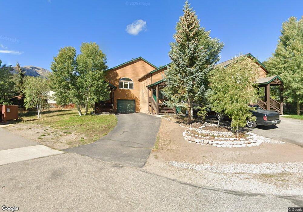
545 Marmot Cir Silverthorne, CO 80498
Estimated Value: $884,000 - $1,003,000
3
Beds
2
Baths
1,424
Sq Ft
$651/Sq Ft
Est. Value
About This Home
This home is located at 545 Marmot Cir, Silverthorne, CO 80498 and is currently estimated at $927,554, approximately $651 per square foot. 545 Marmot Cir is a home located in Summit County with nearby schools including Silverthorne Elementary School, Summit Middle School, and Summit High School.
Ownership History
Date
Name
Owned For
Owner Type
Purchase Details
Closed on
Aug 12, 2011
Sold by
Donahue James K and Donahue Cindy A
Bought by
Hockett Stephen M
Current Estimated Value
Home Financials for this Owner
Home Financials are based on the most recent Mortgage that was taken out on this home.
Original Mortgage
$233,500
Outstanding Balance
$161,371
Interest Rate
4.53%
Mortgage Type
Commercial
Estimated Equity
$766,183
Purchase Details
Closed on
Aug 23, 2005
Sold by
Simcik Dennis L and Simcik Diane E
Bought by
Donahue James K and Donahue Cindy A
Home Financials for this Owner
Home Financials are based on the most recent Mortgage that was taken out on this home.
Original Mortgage
$276,000
Interest Rate
5.12%
Mortgage Type
Commercial
Create a Home Valuation Report for This Property
The Home Valuation Report is an in-depth analysis detailing your home's value as well as a comparison with similar homes in the area
Home Values in the Area
Average Home Value in this Area
Purchase History
| Date | Buyer | Sale Price | Title Company |
|---|---|---|---|
| Hockett Stephen M | $333,500 | Stewart Title | |
| Donahue James K | $345,000 | Title Co Of The Rockies Inc |
Source: Public Records
Mortgage History
| Date | Status | Borrower | Loan Amount |
|---|---|---|---|
| Open | Hockett Stephen M | $233,500 | |
| Previous Owner | Donahue James K | $276,000 |
Source: Public Records
Tax History
| Year | Tax Paid | Tax Assessment Tax Assessment Total Assessment is a certain percentage of the fair market value that is determined by local assessors to be the total taxable value of land and additions on the property. | Land | Improvement |
|---|---|---|---|---|
| 2024 | $2,516 | $50,250 | -- | -- |
| 2023 | $2,516 | $46,565 | $0 | $0 |
| 2022 | $2,224 | $38,920 | $0 | $0 |
| 2021 | $2,243 | $40,040 | $0 | $0 |
| 2020 | $1,920 | $36,603 | $0 | $0 |
| 2019 | $1,893 | $36,603 | $0 | $0 |
| 2018 | $1,606 | $30,087 | $0 | $0 |
| 2017 | $1,469 | $30,087 | $0 | $0 |
| 2016 | $1,435 | $28,944 | $0 | $0 |
| 2015 | $1,390 | $28,944 | $0 | $0 |
| 2014 | $1,244 | $25,590 | $0 | $0 |
| 2013 | -- | $25,590 | $0 | $0 |
Source: Public Records
Map
Nearby Homes
- 481 Marmot Cir
- 490 W Coyote Dr
- 480 W Coyote Dr
- 383 W Coyote Dr
- 432 Bighorn Cir
- 345 N Chipmunk Cir
- 1803 Falcon Dr
- 1730 Red Hawk Rd
- 1709 Red Hawk Rd
- 308 Red Hawk Cir
- 113 Badger Ct
- 104 Talon Cir
- 78 Lantern Aly
- 1813 Stellar Dr
- 89 Emerald Rd
- 125 Two Cabins Dr
- 273 Two Cabins Dr
- 1301 Adams Ave Unit 111
- 1301 Adams Ave Unit 128
- 1301 Adams Ave Unit 141
- 547 Marmot Cir
- 594 W Coyote Dr
- 596 W Coyote Dr
- 559 Marmot Cir
- 525 Marmot Cir
- 592 W Coyote Dr
- 598 W Coyote Dr
- 486 Marmot Cir
- 484 Marmot Cir Unit 484
- 521 Marmot Cir
- 491 Marmot Cir
- 582 W Coyote Dr
- 488 Marmot Cir
- 532 W Coyote Dr
- 550 W Coyote Dr
- 579 Bighorn Cir
- 476 Marmot Cir
- 597 W Coyote Dr
- 595 W Coyote Dr
- 591 W Coyote Dr
Your Personal Tour Guide
Ask me questions while you tour the home.