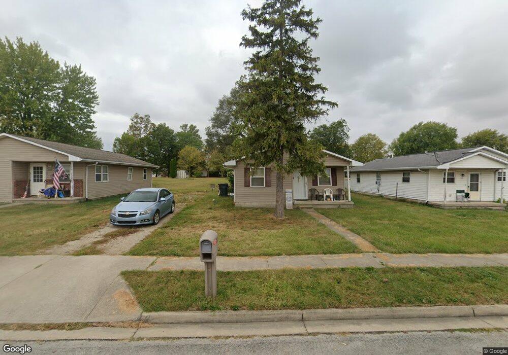
545 N Walnut St Union City, OH 45390
Estimated Value: $85,000 - $132,000
3
Beds
1
Bath
1,008
Sq Ft
$107/Sq Ft
Est. Value
About This Home
This home is located at 545 N Walnut St, Union City, OH 45390 and is currently estimated at $108,207, approximately $107 per square foot. 545 N Walnut St is a home located in Darke County with nearby schools including Mississinawa Valley Elementary School and Mississinawa Valley Junior/Senior High School.
Ownership History
Date
Name
Owned For
Owner Type
Purchase Details
Closed on
Jul 3, 2008
Sold by
Darke County Ohio Habitat For Humanity I
Bought by
Morgan Larry L and Morgan Andra J
Current Estimated Value
Purchase Details
Closed on
Aug 10, 2007
Sold by
Brengman Brian K and Brengman Cindy
Bought by
Darke County Oh Habitat For Humanity Inc
Purchase Details
Closed on
Jun 2, 1993
Sold by
Dunn Donald
Bought by
Morgan Larry L and Morgan Andrea
Purchase Details
Closed on
Jan 17, 1992
Sold by
Dunn Donald
Bought by
Morgan Larry L and Morgan Andrea
Purchase Details
Closed on
Dec 30, 1991
Bought by
Morgan Larry L and Morgan Andrea
Create a Home Valuation Report for This Property
The Home Valuation Report is an in-depth analysis detailing your home's value as well as a comparison with similar homes in the area
Home Values in the Area
Average Home Value in this Area
Purchase History
| Date | Buyer | Sale Price | Title Company |
|---|---|---|---|
| Morgan Larry L | $27,000 | Attorney | |
| Darke County Oh Habitat For Humanity Inc | -- | Attorney | |
| Morgan Larry L | $800 | -- | |
| Morgan Larry L | -- | -- | |
| Morgan Larry L | $17,500 | -- |
Source: Public Records
Tax History Compared to Growth
Tax History
| Year | Tax Paid | Tax Assessment Tax Assessment Total Assessment is a certain percentage of the fair market value that is determined by local assessors to be the total taxable value of land and additions on the property. | Land | Improvement |
|---|---|---|---|---|
| 2024 | $731 | $21,970 | $2,230 | $19,740 |
| 2023 | $733 | $21,970 | $2,230 | $19,740 |
| 2022 | $807 | $20,260 | $1,860 | $18,400 |
| 2021 | $820 | $20,260 | $1,860 | $18,400 |
| 2020 | $825 | $20,260 | $1,860 | $18,400 |
| 2019 | $702 | $17,860 | $1,860 | $16,000 |
| 2018 | $692 | $17,860 | $1,860 | $16,000 |
| 2017 | $644 | $17,860 | $1,860 | $16,000 |
| 2016 | $645 | $17,590 | $2,470 | $15,120 |
| 2015 | $645 | $17,590 | $2,470 | $15,120 |
| 2014 | $647 | $17,590 | $2,470 | $15,120 |
| 2013 | $668 | $17,590 | $2,470 | $15,120 |
Source: Public Records
Map
Nearby Homes
- 543 N Walnut St
- 722 N Union St
- 207 Allen Dr
- 504 N Union St
- 504 N Union St Unit Street
- 113 E North St
- 305 E North St
- 230 NW Deerfield Rd
- 706 Lynwood Ct
- 807 E Cherry St
- 612 N Howard St
- 718 Lynwood Ct
- 507 N Howard St
- 0 W Deerfield Rd Unit 23016117
- 0 W Deerfield Rd Unit 837795
- 0 W Deerfield Rd
- 508 N High St
- 227 South St
- 720 E Main St
- 509 Indiana 28
- 549 N Walnut St
- 551 N Walnut St
- 541 N Walnut St
- 529 N Walnut St
- 528 N Walnut St
- 519 N Walnut St
- 512 N Walnut St
- 505 N Walnut St
- 544 N State Line St
- 510 N Walnut St
- 546 N State Line St
- 591 N Walnut St
- 554 N State Line St
- 528 N State Line St
- 532 N State Line St
- 608 N State Line St
- 501 N Walnut St
- 139 E Caroline St
- 558 N State Line St
- 502 N Walnut St