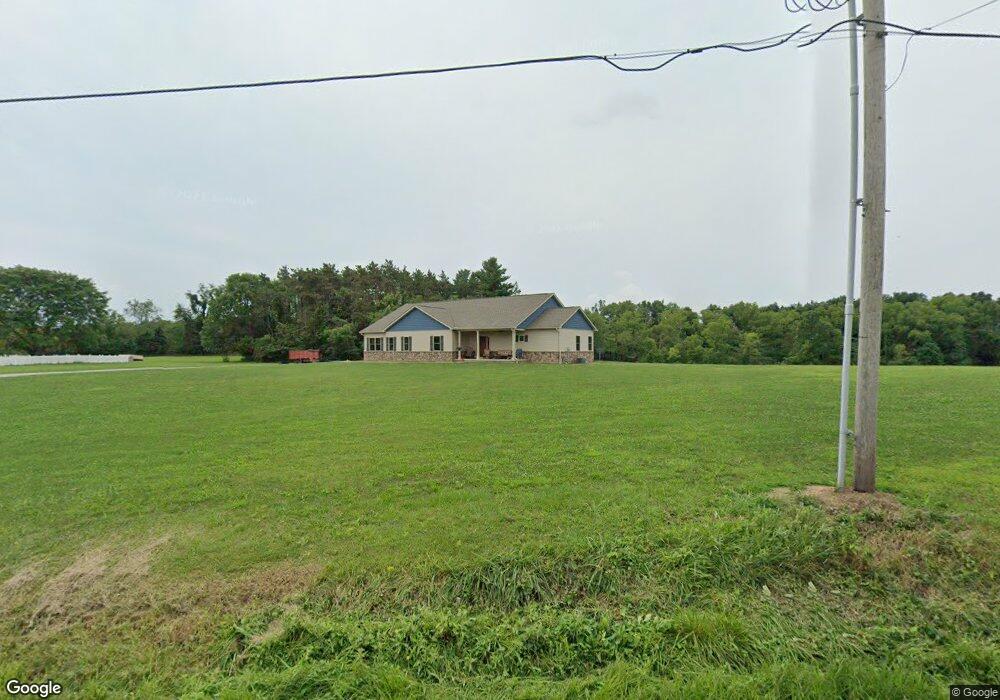
5456 State Route 521 Delaware, OH 43015
Estimated Value: $282,000 - $429,000
3
Beds
1
Bath
1,282
Sq Ft
$268/Sq Ft
Est. Value
About This Home
This home is located at 5456 State Route 521, Delaware, OH 43015 and is currently estimated at $343,138, approximately $267 per square foot. 5456 State Route 521 is a home located in Delaware County with nearby schools including Buckeye Valley High School.
Ownership History
Date
Name
Owned For
Owner Type
Purchase Details
Closed on
Aug 31, 2013
Sold by
Orahood S Neil and Orahood Judy A
Bought by
Department Of Transporation
Current Estimated Value
Purchase Details
Closed on
Oct 26, 2007
Sold by
Jones Denise D and Jones Jeffrey
Bought by
Orahood S Neil and Orahood Judy A
Home Financials for this Owner
Home Financials are based on the most recent Mortgage that was taken out on this home.
Original Mortgage
$100,000
Interest Rate
6.38%
Mortgage Type
Seller Take Back
Create a Home Valuation Report for This Property
The Home Valuation Report is an in-depth analysis detailing your home's value as well as a comparison with similar homes in the area
Home Values in the Area
Average Home Value in this Area
Purchase History
| Date | Buyer | Sale Price | Title Company |
|---|---|---|---|
| Department Of Transporation | $2,260 | None Available | |
| Orahood S Neil | $100,000 | Attorney | |
| Orahood S Neil | -- | Attorney |
Source: Public Records
Mortgage History
| Date | Status | Borrower | Loan Amount |
|---|---|---|---|
| Previous Owner | Orahood S Neil | $100,000 |
Source: Public Records
Tax History Compared to Growth
Tax History
| Year | Tax Paid | Tax Assessment Tax Assessment Total Assessment is a certain percentage of the fair market value that is determined by local assessors to be the total taxable value of land and additions on the property. | Land | Improvement |
|---|---|---|---|---|
| 2024 | $3,352 | $86,460 | $45,190 | $41,270 |
| 2023 | $3,135 | $86,460 | $45,190 | $41,270 |
| 2022 | $2,646 | $65,250 | $28,810 | $36,440 |
| 2021 | $2,649 | $65,250 | $28,810 | $36,440 |
| 2020 | $2,666 | $65,250 | $28,810 | $36,440 |
| 2019 | $2,543 | $57,120 | $24,010 | $33,110 |
| 2018 | $4,139 | $57,120 | $24,010 | $33,110 |
| 2017 | $1,986 | $44,560 | $16,170 | $28,390 |
| 2016 | $1,652 | $44,560 | $16,170 | $28,390 |
| 2015 | $2,123 | $66,580 | $38,190 | $28,390 |
| 2014 | $2,008 | $66,580 | $38,190 | $28,390 |
| 2013 | $1,727 | $67,450 | $39,060 | $28,390 |
Source: Public Records
Map
Nearby Homes
- 3900 Main St
- 6914 Oxford Woods Dr
- 0 Bowtown Rd
- 6239 Howard Rd
- Tract 6 State Route 521
- 0 Twigg Hupp Rd
- 216 County Road 24
- 6824 Linda Ln
- 695 Otter Tail Dr
- 5141 Carters Corner Rd
- 0 Whipple Rd Unit 225024053
- 1779 N Galena Rd
- 6972 Turnstone Loop
- 948 Brittany Dr
- 8356 Ashley Rd
- 1998 State Route 37 E
- 837 Wallace Dr
- 164 Glengary Dr
- 1330 Hanover Rd
- 1330 Hanover Rd Unit 31
- 5424 State Route 521
- 5499 State Route 521
- 5390 State Route 521
- 5592 State Route 521
- 3915 Main St
- 5311 County Home Rd
- 3889 Main St
- 3839 Main St
- 3937 Main St
- 3967 Main St Unit 100
- 3999 Main St
- 3869 Main St
- 4023 Main St
- 0 Main St
- 4035 Main St
- 5662 State Route 521
- 5277 County Home Rd
- 5661 State Route 521
- 3936 Main St
- 3928 Main St