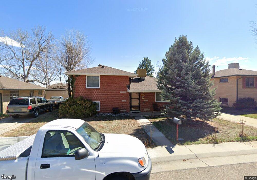
5460 Otis St Arvada, CO 80002
Estimated Value: $528,000 - $581,000
3
Beds
3
Baths
1,391
Sq Ft
$395/Sq Ft
Est. Value
About This Home
This home is located at 5460 Otis St, Arvada, CO 80002 and is currently estimated at $549,425, approximately $394 per square foot. 5460 Otis St is a home located in Jefferson County with nearby schools including Secrest Elementary School, North Arvada Middle School, and Arvada High School.
Ownership History
Date
Name
Owned For
Owner Type
Purchase Details
Closed on
Jan 24, 2008
Sold by
Finn John M
Bought by
Finn Paula A
Current Estimated Value
Purchase Details
Closed on
Apr 27, 1994
Sold by
Cero John R
Bought by
Finn John M and Finn Paula A
Home Financials for this Owner
Home Financials are based on the most recent Mortgage that was taken out on this home.
Original Mortgage
$12,900
Interest Rate
7.76%
Mortgage Type
Seller Take Back
Purchase Details
Closed on
Mar 4, 1994
Sold by
Meis Larry J and Meis Patricia E
Bought by
Cero John R
Home Financials for this Owner
Home Financials are based on the most recent Mortgage that was taken out on this home.
Original Mortgage
$12,900
Interest Rate
7.76%
Mortgage Type
Seller Take Back
Create a Home Valuation Report for This Property
The Home Valuation Report is an in-depth analysis detailing your home's value as well as a comparison with similar homes in the area
Purchase History
| Date | Buyer | Sale Price | Title Company |
|---|---|---|---|
| Finn Paula A | -- | None Available | |
| Finn John M | $92,500 | -- | |
| Cero John R | $84,685 | -- |
Source: Public Records
Mortgage History
| Date | Status | Borrower | Loan Amount |
|---|---|---|---|
| Previous Owner | Finn John M | $12,900 |
Source: Public Records
Tax History
| Year | Tax Paid | Tax Assessment Tax Assessment Total Assessment is a certain percentage of the fair market value that is determined by local assessors to be the total taxable value of land and additions on the property. | Land | Improvement |
|---|---|---|---|---|
| 2024 | $3,175 | $31,866 | $12,796 | $19,070 |
| 2023 | $3,175 | $31,866 | $12,796 | $19,070 |
| 2022 | $2,754 | $27,463 | $9,666 | $17,797 |
| 2021 | $2,795 | $28,253 | $9,944 | $18,309 |
| 2020 | $2,432 | $24,622 | $7,563 | $17,059 |
| 2019 | $2,400 | $24,622 | $7,563 | $17,059 |
| 2018 | $2,242 | $22,348 | $5,522 | $16,826 |
| 2017 | $2,055 | $22,348 | $5,522 | $16,826 |
| 2016 | $2,731 | $18,155 | $5,276 | $12,879 |
| 2015 | $1,556 | $18,155 | $5,276 | $12,879 |
| 2014 | $2,516 | $14,957 | $4,872 | $10,085 |
Source: Public Records
Map
Nearby Homes
- 6865 W 55th Place
- 6910 Reno Dr
- 6940 W 55th Place
- 5465 Reed Ct
- 5423 Saulsbury Ct
- 6427 Grandview Ave Unit A & B
- 5716 Saulsbury St
- 6902 Ralston Rd
- 7357 Grandview Ave Unit 202
- 6480 W 60th Ave
- 6840 W 60th Ave
- 7303 W 59th Ave
- 7856 W 54th Ave Unit 7856
- 7607 Ralston Rd
- 7313 W 60th Ave
- 7931 W 55th Ave Unit 112
- 6990 W 61st Ave
- 5320 Allison St Unit 106
- 5409 Zephyr Ct Unit 5409
- 5366 Allison St Unit D
- 5450 Otis St
- 5470 Otis St
- 5465 Nolan St
- 5475 Nolan St
- 5455 Nolan St
- 5480 Otis St
- 5440 Otis St
- 5465 Otis St
- 5485 Nolan St
- 5445 Nolan St
- 6720 Columbine Dr
- 6680 W 55th Ave
- 6675 W 54th Place
- 6600 W 55th Ave
- 6690 W 55th Ave
- 6665 W 54th Place
- 6735 Columbine Dr
- 6725 W 54th Place
- 5460 Nolan St
- 5450 Nolan St
Your Personal Tour Guide
Ask me questions while you tour the home.