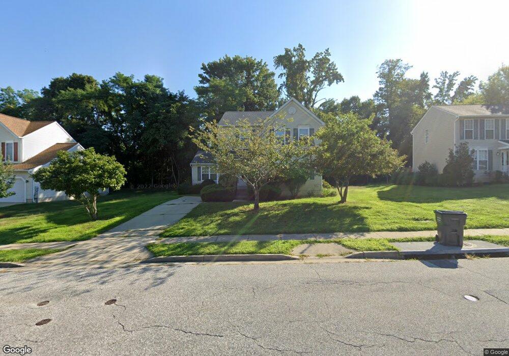
5463 Sir Douglas Dr Bryans Road, MD 20616
Estimated Value: $383,000 - $447,000
4
Beds
4
Baths
1,772
Sq Ft
$237/Sq Ft
Est. Value
About This Home
This home is located at 5463 Sir Douglas Dr, Bryans Road, MD 20616 and is currently estimated at $420,002, approximately $237 per square foot. 5463 Sir Douglas Dr is a home located in Charles County with nearby schools including J.C. Parks Elementary School, Matthew Henson Middle School, and Henry E. Lackey High School.
Ownership History
Date
Name
Owned For
Owner Type
Purchase Details
Closed on
Oct 5, 2009
Sold by
Lasalle Bank National Assoc Trs
Bought by
Ketchum Sherman and Ketchum Mandy
Current Estimated Value
Purchase Details
Closed on
May 14, 2008
Sold by
Dozier Michael and Dozier Rhonda
Bought by
Lasalle Bank National Assoc Trs and C & O Litton Loan Servicing
Purchase Details
Closed on
Jul 12, 2005
Sold by
August Sarah R
Bought by
Dozier Michael and Dozier Rhonda
Home Financials for this Owner
Home Financials are based on the most recent Mortgage that was taken out on this home.
Original Mortgage
$300,000
Interest Rate
6.5%
Mortgage Type
Adjustable Rate Mortgage/ARM
Purchase Details
Closed on
Jun 5, 1998
Sold by
Southampton Corp The
Bought by
August Sarah R
Create a Home Valuation Report for This Property
The Home Valuation Report is an in-depth analysis detailing your home's value as well as a comparison with similar homes in the area
Home Values in the Area
Average Home Value in this Area
Purchase History
| Date | Buyer | Sale Price | Title Company |
|---|---|---|---|
| Ketchum Sherman | $212,500 | -- | |
| Lasalle Bank National Assoc Trs | $257,250 | -- | |
| Dozier Michael | $375,000 | -- | |
| August Sarah R | $145,040 | -- |
Source: Public Records
Mortgage History
| Date | Status | Borrower | Loan Amount |
|---|---|---|---|
| Previous Owner | Dozier Michael | $300,000 | |
| Previous Owner | Dozier Michael | $75,000 | |
| Closed | August Sarah R | -- |
Source: Public Records
Tax History Compared to Growth
Tax History
| Year | Tax Paid | Tax Assessment Tax Assessment Total Assessment is a certain percentage of the fair market value that is determined by local assessors to be the total taxable value of land and additions on the property. | Land | Improvement |
|---|---|---|---|---|
| 2025 | $10,498 | $367,700 | $72,100 | $295,600 |
| 2024 | $4,558 | $338,333 | $0 | $0 |
| 2023 | $4,415 | $308,967 | $0 | $0 |
| 2022 | $3,950 | $279,600 | $70,100 | $209,500 |
| 2021 | $3,726 | $272,767 | $0 | $0 |
| 2020 | $3,726 | $265,933 | $0 | $0 |
| 2019 | $3,621 | $259,100 | $60,100 | $199,000 |
| 2018 | $3,466 | $250,467 | $0 | $0 |
| 2017 | $3,345 | $241,833 | $0 | $0 |
| 2016 | -- | $233,200 | $0 | $0 |
| 2015 | $3,040 | $233,200 | $0 | $0 |
| 2014 | $3,040 | $233,200 | $0 | $0 |
Source: Public Records
Map
Nearby Homes
- 6551 Cornell Rd
- 5115 Culpepper Place
- 2760 Cheyenne Ct
- 2609 Larissa Ct
- 2860 Chippewa St
- 6876 Barrowfield Place
- 6826 Matthews Rd
- 6836 Matthews Rd
- 6838 Matthews Rd
- 6830 Matthews Rd
- 6822 Matthews Rd
- 6954 Farragut Dr
- 6520 Jousting Ct
- 2762 Bridgewater Dr
- 2647 Longbow Ct
- 3027 Coriander Place
- 6528 Jousting Ct
- 2978 Knight Ct
- 2950 Knight Ct
- 5829 Monmouth Ct
- 5467 Sir Douglas Dr
- 5459 Sir Douglas Dr
- 5471 Sir Douglas Dr
- 5455 Sir Douglas Dr
- 6713 Amherst Rd
- 6711 Amherst Rd
- 5458 Sir Douglas Dr
- 2074 Walden Ct
- 6715 Amherst Rd
- 5454 Sir Douglas Dr
- 6709 Amherst Rd
- 2104 Wilder Ct
- 5475 Sir Douglas Dr
- 2070 Walden Ct
- 2100 Wilder Ct
- 1921 Hilton Ct
- 2077 Walden Ct
- 6717 Amherst Rd
- 6707 Amherst Rd
- 5446 Sir Douglas Dr