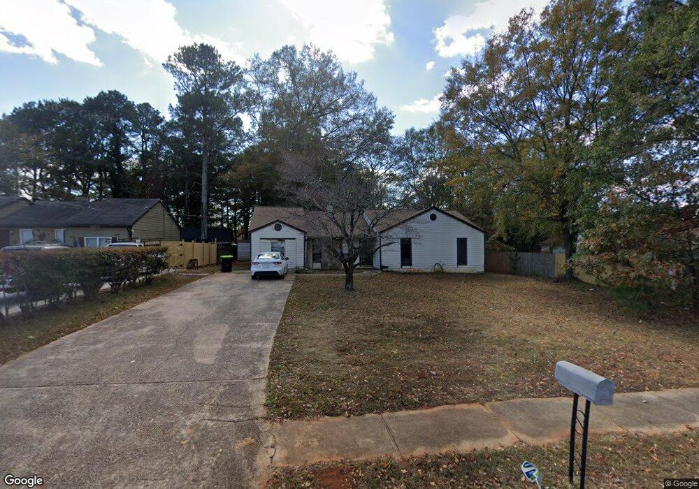
5465 Reynolds Rd Unit II Morrow, GA 30260
Estimated Value: $206,784 - $283,000
--
Bed
2
Baths
1,750
Sq Ft
$142/Sq Ft
Est. Value
About This Home
This home is located at 5465 Reynolds Rd Unit II, Morrow, GA 30260 and is currently estimated at $247,696, approximately $141 per square foot. 5465 Reynolds Rd Unit II is a home located in Clayton County with nearby schools including Lake City Elementary School, Babb Middle School, and Forest Park High School.
Ownership History
Date
Name
Owned For
Owner Type
Purchase Details
Closed on
May 28, 1999
Sold by
Franklin Carolyn
Bought by
Person Patience
Current Estimated Value
Home Financials for this Owner
Home Financials are based on the most recent Mortgage that was taken out on this home.
Original Mortgage
$83,892
Outstanding Balance
$20,807
Interest Rate
7.04%
Mortgage Type
FHA
Estimated Equity
$226,889
Create a Home Valuation Report for This Property
The Home Valuation Report is an in-depth analysis detailing your home's value as well as a comparison with similar homes in the area
Home Values in the Area
Average Home Value in this Area
Purchase History
| Date | Buyer | Sale Price | Title Company |
|---|---|---|---|
| Person Patience | $85,000 | -- |
Source: Public Records
Mortgage History
| Date | Status | Borrower | Loan Amount |
|---|---|---|---|
| Open | Person Patience | $83,892 |
Source: Public Records
Tax History Compared to Growth
Tax History
| Year | Tax Paid | Tax Assessment Tax Assessment Total Assessment is a certain percentage of the fair market value that is determined by local assessors to be the total taxable value of land and additions on the property. | Land | Improvement |
|---|---|---|---|---|
| 2024 | $3,261 | $93,600 | $7,200 | $86,400 |
| 2023 | $3,029 | $83,880 | $7,200 | $76,680 |
| 2022 | $1,925 | $59,040 | $7,200 | $51,840 |
| 2021 | $1,468 | $47,160 | $7,200 | $39,960 |
| 2020 | $1,353 | $43,836 | $7,200 | $36,636 |
| 2019 | $1,124 | $37,689 | $4,800 | $32,889 |
| 2018 | $850 | $30,928 | $4,800 | $26,128 |
| 2017 | $567 | $23,924 | $4,800 | $19,124 |
| 2016 | $560 | $23,773 | $4,800 | $18,973 |
| 2015 | $263 | $0 | $0 | $0 |
| 2014 | $317 | $17,951 | $5,600 | $12,351 |
Source: Public Records
Map
Nearby Homes
- 1112 Reynolds Ct Unit 4
- 5489 Ahyoka Dr
- 1167 Sanders Dr
- 5570 Ash St
- 965 Cone Rd
- 1063 Pine Mountain Dr
- 0 Ash St Unit 10563129
- 5690 Cypress Dr
- 865 Oakdale Dr
- 843 White Oak Dr
- 5344 Sharon St
- 5355 Sharon St
- 1124 Ponderosa Park Dr
- 960 Longleaf Dr
- 743 Brookwood Dr
- 655 Shellnut Dr Unit 2
- 1343 Burbank Trail
- 913 Longleaf Dr
- 98 Werner Brook Way SW
- 804 Linda Way
- 5471 Reynolds Rd Unit II
- 5546 Phillips Dr Unit 12
- 5546 Phillips Dr Unit 1
- 5552 Phillips Dr
- 5477 Reynolds Rd
- 5558 Phillips Dr Unit 1
- 5483 Reynolds Rd
- 1106 Reynolds Ct
- 5564 Phillips Dr
- 1098 Reynolds Ct Unit 33
- 1098 Reynolds Ct
- 5553 Phillips Dr
- 5555 Phillips Dr
- 1624 Pineridge Rd
- 5489 Reynolds Rd
- 5574 Phillips Dr
- 5563 Phillips Dr
- 1064 Pineridge Dr
- 5495 Reynolds Rd
- 1120 Reynolds Ct