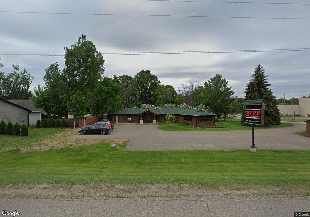
5469 Highway 12 Maple Plain, MN 55359
Estimated Value: $473,265
Studio
--
Bath
2,472
Sq Ft
$191/Sq Ft
Est. Value
About This Home
This home is located at 5469 Highway 12, Maple Plain, MN 55359 and is currently estimated at $473,265, approximately $191 per square foot. 5469 Highway 12 is a home located in Hennepin County with nearby schools including Schumann Elementary School, Orono Intermediate Elementary School, and Orono Middle School.
Ownership History
Date
Name
Owned For
Owner Type
Purchase Details
Closed on
Jan 7, 2016
Sold by
Adams Winston and Adams Barbara
Bought by
Minnesota Beef Promotion & Research Coun
Current Estimated Value
Purchase Details
Closed on
Jun 20, 2015
Sold by
Al Rich Llc
Bought by
Adams Winston and Adams Barbara
Purchase Details
Closed on
Jul 13, 2011
Sold by
Woods William B
Bought by
Adams Winston and Adams Barbara
Purchase Details
Closed on
Mar 1, 2006
Sold by
Jamts John
Bought by
Woods William and Woods Nicole
Purchase Details
Closed on
Mar 29, 2002
Sold by
Mcglinsky Robert G
Bought by
James John M and James Lisa H
Create a Home Valuation Report for This Property
The Home Valuation Report is an in-depth analysis detailing your home's value as well as a comparison with similar homes in the area
Home Values in the Area
Average Home Value in this Area
Purchase History
| Date | Buyer | Sale Price | Title Company |
|---|---|---|---|
| Minnesota Beef Promotion & Research Coun | $300,000 | Attorney | |
| Adams Winston | -- | First American Title | |
| Adams Winston | $300,000 | North American Title Company | |
| Adams Winston | $300,000 | -- | |
| Woods William | $275,000 | -- | |
| James John M | $88,815 | -- |
Source: Public Records
Tax History
| Year | Tax Paid | Tax Assessment Tax Assessment Total Assessment is a certain percentage of the fair market value that is determined by local assessors to be the total taxable value of land and additions on the property. | Land | Improvement |
|---|---|---|---|---|
| 2024 | -- | -- | -- | -- |
| 2023 | $0 | $0 | $0 | $0 |
| 2022 | $0 | $0 | $0 | $0 |
| 2021 | $7,574 | $0 | $0 | $0 |
| 2020 | $7,574 | $0 | $0 | $0 |
| 2019 | $7,574 | $0 | $0 | $0 |
| 2018 | $0 | $0 | $0 | $0 |
| 2017 | $0 | $0 | $0 | $0 |
| 2016 | $7,574 | $214,000 | $79,000 | $135,000 |
| 2015 | $7,437 | $204,000 | $75,000 | $129,000 |
| 2014 | -- | $204,000 | $75,000 | $129,000 |
Source: Public Records
Map
Nearby Homes
- 1635 Delano Ave
- 5340 Main St E
- 5249 Main St E
- 5183 Independence St
- 5245 Clayton Dr
- 5540 Timber Trail
- 2017 Bridgevine Ct
- 4819 Baker Reserve Ln
- 4835 Drake St
- 2045 Bridgevine Ct
- 4842 Baker Reserve Ln
- 4801 Baker Reserve Ln
- 2101 Bridgevine Ct
- 2211 Heritage Trail
- 2073 Bridgevine Ct
- 2084 Bridgevine Ct
- 4894 Bridgevine Way
- 2224 Bridgevine Ct
- 5901 Drake Dr
- 5112 S Lakeshore Dr
- 1675 Spring Ave
- 1675 Spring Ave
- 5470 Main St E
- 1665 1665 Spring-Avenue-
- 1665 Spring Ave
- 5440 Main St E
- 1660 Spring Ave
- 5420 Main St E
- 1655 Marsh Ave
- 1647 Marsh Ave
- 5390 Main St E
- 5390 5390 Main-Street-e
- 5530 Main St W
- 5465 Main St W
- 5465 W Main St
- 5465 5465 Main-Street-w
- 5445 Main St W
- 5475 Main St W
- 5485 Main St W
- 5536 Main St W
Your Personal Tour Guide
Ask me questions while you tour the home.