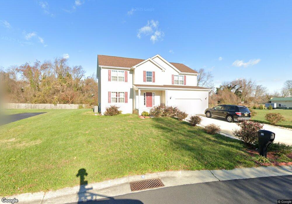
547 Quail Landing Cir Magnolia, DE 19962
Rising Sun-Lebanon NeighborhoodEstimated Value: $431,000 - $484,748
4
Beds
3
Baths
1,800
Sq Ft
$256/Sq Ft
Est. Value
About This Home
This home is located at 547 Quail Landing Cir, Magnolia, DE 19962 and is currently estimated at $460,937, approximately $256 per square foot. 547 Quail Landing Cir is a home located in Kent County with nearby schools including Allen Frear Elementary School, F. Niel Postlethwait Middle School, and Caesar Rodney High School.
Ownership History
Date
Name
Owned For
Owner Type
Purchase Details
Closed on
Aug 16, 2019
Sold by
U & I Investments Llc
Bought by
Saini Rajpal
Current Estimated Value
Home Financials for this Owner
Home Financials are based on the most recent Mortgage that was taken out on this home.
Original Mortgage
$299,552
Outstanding Balance
$263,895
Interest Rate
3.99%
Mortgage Type
FHA
Estimated Equity
$197,042
Purchase Details
Closed on
Aug 22, 2018
Sold by
Never Ever Llc
Bought by
U & I Investments Llc
Purchase Details
Closed on
Sep 25, 2017
Sold by
Santone Enterprises Llc
Bought by
Never Ever Llc
Create a Home Valuation Report for This Property
The Home Valuation Report is an in-depth analysis detailing your home's value as well as a comparison with similar homes in the area
Home Values in the Area
Average Home Value in this Area
Purchase History
| Date | Buyer | Sale Price | Title Company |
|---|---|---|---|
| Saini Rajpal | $320,000 | None Available | |
| U & I Investments Llc | $1,155,000 | None Available | |
| Never Ever Llc | -- | None Available |
Source: Public Records
Mortgage History
| Date | Status | Borrower | Loan Amount |
|---|---|---|---|
| Open | Saini Rajpal | $299,552 |
Source: Public Records
Tax History Compared to Growth
Tax History
| Year | Tax Paid | Tax Assessment Tax Assessment Total Assessment is a certain percentage of the fair market value that is determined by local assessors to be the total taxable value of land and additions on the property. | Land | Improvement |
|---|---|---|---|---|
| 2025 | $2,251 | $424,800 | $81,600 | $343,200 |
| 2024 | $2,251 | $424,800 | $81,600 | $343,200 |
| 2023 | $2,188 | $66,000 | $5,100 | $60,900 |
| 2022 | $2,060 | $66,000 | $5,100 | $60,900 |
| 2021 | $2,077 | $66,000 | $5,100 | $60,900 |
| 2020 | $1,640 | $66,000 | $5,100 | $60,900 |
| 2019 | $212 | $5,100 | $5,100 | $0 |
| 2018 | $121 | $500 | $500 | $0 |
| 2017 | $124 | $500 | $0 | $0 |
| 2016 | $110 | $500 | $0 | $0 |
| 2015 | $97 | $500 | $0 | $0 |
| 2014 | $119 | $500 | $0 | $0 |
Source: Public Records
Map
Nearby Homes
- 580 Locust Grove Rd
- 38 Planters Run Ct
- 128 Jillian Ct
- 1810 Windswept Cir
- 5 Crossley Dr
- 83 Homestead Dr
- 3444 S State St
- 2043 Highland Ave
- 207 Chenault Ct
- 326 Remington Dr
- 279 Remington Dr
- 284 Remington Dr
- 106 Steffens Blvd
- 265 Remington Dr
- 573 W Birdie Ln
- 139 Chase St
- 270 Remington Dr
- 253 Remington Dr
- 239 Remington Dr
- 200 Beechwood Ave Unit 2
- 529 Quail Landing Cir
- 560 Quail Landing Cir
- 511 Quail Landing Cir
- 516 Quail Landing Cir
- 1483 Cypress Branch Rd
- 0 Trapper Ln Unit 5349029
- 0 Trapper Ln Unit 5363468
- 0 Trapper Ln Unit 5625610
- 0 Trapper Ln Unit 5625614
- 0 Trapper Ln Unit 5625613
- 0 Trapper Ln Unit 5885109
- 0 Trapper Ln Unit 5885162
- 0 Trapper Ln Unit 5885158
- Trapper Ln
- 0 Trapper Ln Unit 1008939570
- 0 Trapper Ln Unit 1008939534
- 0 Trapper Ln Unit 1008939482
- 495 Quail Landing Cir
- 588 Quail Landing Cir
- 1543 Cypress Branch Rd