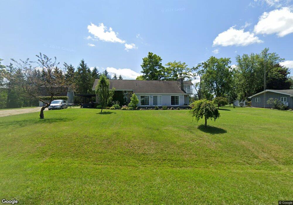
547 Rolling Meadows Dr Unit ROLLING MEADOW DR Hudson, MI 49247
Estimated Value: $353,283 - $413,000
3
Beds
2
Baths
2,052
Sq Ft
$191/Sq Ft
Est. Value
About This Home
This home is located at 547 Rolling Meadows Dr Unit ROLLING MEADOW DR, Hudson, MI 49247 and is currently estimated at $391,761, approximately $190 per square foot. 547 Rolling Meadows Dr Unit ROLLING MEADOW DR is a home located in Lenawee County with nearby schools including Lincoln Elementary School, Hudson Middle School, and Southern Michigan Center For Science & Industry (SMCSI).
Ownership History
Date
Name
Owned For
Owner Type
Purchase Details
Closed on
Jun 28, 2012
Sold by
Federal Home Loan Mortgage Corporation
Bought by
Suilivian Dennis P and Suilivian Bridget L
Current Estimated Value
Home Financials for this Owner
Home Financials are based on the most recent Mortgage that was taken out on this home.
Original Mortgage
$97,920
Outstanding Balance
$73,483
Interest Rate
5.62%
Mortgage Type
Adjustable Rate Mortgage/ARM
Estimated Equity
$318,278
Purchase Details
Closed on
Sep 1, 2011
Sold by
Behland Nick C and Behland Doris M
Bought by
Federal Home Loan Mortgage Corporation
Purchase Details
Closed on
May 30, 1997
Bought by
Sullivan Ii Dennis P and Sullivan Bridget L
Create a Home Valuation Report for This Property
The Home Valuation Report is an in-depth analysis detailing your home's value as well as a comparison with similar homes in the area
Home Values in the Area
Average Home Value in this Area
Purchase History
| Date | Buyer | Sale Price | Title Company |
|---|---|---|---|
| Suilivian Dennis P | $109,000 | None Available | |
| Federal Home Loan Mortgage Corporation | $205,104 | None Available | |
| Sullivan Ii Dennis P | $170,000 | -- |
Source: Public Records
Mortgage History
| Date | Status | Borrower | Loan Amount |
|---|---|---|---|
| Open | Suilivian Dennis P | $97,920 |
Source: Public Records
Tax History Compared to Growth
Tax History
| Year | Tax Paid | Tax Assessment Tax Assessment Total Assessment is a certain percentage of the fair market value that is determined by local assessors to be the total taxable value of land and additions on the property. | Land | Improvement |
|---|---|---|---|---|
| 2025 | $3,111 | $168,800 | $0 | $0 |
| 2024 | $1,223 | $161,500 | $0 | $0 |
| 2023 | $2,847 | $141,500 | $0 | $0 |
| 2022 | $1,074 | $128,400 | $0 | $0 |
| 2021 | $2,782 | $116,600 | $0 | $0 |
| 2020 | $2,751 | $106,200 | $0 | $0 |
| 2019 | $257,179 | $104,300 | $0 | $0 |
| 2018 | $2,671 | $104,310 | $0 | $0 |
| 2017 | $2,683 | $96,118 | $0 | $0 |
| 2016 | $2,481 | $87,491 | $0 | $0 |
| 2014 | -- | $87,516 | $0 | $0 |
Source: Public Records
Map
Nearby Homes
- 592 Rolling Meadows Dr
- V/L Forrister Rd
- 13627 Cadmus Rd
- 16378 Cadmus Rd
- 782 N Maple Grove Ave
- 9917 Beecher Rd
- 18000 blk #1 Forrister Rd
- 18000 blk #3 Forrister Rd
- 18000 blk #2 Forrister Rd
- 575 State St
- 11609 Carleton Rd
- 111 & 115 N Market St
- 11597 W Carleton Rd
- 10913 E Railroad St
- 18000 blk Forrister Rd
- 3601 Seneca St
- 14980 Forrister Rd
- 310 School St
- 542 Tiffin St
- 4675 Munson Hwy
- 547 Rolling Meadows Dr
- 547 Rolling Meadows Dr
- 551 Rolling Meadows Dr
- 500 BLK Rolling Meadows Dr
- 0 Rolling Meadows Dr
- 567 Rolling Meadows Dr
- 566 Rolling Meadows Dr
- 1240 N Posey Lake Hwy
- 568 Rolling Meadows Dr
- 572 Rolling Meadows Dr
- 575 Rolling Meadows Dr Unit ROLLING MEADOWS DR
- 575 Rolling Meadows Dr
- 574 Rolling Meadows Dr
- 544 N Posey Lake Hwy
- 544 Rolling Meadows Dr
- 1220 Posey Lake Hwy
- 578 Rolling Meadows Dr
- 5401 Shady Lane Dr
- 1220 N Posey Lake Hwy
- 595 Rolling Meadows Dr