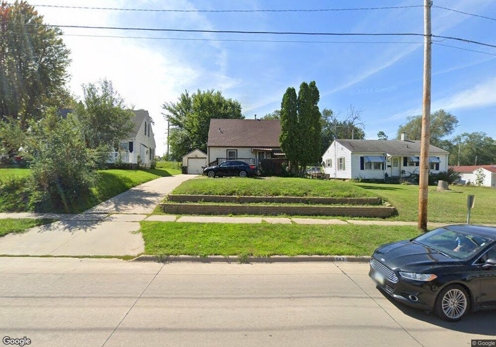
547 S Ferry St Ottumwa, IA 52501
Estimated Value: $109,000 - $127,000
2
Beds
1
Bath
972
Sq Ft
$121/Sq Ft
Est. Value
About This Home
This home is located at 547 S Ferry St, Ottumwa, IA 52501 and is currently estimated at $117,489, approximately $120 per square foot. 547 S Ferry St is a home located in Wapello County with nearby schools including Liberty Elementary School, Douma Elementary School, and Evans Middle School.
Ownership History
Date
Name
Owned For
Owner Type
Purchase Details
Closed on
Jul 7, 2025
Sold by
Ames Holdings Llc
Bought by
Iat 113 Llc
Current Estimated Value
Purchase Details
Closed on
Jun 10, 2025
Sold by
Treasurer Of Wapello County
Bought by
Ames Holdings Llc
Purchase Details
Closed on
Apr 6, 2018
Sold by
Saenz Norma M
Bought by
Hernandez Marcela
Purchase Details
Closed on
Feb 20, 2007
Sold by
Smith Lonnie Duane
Bought by
Saenz Norma M
Home Financials for this Owner
Home Financials are based on the most recent Mortgage that was taken out on this home.
Original Mortgage
$46,350
Interest Rate
6.23%
Mortgage Type
New Conventional
Create a Home Valuation Report for This Property
The Home Valuation Report is an in-depth analysis detailing your home's value as well as a comparison with similar homes in the area
Home Values in the Area
Average Home Value in this Area
Purchase History
| Date | Buyer | Sale Price | Title Company |
|---|---|---|---|
| Iat 113 Llc | -- | None Listed On Document | |
| Ames Holdings Llc | $1,821 | None Listed On Document | |
| Ames Holdings Llc | $1,821 | None Listed On Document | |
| Hernandez Marcela | $42,500 | -- | |
| Saenz Norma M | $46,500 | None Available |
Source: Public Records
Mortgage History
| Date | Status | Borrower | Loan Amount |
|---|---|---|---|
| Previous Owner | Saenz Norma M | $46,350 |
Source: Public Records
Tax History Compared to Growth
Tax History
| Year | Tax Paid | Tax Assessment Tax Assessment Total Assessment is a certain percentage of the fair market value that is determined by local assessors to be the total taxable value of land and additions on the property. | Land | Improvement |
|---|---|---|---|---|
| 2025 | $1,868 | $90,940 | $7,800 | $83,140 |
| 2024 | $1,868 | $86,170 | $7,800 | $78,370 |
| 2023 | $1,650 | $86,170 | $7,800 | $78,370 |
| 2022 | $1,656 | $69,090 | $7,800 | $61,290 |
| 2021 | $1,656 | $65,240 | $7,800 | $57,440 |
| 2020 | $1,600 | $62,250 | $7,800 | $54,450 |
| 2019 | $1,634 | $62,250 | $0 | $0 |
| 2018 | $1,586 | $62,250 | $0 | $0 |
| 2017 | $1,586 | $62,250 | $0 | $0 |
| 2016 | $1,568 | $62,737 | $0 | $0 |
| 2015 | $1,352 | $62,737 | $0 | $0 |
| 2014 | $1,332 | $62,737 | $0 | $0 |
Source: Public Records
Map
Nearby Homes
- 546 Minnesota St
- 419 S Pocahontas St
- 0 S Webster Unit NOC6332429
- 00 S Webster St
- 404 W Mary St
- 522 S Adella St
- 9 Kingsley Dr
- 534 Ray St
- 920 W Finley Ave
- 401 S Willard St
- 530 Leighton St
- 519 W Finley Ave
- 434 S Ward St
- 1401 W Finley Ave
- 846 S Adella St
- 314 Hamilton St
- 120 Shaul Ave
- 1508 Hamilton St
- 522 S Davis St
- 714 Lake Rd
- 551 S Ferry St
- 543 S Ferry St
- 559 S Ferry St
- 535 S Ferry St
- 546 S Ferry St
- 550 S Ferry St
- 542 S Ferry St
- 531 S Ferry St
- 749 W Mary St
- 530 S Ferry St
- 527 S Ferry St
- 530 S Ferry St
- 750 W Mary St
- 525 S Ferry St
- 524 S Ferry St
- 539 Minnesota St
- 547 Minnesota St
- 537 Minnesota St
- 549 Minnesota St
- 535 Minnesota St