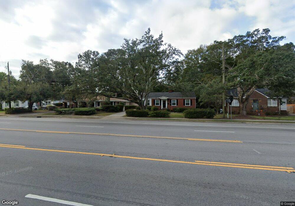
547 Saint Andrews Blvd Charleston, SC 29407
Estimated Value: $400,000 - $665,000
3
Beds
1
Bath
1,628
Sq Ft
$337/Sq Ft
Est. Value
About This Home
This home is located at 547 Saint Andrews Blvd, Charleston, SC 29407 and is currently estimated at $548,324, approximately $336 per square foot. 547 Saint Andrews Blvd is a home located in Charleston County with nearby schools including St. Andrews School Of Math And Science, West Ashley High School, and Charleston Development Academy.
Ownership History
Date
Name
Owned For
Owner Type
Purchase Details
Closed on
Jan 7, 2015
Sold by
Burmester Howard F
Bought by
Knowles Elizabeth F
Current Estimated Value
Home Financials for this Owner
Home Financials are based on the most recent Mortgage that was taken out on this home.
Original Mortgage
$68,800
Outstanding Balance
$53,084
Interest Rate
4.04%
Mortgage Type
New Conventional
Estimated Equity
$495,240
Purchase Details
Closed on
Dec 21, 2005
Sold by
Burchfield Marsha
Bought by
Burmester Howard F
Purchase Details
Closed on
Dec 6, 2005
Sold by
Burmester Howard F
Bought by
Burmester Howard F and Burchfield Marsha
Create a Home Valuation Report for This Property
The Home Valuation Report is an in-depth analysis detailing your home's value as well as a comparison with similar homes in the area
Home Values in the Area
Average Home Value in this Area
Purchase History
| Date | Buyer | Sale Price | Title Company |
|---|---|---|---|
| Knowles Elizabeth F | $86,000 | -- | |
| Burmester Howard F | $80,000 | None Available | |
| Burmester Howard F | -- | None Available |
Source: Public Records
Mortgage History
| Date | Status | Borrower | Loan Amount |
|---|---|---|---|
| Open | Knowles Elizabeth F | $68,800 |
Source: Public Records
Tax History Compared to Growth
Tax History
| Year | Tax Paid | Tax Assessment Tax Assessment Total Assessment is a certain percentage of the fair market value that is determined by local assessors to be the total taxable value of land and additions on the property. | Land | Improvement |
|---|---|---|---|---|
| 2024 | $1,095 | $7,660 | $0 | $0 |
| 2023 | $1,095 | $7,660 | $0 | $0 |
| 2022 | $996 | $7,660 | $0 | $0 |
| 2021 | $1,042 | $7,660 | $0 | $0 |
| 2020 | $1,079 | $7,660 | $0 | $0 |
| 2019 | $932 | $6,400 | $0 | $0 |
| 2017 | $902 | $8,400 | $0 | $0 |
| 2016 | $3,258 | $8,400 | $0 | $0 |
| 2015 | $968 | $7,000 | $0 | $0 |
| 2014 | $976 | $0 | $0 | $0 |
| 2011 | -- | $0 | $0 | $0 |
Source: Public Records
Map
Nearby Homes
- 554 Godfrey Park Place
- 718 Parish Rd
- 549 Godfrey Park Place
- 867 Colony Dr Unit F92
- 874 Colony Dr Unit B19
- 870 Colony Dr Unit 2
- 41 Berkeley Rd
- 21 Beverly Rd Unit A & B
- 8 Stratford Rd
- 33 Yeadon Ave
- 699 Savannah Hwy
- 18 Lyttleton Ave
- 103 Tall Oak Ave
- 3 Lord Ashley Dr
- 24 Oakdale Place
- 46 Chadwick Dr
- 351 Confederate Cir
- 48 Avondale Ave
- 345 Confederate Cir
- 335 Savannah Hwy
- 551 Saint Andrews Blvd
- 543 Saint Andrews Blvd
- 555 Saint Andrews Blvd
- 541 Saint Andrews Blvd
- 548 Godfrey Park Place
- 546 Godfrey Park Place
- 552 Godfrey Park Place
- 559 St Andrews Blvd
- 542 Godfrey Park Place
- 559 Saint Andrews Blvd
- 537 Saint Andrews Blvd
- 802 Sheldon Rd
- 540 Godfrey Park Place
- 712 Parish Rd
- 561 Saint Andrews Blvd
- 538 Saint Andrews Blvd
- 533 Saint Andrews Blvd
- 803 Sheldon Rd
- 804 Sheldon Rd
- 534 Saint Andrews Blvd