Estimated Value: $141,801 - $171,000
--
Bed
1
Bath
1,072
Sq Ft
$146/Sq Ft
Est. Value
About This Home
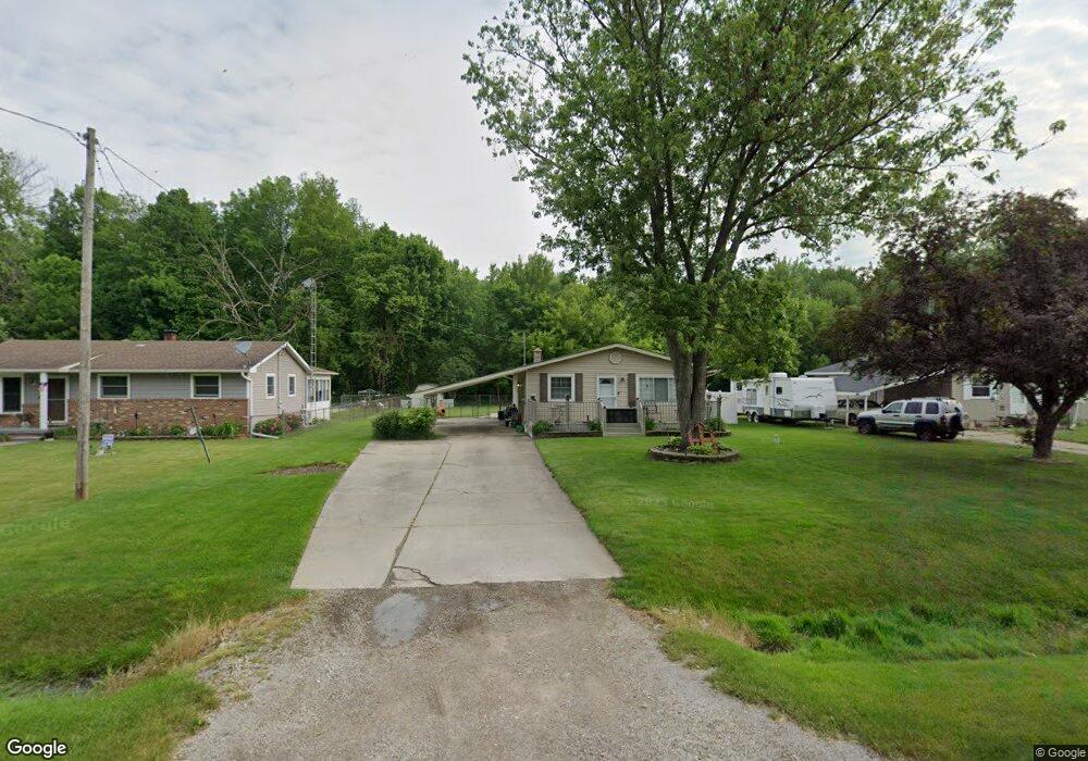
This home is located at 5471 Hopkins Rd, Flint, MI 48506 and is currently estimated at $156,450, approximately $145 per square foot. 5471 Hopkins Rd is a home located in Genesee County with nearby schools including Weston Elementary School, Leota Fiedler Elementary School, and Kate Dowdall Elementary School.
Ownership History
Date
Name
Owned For
Owner Type
Purchase Details
Closed on
Oct 28, 2009
Sold by
Richardson Dennis M and Hanner Deborah A
Bought by
Richardson Dennis M and Richardson Deborah A
Current Estimated Value
Home Financials for this Owner
Home Financials are based on the most recent Mortgage that was taken out on this home.
Original Mortgage
$68,000
Interest Rate
5.11%
Mortgage Type
New Conventional
Purchase Details
Closed on
Sep 17, 2003
Sold by
Richardson Joseph D and Richardson Alice
Bought by
Richardson Dennis M and Hanner Deborah A
Create a Home Valuation Report for This Property
The Home Valuation Report is an in-depth analysis detailing your home's value as well as a comparison with similar homes in the area
Home Values in the Area
Average Home Value in this Area
Purchase History
| Date | Buyer | Sale Price | Title Company |
|---|---|---|---|
| Richardson Dennis M | -- | Cislo Title Co | |
| Richardson Dennis M | $95,000 | Guaranty Title Company |
Source: Public Records
Mortgage History
| Date | Status | Borrower | Loan Amount |
|---|---|---|---|
| Closed | Richardson Dennis M | $68,000 |
Source: Public Records
Tax History Compared to Growth
Tax History
| Year | Tax Paid | Tax Assessment Tax Assessment Total Assessment is a certain percentage of the fair market value that is determined by local assessors to be the total taxable value of land and additions on the property. | Land | Improvement |
|---|---|---|---|---|
| 2025 | $1,457 | $74,800 | $0 | $0 |
| 2024 | $391 | $69,500 | $0 | $0 |
| 2023 | $373 | $61,800 | $0 | $0 |
| 2022 | $1,190 | $56,600 | $0 | $0 |
| 2021 | $1,180 | $51,500 | $0 | $0 |
| 2020 | $341 | $46,300 | $0 | $0 |
| 2019 | $336 | $41,300 | $0 | $0 |
| 2018 | $1,229 | $35,600 | $0 | $0 |
| 2017 | $1,074 | $34,900 | $0 | $0 |
| 2016 | $1,066 | $32,200 | $0 | $0 |
| 2015 | $928 | $29,300 | $0 | $0 |
| 2014 | $310 | $27,300 | $0 | $0 |
| 2012 | -- | $26,500 | $26,500 | $0 |
Source: Public Records
Map
Nearby Homes
- 5429 Hopkins Rd
- 5335 Rose Ln
- 6323 Bluejay Dr
- 5068 Roberts Dr
- 5111 Paro Dr
- 6363 Bluejay Dr
- 6077 Crown Point
- 6298 Nightingale Dr
- 4455 N Genesee Rd
- 4062 N Belsay Rd
- 5521 N Belsay Rd
- 4465 Market Place
- 5141 N Vassar Rd
- 4489 Home Town Dr Unit 32
- 4459 Market Place
- 4453 Market Place
- 4441 Market Place
- 4435 Market Place
- 4425 Market Place
- 0000 Home Town Dr
- 5463 Hopkins Rd
- 5477 Hopkins Rd
- 5485 Hopkins Rd
- 5457 Hopkins Rd
- 5493 Hopkins Rd
- 5447 Hopkins Rd
- 5441 Hopkins Rd
- 5501 Hopkins Rd
- 5427 Hopkins Rd
- 5496 Hopkins Rd
- 5509 Hopkins Rd
- 5431 Hopkins Rd
- 5504 Hopkins Rd
- 5021 N Belsay Rd
- 5468 Hopkins Rd
- 5011 N Belsay Rd
- 5029 N Belsay Rd
- 5454 Hopkins Rd
- 5478 Hopkins Rd
- 5037 N Belsay Rd