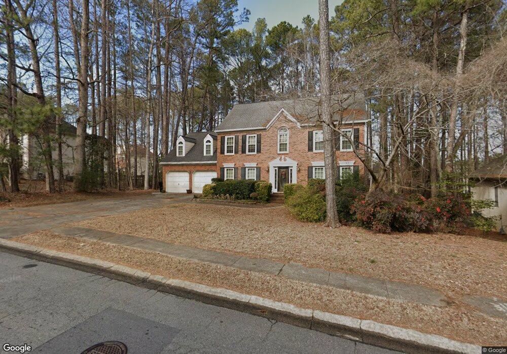
5484 Brookstone Dr NW Unit 1 Acworth, GA 30101
Estimated Value: $518,100 - $587,000
5
Beds
3
Baths
2,943
Sq Ft
$188/Sq Ft
Est. Value
About This Home
This home is located at 5484 Brookstone Dr NW Unit 1, Acworth, GA 30101 and is currently estimated at $552,525, approximately $187 per square foot. 5484 Brookstone Dr NW Unit 1 is a home located in Cobb County with nearby schools including Pickett's Mill Elementary School, Durham Middle School, and Allatoona High School.
Ownership History
Date
Name
Owned For
Owner Type
Purchase Details
Closed on
Aug 15, 2007
Sold by
Ross Richard M
Bought by
Ross Richard M and Ross Janet B
Current Estimated Value
Home Financials for this Owner
Home Financials are based on the most recent Mortgage that was taken out on this home.
Original Mortgage
$200,000
Interest Rate
6.65%
Mortgage Type
New Conventional
Purchase Details
Closed on
Aug 16, 1999
Sold by
Horner Milford and Horner Gloria M
Bought by
Ross Richard M and Ross Janet B
Home Financials for this Owner
Home Financials are based on the most recent Mortgage that was taken out on this home.
Original Mortgage
$143,900
Interest Rate
7.5%
Mortgage Type
New Conventional
Create a Home Valuation Report for This Property
The Home Valuation Report is an in-depth analysis detailing your home's value as well as a comparison with similar homes in the area
Home Values in the Area
Average Home Value in this Area
Purchase History
| Date | Buyer | Sale Price | Title Company |
|---|---|---|---|
| Ross Richard M | -- | -- | |
| Ross Richard M | -- | -- | |
| Ross Richard M | $159,900 | -- |
Source: Public Records
Mortgage History
| Date | Status | Borrower | Loan Amount |
|---|---|---|---|
| Closed | Ross Richard M | $200,000 | |
| Previous Owner | Ross Richard M | $143,900 |
Source: Public Records
Tax History Compared to Growth
Tax History
| Year | Tax Paid | Tax Assessment Tax Assessment Total Assessment is a certain percentage of the fair market value that is determined by local assessors to be the total taxable value of land and additions on the property. | Land | Improvement |
|---|---|---|---|---|
| 2025 | $1,252 | $200,512 | $52,000 | $148,512 |
| 2024 | $1,257 | $200,512 | $52,000 | $148,512 |
| 2023 | $955 | $168,716 | $34,000 | $134,716 |
| 2022 | $1,161 | $168,716 | $34,000 | $134,716 |
| 2021 | $1,063 | $135,792 | $34,000 | $101,792 |
| 2020 | $3,182 | $124,000 | $26,000 | $98,000 |
| 2019 | $3,265 | $127,792 | $26,000 | $101,792 |
| 2018 | $2,794 | $106,272 | $24,000 | $82,272 |
| 2017 | $2,673 | $106,272 | $24,000 | $82,272 |
| 2016 | $2,529 | $99,612 | $24,000 | $75,612 |
| 2015 | $2,631 | $101,492 | $24,000 | $77,492 |
| 2014 | $2,652 | $101,492 | $0 | $0 |
Source: Public Records
Map
Nearby Homes
- 5485 Brookstone Dr NW
- 1799 Mclain Rd NW
- 5362 Manor View Dr NW Unit 12
- 1963 Heatherbrooke Ln NW
- 5711 Brynwood Cir NW
- 1364 Fallsbrook Way NW
- 2009 Mclain Rd NW
- 5573 Fallsbrook Trace NW
- 1516 Drayton Hall Dr NW
- 5256 Middleton Place NW
- 5654 Brookstone Dr NW
- 5116 Barton Pass NW
- 1474 Fallsbrook Ct NW Unit 3
- 1314 Fallsbrook Terrace NW
- 5090 Newpark Dr NW
- 5719 Brookstone Walk NW
- 1313 Fallsbrook Terrace NW
- 5482 Brookstone Dr NW
- 1776 Brookstone Place NW
- 1781 Brookstone Ct NW
- 1778 Brookstone Place NW
- 5483 Brookstone Dr NW
- 5487 Brookstone Dr NW
- 0 Brookstone Place NW
- 5481 Brookstone Dr NW
- 1783 Brookstone Ct NW
- 5489 Brookstone Dr NW
- 5489 Heatherbrooke Dr NW
- 0 Brookstone Ct NW
- 5479 Brookstone Dr NW
- 1779 Brookstone Place NW
- 5495 Heatherbrooke Dr NW
- 5501 Heatherbrooke Dr NW
- 1784 Brookstone Ct NW
- 5501 Heatherbrooke Dr NW
- 5491 Brookstone Dr NW Unit 1
- 5483 Heatherbrooke Dr NW