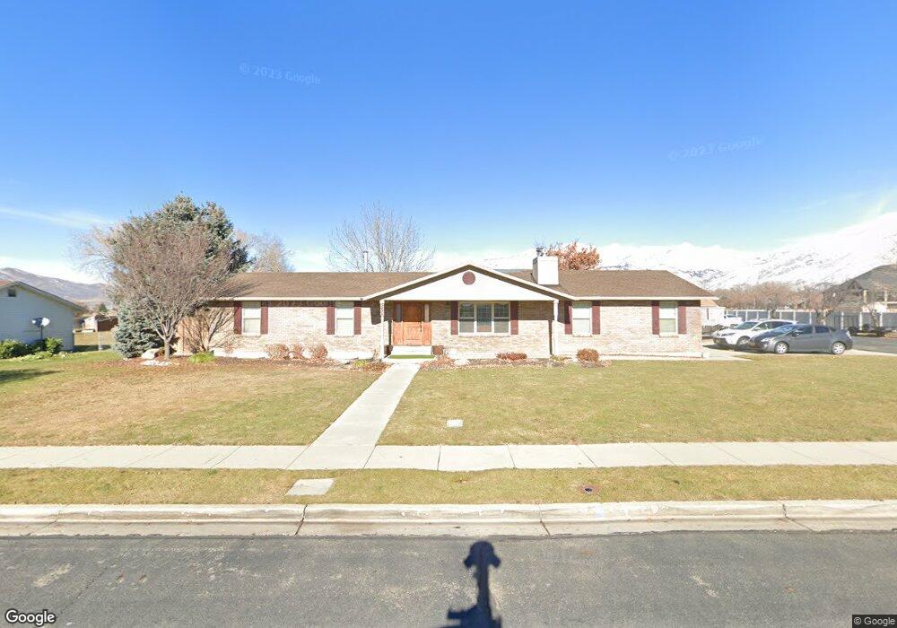
5488 W 10180 N Highland, UT 84003
Estimated Value: $713,000 - $773,419
5
Beds
3
Baths
3,068
Sq Ft
$244/Sq Ft
Est. Value
About This Home
This home is located at 5488 W 10180 N, Highland, UT 84003 and is currently estimated at $748,355, approximately $243 per square foot. 5488 W 10180 N is a home located in Utah County with nearby schools including Legacy Elementary School, Mountain Ridge Junior High School, and American Fork High School.
Ownership History
Date
Name
Owned For
Owner Type
Purchase Details
Closed on
Mar 1, 2005
Sold by
Hunsaker Greg Peter
Bought by
Hunsaker Greg Peter and Hunsaker Clifford Eugene
Current Estimated Value
Purchase Details
Closed on
Apr 27, 2001
Sold by
Hunsaker Gregory P and Hunsaker Liane K
Bought by
Hunsaker Greg P and Hunsaker Liane K
Home Financials for this Owner
Home Financials are based on the most recent Mortgage that was taken out on this home.
Original Mortgage
$147,300
Outstanding Balance
$54,554
Interest Rate
6.92%
Estimated Equity
$693,801
Purchase Details
Closed on
Jun 27, 1997
Sold by
Mcewen Gary N and Mcewen Lisa D
Bought by
Hunsaker Greg P and Hunsaker Liane K
Home Financials for this Owner
Home Financials are based on the most recent Mortgage that was taken out on this home.
Original Mortgage
$148,500
Interest Rate
7.91%
Create a Home Valuation Report for This Property
The Home Valuation Report is an in-depth analysis detailing your home's value as well as a comparison with similar homes in the area
Home Values in the Area
Average Home Value in this Area
Purchase History
| Date | Buyer | Sale Price | Title Company |
|---|---|---|---|
| Hunsaker Greg Peter | -- | Title West Title Company | |
| Hunsaker Greg P | -- | Meridian Title | |
| Hunsaker Greg P | -- | -- |
Source: Public Records
Mortgage History
| Date | Status | Borrower | Loan Amount |
|---|---|---|---|
| Open | Hunsaker Greg P | $147,300 | |
| Closed | Hunsaker Greg P | $148,500 |
Source: Public Records
Tax History
| Year | Tax Paid | Tax Assessment Tax Assessment Total Assessment is a certain percentage of the fair market value that is determined by local assessors to be the total taxable value of land and additions on the property. | Land | Improvement |
|---|---|---|---|---|
| 2025 | $3,071 | $395,670 | -- | -- |
| 2024 | $3,071 | $379,280 | $0 | $0 |
| 2023 | $2,961 | $394,515 | $0 | $0 |
| 2022 | $3,012 | $389,125 | $0 | $0 |
| 2021 | $2,619 | $504,000 | $194,800 | $309,200 |
| 2020 | $2,473 | $466,700 | $169,400 | $297,300 |
| 2019 | $2,212 | $436,700 | $169,400 | $267,300 |
| 2018 | $2,228 | $418,000 | $157,000 | $261,000 |
| 2017 | $1,624 | $162,690 | $0 | $0 |
| 2016 | $1,636 | $153,120 | $0 | $0 |
| 2015 | $1,593 | $146,300 | $0 | $0 |
| 2014 | -- | $126,940 | $0 | $0 |
Source: Public Records
Map
Nearby Homes
- 5378 W 10130 N
- 5537 W Kensington Cir
- 10197 N 5750 W
- 10507 N 5470 W
- 9796 N 5800 W
- Sonderborg Plan at Ridgeview - Scandia Cottages
- Murano Traditional Plan at Ridgeview - Estates
- Nyborg Plan at Ridgeview - Scandia Cottages
- Kronborg Plan at Ridgeview - Scandia Cottages
- McLean Farmhouse Plan at Ridgeview - Cottages
- Goteborg Plan at Ridgeview - Scandia Cottages
- 5093 W Crimson Oak Ln
- 5093 Crimson Oak Ln
- 5042 W Green Ash Ln
- 5034 W Green Ash Ln
- 4998 W Green Ash Ln
- 4992 W Green Ash Ln
- 5006 W Green Ash Ln
- 5056 W Green Ash Ln
- 1793 E Kern Mountain
- 5506 W 10180 N
- 5466 W 10180 N
- 5489 W 10180 N
- 5524 W 10180 N
- 5526 W 10180 N
- 5505 W 10180 N
- 10164 N 5480 W
- 5442 W 10180 N
- 5523 W 10180 N
- 5544 W 10180 N
- 5492 W 10130 N
- 10150 N 5480 W
- 5451 W 10180 N
- 5514 W 10130 N
- 5468 W 10130 N
- 5543 W 10180 N
- 5522 W 10130 N
- 5419 W Christie Ct Unit 4
- 5419 W Christie Ct
- 5422 W 10180 N
Your Personal Tour Guide
Ask me questions while you tour the home.