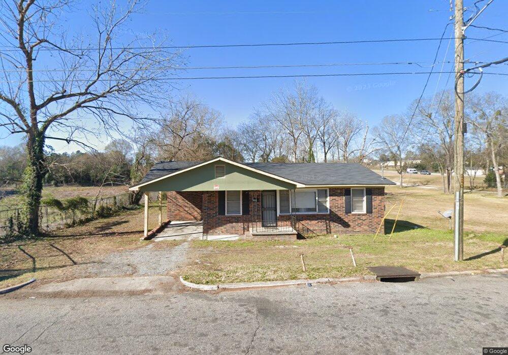
549 Key St Macon, GA 31204
Estimated Value: $67,000 - $83,000
2
Beds
1
Bath
1,076
Sq Ft
$68/Sq Ft
Est. Value
About This Home
This home is located at 549 Key St, Macon, GA 31204 and is currently estimated at $73,635, approximately $68 per square foot. 549 Key St is a home located in Bibb County with nearby schools including Hartley Elementary School, Southwest High School, and Cirrus Charter Academy.
Ownership History
Date
Name
Owned For
Owner Type
Purchase Details
Closed on
Mar 9, 2015
Sold by
Keanamland Developers Llc
Bought by
Jackson Moses
Current Estimated Value
Purchase Details
Closed on
Aug 28, 2006
Sold by
Oliver Betty P
Bought by
Keanamland Developers Llc
Home Financials for this Owner
Home Financials are based on the most recent Mortgage that was taken out on this home.
Original Mortgage
$31,500
Interest Rate
6.45%
Mortgage Type
Future Advance Clause Open End Mortgage
Create a Home Valuation Report for This Property
The Home Valuation Report is an in-depth analysis detailing your home's value as well as a comparison with similar homes in the area
Purchase History
| Date | Buyer | Sale Price | Title Company |
|---|---|---|---|
| Jackson Moses | $10,000 | None Available | |
| Keanamland Developers Llc | $42,000 | None Available | |
| Keanamland Developers Llc | $42,000 | None Available |
Source: Public Records
Mortgage History
| Date | Status | Borrower | Loan Amount |
|---|---|---|---|
| Previous Owner | Keanamland Developers Llc | $31,500 |
Source: Public Records
Tax History
| Year | Tax Paid | Tax Assessment Tax Assessment Total Assessment is a certain percentage of the fair market value that is determined by local assessors to be the total taxable value of land and additions on the property. | Land | Improvement |
|---|---|---|---|---|
| 2025 | $716 | $29,132 | $3,118 | $26,014 |
| 2024 | $729 | $28,698 | $3,118 | $25,580 |
| 2023 | $701 | $23,650 | $2,150 | $21,500 |
| 2022 | $355 | $10,255 | $2,241 | $8,014 |
| 2021 | $390 | $10,255 | $2,241 | $8,014 |
| 2020 | $398 | $10,255 | $2,241 | $8,014 |
| 2019 | $401 | $10,255 | $2,241 | $8,014 |
| 2018 | $795 | $10,255 | $2,241 | $8,014 |
| 2017 | $384 | $10,255 | $2,241 | $8,014 |
| 2016 | $138 | $7,064 | $2,241 | $4,822 |
| 2015 | $876 | $17,884 | $2,241 | $15,642 |
| 2014 | $1,007 | $17,884 | $2,241 | $15,642 |
Source: Public Records
Map
Nearby Homes
- 684 Sapp St
- 646 Straight St
- 736 Key St
- 284 Grosso Ave
- 1516 Berkner Ave
- 1511 Berkner Ave
- 800 Patton Ave
- 3045 Montpelier Place
- 391 Grosso Ave
- 3069 Montpelier Place
- 348 Hortman Ave
- 730 Grayson Ave
- 3083 Montpelier Place
- 815 Edwards Ave
- 742 Grayson Ave
- 1556 Wellworth Ave
- 1475 Berkner Ave
- 460 Daffodil St
- 1463 Berkner Ave
- 1458 Bailey Ave
- 689 Sapp St
- 3012 Mercer University Dr
- 677 Sapp St
- 651 Straight St
- 672 Sapp St
- 683 Straight St
- 669 Sapp St
- 668 Sapp St
- 657 Sapp St
- 2966 Mercer University Dr
- 664 Sapp St
- 688 Straight St
- 691 Straight St
- 678 Straight St
- 666 Straight St
- 639 Sapp St
- 2956 Mercer University Dr
- 3017 Mercer University Dr
- 627 Key St
- 3009 Mercer University Dr
Your Personal Tour Guide
Ask me questions while you tour the home.