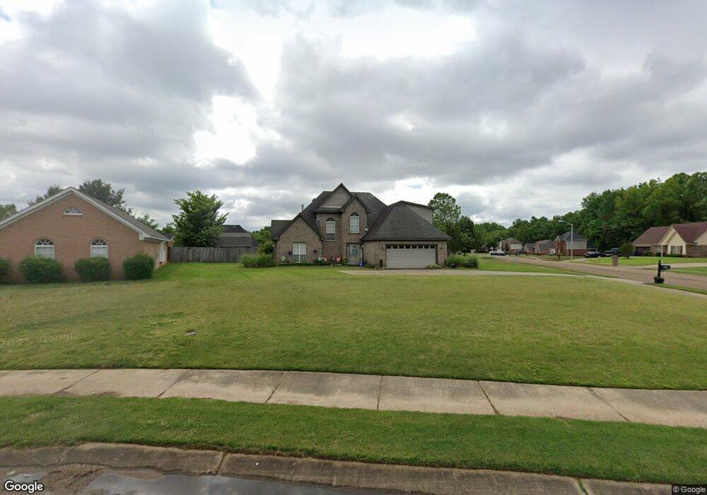
5492 Blocker St Olive Branch, MS 38654
Estimated Value: $278,000 - $307,000
4
Beds
3
Baths
2,183
Sq Ft
$133/Sq Ft
Est. Value
About This Home
This home is located at 5492 Blocker St, Olive Branch, MS 38654 and is currently estimated at $290,374, approximately $133 per square foot. 5492 Blocker St is a home located in DeSoto County with nearby schools including Chickasaw Elementary School, Olive Branch Middle School, and Olive Branch High School.
Ownership History
Date
Name
Owned For
Owner Type
Purchase Details
Closed on
Dec 29, 2010
Sold by
Scranton Steven J and Scranton Marian A
Bought by
Guy Brian E
Current Estimated Value
Home Financials for this Owner
Home Financials are based on the most recent Mortgage that was taken out on this home.
Original Mortgage
$151,295
Outstanding Balance
$101,356
Interest Rate
4.42%
Mortgage Type
New Conventional
Estimated Equity
$189,018
Create a Home Valuation Report for This Property
The Home Valuation Report is an in-depth analysis detailing your home's value as well as a comparison with similar homes in the area
Home Values in the Area
Average Home Value in this Area
Purchase History
| Date | Buyer | Sale Price | Title Company |
|---|---|---|---|
| Guy Brian E | -- | Multiple |
Source: Public Records
Mortgage History
| Date | Status | Borrower | Loan Amount |
|---|---|---|---|
| Open | Guy Brian E | $151,295 |
Source: Public Records
Tax History Compared to Growth
Tax History
| Year | Tax Paid | Tax Assessment Tax Assessment Total Assessment is a certain percentage of the fair market value that is determined by local assessors to be the total taxable value of land and additions on the property. | Land | Improvement |
|---|---|---|---|---|
| 2024 | $1,495 | $13,151 | $2,000 | $11,151 |
| 2023 | $1,495 | $13,151 | $0 | $0 |
| 2022 | $1,495 | $13,151 | $2,000 | $11,151 |
| 2021 | $1,495 | $13,151 | $2,000 | $11,151 |
| 2020 | $1,369 | $12,231 | $2,000 | $10,231 |
| 2019 | $1,369 | $12,231 | $2,000 | $10,231 |
| 2017 | $1,334 | $21,816 | $11,908 | $9,908 |
| 2016 | $1,409 | $12,458 | $2,000 | $10,458 |
| 2015 | $1,709 | $22,916 | $12,458 | $10,458 |
| 2014 | $1,409 | $12,458 | $0 | $0 |
| 2013 | $1,359 | $12,458 | $0 | $0 |
Source: Public Records
Map
Nearby Homes
- 5619 Eagleston Dr
- 2914 Cypress Lake Dr S
- 5841 Blocker St
- 5195 Mary Ln N
- 5806 Southbend Ln
- 9598 Nielsen Dr
- 0 Hacks Rd Unit 4132565
- 8754 Ln
- 9653 Trenton Trail
- 5427 Highway 305 N
- 5295 Blocker St
- 6032 Robby Cove
- 9821 Morgan Manor Dr
- 9635 Austin Dr
- 6180 Rd
- 9930 Sequoia Ln
- 9113 Rue Orleans Ln
- 9893 Cherokee Dr
- 9811 Cherokee Dr
- 7550 Old Highway 78
- 5634 Stone St
- 5635 Sparrow Run
- 5647 Sparrow Run
- 5611 Sparrow Run
- 5499 Blocker St
- 5646 Stone St
- 5487 Blocker St
- 5511 Blocker St
- 5475 Blocker St
- 5671 Sparrow Run
- 5540 Blocker St
- 5523 Blocker St
- 5658 Stone St
- 5683 Sparrow Run
- 5535 Blocker St
- 5445 Blocker St
- 5642 Sparrow Run
- 5630 Sparrow Run
- 5604 Sparrow Run
- 5616 Sparrow Run