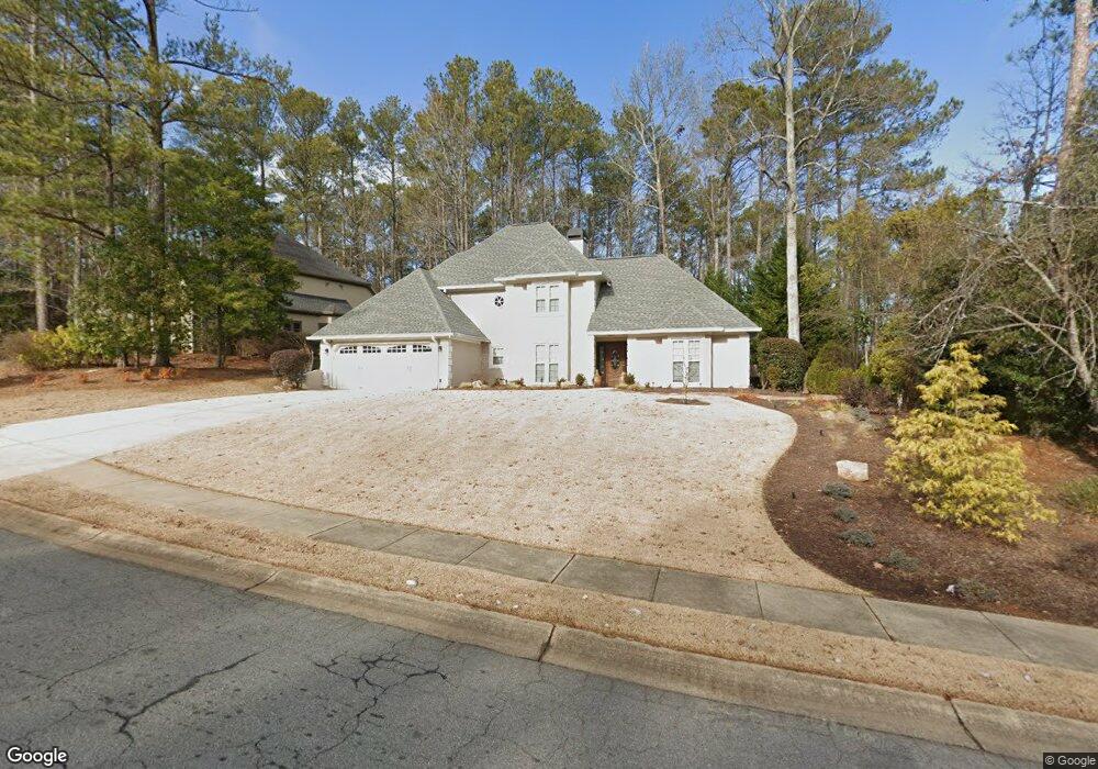
5492 Brookstone Dr NW Unit 1 Acworth, GA 30101
Estimated Value: $470,212 - $530,000
4
Beds
3
Baths
2,562
Sq Ft
$196/Sq Ft
Est. Value
About This Home
This home is located at 5492 Brookstone Dr NW Unit 1, Acworth, GA 30101 and is currently estimated at $502,303, approximately $196 per square foot. 5492 Brookstone Dr NW Unit 1 is a home located in Cobb County with nearby schools including Pickett's Mill Elementary School, Durham Middle School, and Allatoona High School.
Ownership History
Date
Name
Owned For
Owner Type
Purchase Details
Closed on
Apr 25, 2003
Sold by
Astles Ruby R
Bought by
Werren Marcus and Werren Laura
Current Estimated Value
Home Financials for this Owner
Home Financials are based on the most recent Mortgage that was taken out on this home.
Original Mortgage
$211,000
Interest Rate
5.56%
Mortgage Type
New Conventional
Purchase Details
Closed on
Jul 31, 1998
Sold by
Associates Relocation Mgmnt
Bought by
Astles Ruby R
Create a Home Valuation Report for This Property
The Home Valuation Report is an in-depth analysis detailing your home's value as well as a comparison with similar homes in the area
Home Values in the Area
Average Home Value in this Area
Purchase History
| Date | Buyer | Sale Price | Title Company |
|---|---|---|---|
| Werren Marcus | $212,500 | -- | |
| Astles Ruby R | $182,500 | -- | |
| Associates Relocation Mgmnt | $182,500 | -- |
Source: Public Records
Mortgage History
| Date | Status | Borrower | Loan Amount |
|---|---|---|---|
| Previous Owner | Werren Marcus | $211,000 | |
| Closed | Associates Relocation Mgmnt | -- |
Source: Public Records
Tax History Compared to Growth
Tax History
| Year | Tax Paid | Tax Assessment Tax Assessment Total Assessment is a certain percentage of the fair market value that is determined by local assessors to be the total taxable value of land and additions on the property. | Land | Improvement |
|---|---|---|---|---|
| 2025 | $4,479 | $184,668 | $52,000 | $132,668 |
| 2024 | $4,482 | $184,668 | $52,000 | $132,668 |
| 2023 | $3,127 | $147,216 | $34,000 | $113,216 |
| 2022 | $3,698 | $147,216 | $34,000 | $113,216 |
| 2021 | $2,933 | $112,308 | $34,000 | $78,308 |
| 2020 | $2,758 | $104,308 | $26,000 | $78,308 |
| 2019 | $2,758 | $104,308 | $26,000 | $78,308 |
| 2018 | $2,375 | $87,276 | $24,000 | $63,276 |
| 2017 | $2,253 | $87,276 | $24,000 | $63,276 |
| 2016 | $2,252 | $87,216 | $24,000 | $63,216 |
| 2015 | $2,197 | $83,428 | $24,000 | $59,428 |
| 2014 | $2,216 | $83,428 | $0 | $0 |
Source: Public Records
Map
Nearby Homes
- 5485 Brookstone Dr NW
- 1799 Mclain Rd NW
- 1963 Heatherbrooke Ln NW
- 5362 Manor View Dr NW Unit 12
- 5711 Brynwood Cir NW
- 5654 Brookstone Dr NW
- 2009 Mclain Rd NW
- 1364 Fallsbrook Way NW
- 5573 Fallsbrook Trace NW
- The Ashburn Plan at Woodford
- The Rebecca Plan at Woodford
- The Dillard Plan at Woodford
- The Oxford Plan at Woodford
- The Pinehurst Plan at Woodford
- The Trenton Plan at Woodford
- The Vinings Plan at Woodford
- The Bainbridge Plan at Woodford
- The Brooks Plan at Woodford
- The Evans Plan at Woodford
- 1314 Fallsbrook Terrace NW
- 5494 Brookstone Dr NW
- 1775 Brookstone Place NW
- 1777 Brookstone Place NW Unit 1
- 5496 Brookstone Dr NW
- 5497 Brookstone Dr NW
- 0 Brookstone Place NW
- 5493 Brookstone Dr NW
- 5495 Brookstone Dr NW
- 5499 Brookstone Dr NW
- 5491 Brookstone Dr NW Unit 1
- 0 Heatherbrooke Dr NW Unit 7509223
- 0 Heatherbrooke Dr NW Unit 7404408
- 0 Heatherbrooke Dr NW Unit 7397712
- 0 Heatherbrooke Dr NW Unit 7390211
- 0 Heatherbrooke Dr NW Unit 7358175
- 0 Heatherbrooke Dr NW Unit 7326518
- 0 Heatherbrooke Dr NW Unit 7215559
- 0 Heatherbrooke Dr NW Unit 7187544
- 0 Heatherbrooke Dr NW Unit 7186557
- 0 Heatherbrooke Dr NW Unit 8774667