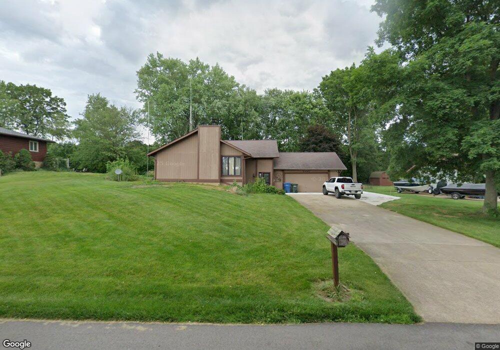
5497 Apple Ridge Cir Clinton, OH 44216
Estimated Value: $337,265 - $441,000
3
Beds
2
Baths
2,220
Sq Ft
$177/Sq Ft
Est. Value
About This Home
This home is located at 5497 Apple Ridge Cir, Clinton, OH 44216 and is currently estimated at $393,316, approximately $177 per square foot. 5497 Apple Ridge Cir is a home located in Summit County with nearby schools including Greenwood Elementary School, Green Intermediate Elementary School, and Green Primary School.
Ownership History
Date
Name
Owned For
Owner Type
Purchase Details
Closed on
Nov 13, 2008
Sold by
Hausch Gail William and Hausch Teresa Marie
Bought by
Storr William A
Current Estimated Value
Home Financials for this Owner
Home Financials are based on the most recent Mortgage that was taken out on this home.
Original Mortgage
$178,000
Interest Rate
6.09%
Mortgage Type
Purchase Money Mortgage
Create a Home Valuation Report for This Property
The Home Valuation Report is an in-depth analysis detailing your home's value as well as a comparison with similar homes in the area
Purchase History
| Date | Buyer | Sale Price | Title Company |
|---|---|---|---|
| Storr William A | $198,000 | Abby Title |
Source: Public Records
Mortgage History
| Date | Status | Borrower | Loan Amount |
|---|---|---|---|
| Closed | Storr William A | $178,000 |
Source: Public Records
Tax History
| Year | Tax Paid | Tax Assessment Tax Assessment Total Assessment is a certain percentage of the fair market value that is determined by local assessors to be the total taxable value of land and additions on the property. | Land | Improvement |
|---|---|---|---|---|
| 2024 | $4,608 | $98,413 | $15,862 | $82,551 |
| 2023 | $4,608 | $98,413 | $15,862 | $82,551 |
| 2022 | $3,727 | $71,537 | $11,494 | $60,043 |
| 2021 | $3,493 | $71,537 | $11,494 | $60,043 |
| 2020 | $3,425 | $71,530 | $11,490 | $60,040 |
| 2019 | $3,481 | $68,130 | $9,380 | $58,750 |
| 2018 | $3,559 | $68,130 | $9,380 | $58,750 |
| 2017 | $3,121 | $68,130 | $9,380 | $58,750 |
| 2016 | $3,105 | $56,090 | $9,380 | $46,710 |
| 2015 | $3,121 | $56,090 | $9,380 | $46,710 |
| 2014 | $3,100 | $56,090 | $9,380 | $46,710 |
| 2013 | $3,425 | $61,590 | $9,380 | $52,210 |
Source: Public Records
Map
Nearby Homes
- 5796 Starview Dr
- 0 S Arlington Rd Unit 4494606
- 1392 Koons Rd
- 5052 Timbercreek Cir
- 4995 Timbercreek Cir
- 5107 Fox Ridge Dr
- 810 Mount Pleasant St NW
- Roanoke Plan at Stoney Creek
- Columbia Plan at Stoney Creek
- Lehigh Plan at Stoney Creek
- Ballenger Plan at Stoney Creek
- 8069 Orchardway St NW
- 5135 Sheaters Dr
- 4586 Everhart Dr
- 259 Oak Dr NW
- 81 Cherry Dr NW
- 1499 King Dr
- 4710 Pinecrest Dr
- 115 Spruce Dr NW
- 4324 Evergreen Ct Unit 53
- 5485 Apple Ridge Cir
- 5509 Apple Ridge Cir
- 5473 Apple Ridge Cir
- 5516 Arlington Rd
- 5490 Apple Ridge Cir
- 5500 Apple Ridge Cir
- 5480 Apple Ridge Cir
- 5510 Apple Ridge Cir
- 5486 Arlington Rd Unit 5488
- 5526 Arlington Rd
- 5461 Apple Ridge Cir
- 5470 Apple Ridge Cir
- 5520 Apple Ridge Cir
- 5531 Apple Ridge Cir
- 5536 Arlington Rd
- 5464 Arlington Rd
- 5530 Apple Ridge Cir
- 5505 Arlington Rd
- 1105 Apple Ridge Rd
- 5493 Arlington Rd
Your Personal Tour Guide
Ask me questions while you tour the home.