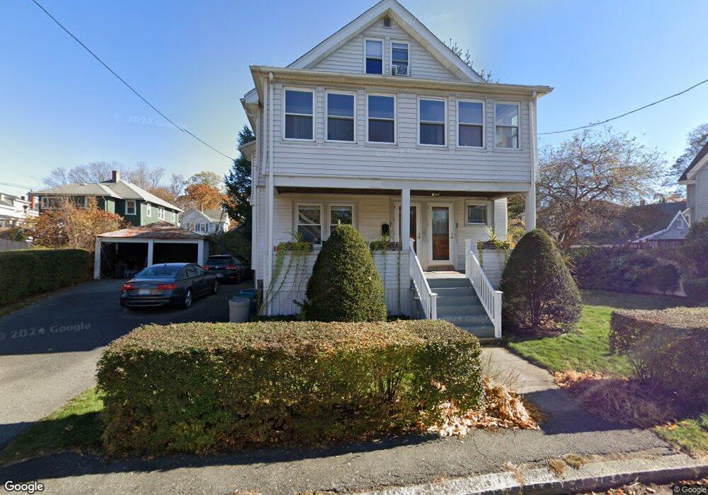
55-57 Leonard Rd Unit 1 Melrose, MA 02176
Downtown Melrose NeighborhoodEstimated Value: $967,000 - $1,000,000
2
Beds
1
Bath
2,424
Sq Ft
$406/Sq Ft
Est. Value
About This Home
This home is located at 55-57 Leonard Rd Unit 1, Melrose, MA 02176 and is currently estimated at $983,915, approximately $405 per square foot. 55-57 Leonard Rd Unit 1 is a home located in Middlesex County with nearby schools including Lincoln Elementary School, Winthrop Elementary School, and Horace Mann Elementary School.
Ownership History
Date
Name
Owned For
Owner Type
Purchase Details
Closed on
Jan 26, 1996
Sold by
Keshian James H and Keshian Elaine
Bought by
Okeefe Michael P
Current Estimated Value
Home Financials for this Owner
Home Financials are based on the most recent Mortgage that was taken out on this home.
Original Mortgage
$172,000
Outstanding Balance
$5,695
Interest Rate
7.13%
Mortgage Type
Purchase Money Mortgage
Estimated Equity
$978,220
Create a Home Valuation Report for This Property
The Home Valuation Report is an in-depth analysis detailing your home's value as well as a comparison with similar homes in the area
Home Values in the Area
Average Home Value in this Area
Purchase History
| Date | Buyer | Sale Price | Title Company |
|---|---|---|---|
| Okeefe Michael P | $215,000 | -- |
Source: Public Records
Mortgage History
| Date | Status | Borrower | Loan Amount |
|---|---|---|---|
| Open | Okeefe Michael P | $172,000 | |
| Open | Okeefe Michael P | $280,000 | |
| Previous Owner | Okeefe Michael P | $28,300 |
Source: Public Records
Tax History Compared to Growth
Tax History
| Year | Tax Paid | Tax Assessment Tax Assessment Total Assessment is a certain percentage of the fair market value that is determined by local assessors to be the total taxable value of land and additions on the property. | Land | Improvement |
|---|---|---|---|---|
| 2025 | $75 | $760,100 | $428,000 | $332,100 |
| 2024 | $7,086 | $713,600 | $400,400 | $313,200 |
| 2023 | $7,077 | $679,200 | $372,800 | $306,400 |
| 2022 | $6,923 | $655,000 | $359,000 | $296,000 |
| 2021 | $6,695 | $611,400 | $345,200 | $266,200 |
| 2020 | $6,413 | $580,400 | $317,500 | $262,900 |
| 2019 | $6,040 | $558,700 | $303,700 | $255,000 |
| 2018 | $5,647 | $498,400 | $252,000 | $246,400 |
| 2017 | $5,554 | $470,700 | $241,600 | $229,100 |
| 2016 | $5,144 | $417,200 | $214,000 | $203,200 |
| 2015 | $5,183 | $399,900 | $214,000 | $185,900 |
| 2014 | $5,081 | $382,600 | $196,700 | $185,900 |
Source: Public Records
Map
Nearby Homes
- 16-18 Beacon Place
- 58 Summer St
- 333 Main St
- 20 Herbert St
- 16 Willow St Unit 207
- 12 Mount Vernon St Unit 27
- 23 Waverly Place
- 36 Waverly Place Unit 2
- 447 Pleasant St
- 218 Upham St
- 407 Pleasant St Unit 1A
- 8 Crystal St Unit 3
- 8 Crystal St Unit 2
- 42 Fairfield Ave
- 16 Baxter St
- 12 Sylvan St Unit 4
- 12 Sylvan St Unit 3
- 22 Adams St
- 30 Wheeler Ave
- 6 Linden Rd