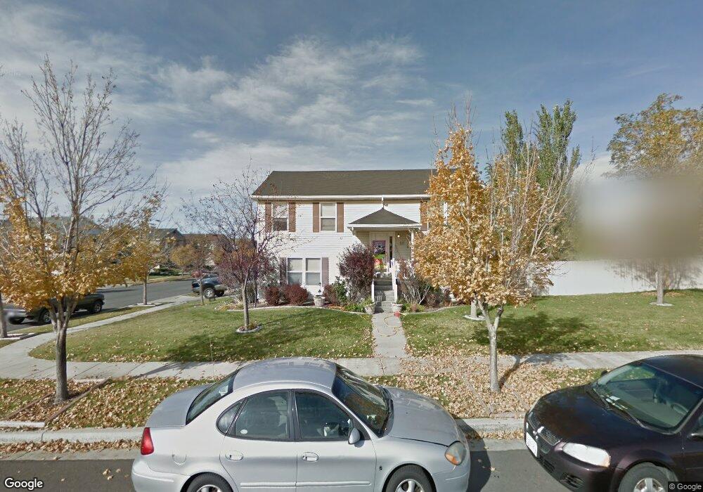
55 Aaron Dr Tooele, UT 84074
Estimated Value: $396,000 - $414,000
3
Beds
2
Baths
1,790
Sq Ft
$225/Sq Ft
Est. Value
About This Home
This home is located at 55 Aaron Dr, Tooele, UT 84074 and is currently estimated at $402,977, approximately $225 per square foot. 55 Aaron Dr is a home located in Tooele County with nearby schools including Overlake Elementary School, Clarke N. Johnsen Junior High School, and Stansbury High School.
Ownership History
Date
Name
Owned For
Owner Type
Purchase Details
Closed on
Apr 15, 2014
Sold by
Tucker Neldon Edward and Tucker Melissa L
Bought by
Craig Cody
Current Estimated Value
Home Financials for this Owner
Home Financials are based on the most recent Mortgage that was taken out on this home.
Original Mortgage
$161,122
Outstanding Balance
$121,973
Interest Rate
4.23%
Mortgage Type
New Conventional
Estimated Equity
$281,004
Purchase Details
Closed on
May 18, 2009
Sold by
Tucker Neldon Edward
Bought by
Tucker Neldon Edward and Tucker Melissa L
Home Financials for this Owner
Home Financials are based on the most recent Mortgage that was taken out on this home.
Original Mortgage
$134,500
Interest Rate
4.82%
Mortgage Type
New Conventional
Create a Home Valuation Report for This Property
The Home Valuation Report is an in-depth analysis detailing your home's value as well as a comparison with similar homes in the area
Purchase History
| Date | Buyer | Sale Price | Title Company |
|---|---|---|---|
| Craig Cody | -- | Inwest Title | |
| Tucker Neldon Edward | -- | Canyon View Title Insuranc | |
| Tucker Neldon Edward | -- | Canyon View Title Insurance |
Source: Public Records
Mortgage History
| Date | Status | Borrower | Loan Amount |
|---|---|---|---|
| Open | Craig Cody | $161,122 | |
| Previous Owner | Tucker Neldon Edward | $134,500 |
Source: Public Records
Tax History
| Year | Tax Paid | Tax Assessment Tax Assessment Total Assessment is a certain percentage of the fair market value that is determined by local assessors to be the total taxable value of land and additions on the property. | Land | Improvement |
|---|---|---|---|---|
| 2025 | $2,347 | $343,950 | $106,250 | $237,700 |
| 2024 | $2,560 | $189,271 | $58,438 | $130,833 |
| 2023 | $2,560 | $203,177 | $55,649 | $147,528 |
| 2022 | $2,537 | $209,602 | $68,723 | $140,879 |
| 2021 | $2,203 | $151,356 | $22,310 | $129,046 |
| 2020 | $2,067 | $250,053 | $40,563 | $209,490 |
| 2019 | $1,929 | $231,008 | $40,563 | $190,445 |
| 2018 | $1,549 | $176,496 | $30,000 | $146,496 |
| 2017 | $1,238 | $166,912 | $30,000 | $136,912 |
| 2016 | $1,145 | $85,304 | $11,000 | $74,304 |
| 2015 | $1,145 | $81,188 | $0 | $0 |
| 2014 | -- | $67,796 | $0 | $0 |
Source: Public Records
Map
Nearby Homes
- 1651 N 40 E
- 1742 N 80 E
- 78 E Broxburn Way
- 1782 Brett St
- 58 W 1570 N
- 182 Aparicio Dr
- 1245 N Clemente Way
- 88 Aparicio Dr
- 1428 Baen Way Unit 241
- 1893 N 70 W
- 1909 N 70 W
- 124 Ebbets Field
- 1558 Durocher Ln
- 179 Green Pines Ave
- 1416 N Harper Way Unit 216
- 244 W Crescent Ln N Unit 94
- 244 W Crescent Ln N Unit 95
- 244 W Crescent Ln N Unit 96
- 234 W Crescent Ln Unit 99
- 2042 N Essie Dr
- 1665 N 80 E
- 1672 N 40 E
- 1677 N 80 E
- 1628 N Baen Way
- 1635 N Brodric Ln Unit 103
- 1635 N Brodric Ln
- 1686 N 40 E
- 1691 N 80 E
- 1622 N Baen Way
- 1622 N Baen Way Unit 224
- 1625 N Brodric Ln
- 1698 N 40 E
- 1663 N 40 E
- 1668 N 80 E
- 1678 N Boggs St
- 1678 N 80 E
- 1621 N Baen Way
- 1612 Baen Way Unit 225
- 1615 N Brodric Ln Unit 105
- 1705 80 E
Your Personal Tour Guide
Ask me questions while you tour the home.