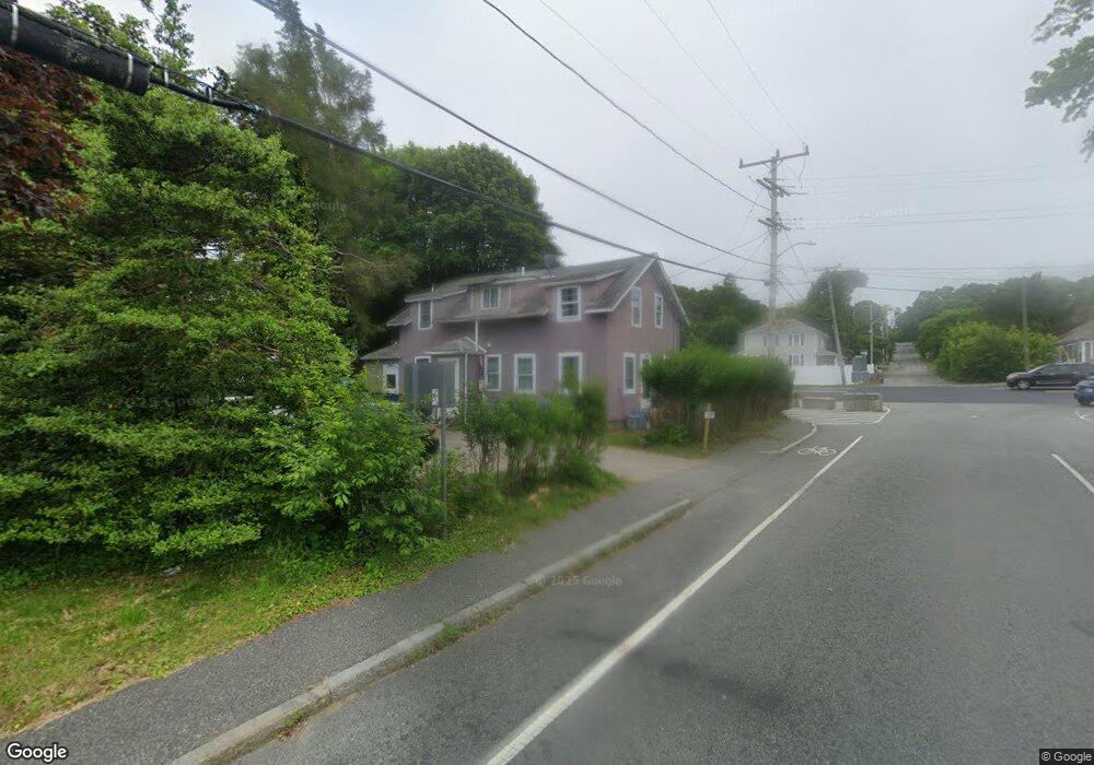
55 Adams St Bourne, MA 2532
Estimated Value: $344,000 - $595,000
4
Beds
2
Baths
1,632
Sq Ft
$282/Sq Ft
Est. Value
About This Home
This home is located at 55 Adams St, Bourne, MA 2532 and is currently estimated at $460,788, approximately $282 per square foot. 55 Adams St is a home located in Barnstable County with nearby schools including Bourne High School, Bridgeview Montessori School, and Waldorf School of Cape Cod.
Ownership History
Date
Name
Owned For
Owner Type
Purchase Details
Closed on
Jun 30, 2021
Sold by
Kam Rt and Mccarthy
Bought by
Chamney Erica V
Current Estimated Value
Home Financials for this Owner
Home Financials are based on the most recent Mortgage that was taken out on this home.
Original Mortgage
$255,290
Outstanding Balance
$230,629
Interest Rate
2.9%
Mortgage Type
FHA
Estimated Equity
$230,159
Purchase Details
Closed on
Oct 29, 2012
Sold by
Mccarthy Kevin
Bought by
Kam Rt and Mccarthy
Purchase Details
Closed on
Mar 5, 2010
Sold by
Archambeault Jayme M and Archambeault James M
Bought by
Mccarthy Kevin
Home Financials for this Owner
Home Financials are based on the most recent Mortgage that was taken out on this home.
Original Mortgage
$150,000
Interest Rate
5%
Mortgage Type
Purchase Money Mortgage
Create a Home Valuation Report for This Property
The Home Valuation Report is an in-depth analysis detailing your home's value as well as a comparison with similar homes in the area
Home Values in the Area
Average Home Value in this Area
Purchase History
| Date | Buyer | Sale Price | Title Company |
|---|---|---|---|
| Chamney Erica V | $260,000 | None Available | |
| Chamney Erica V | $260,000 | None Available | |
| Kam Rt | -- | -- | |
| Kam Rt | -- | -- | |
| Mccarthy Kevin | $200,000 | -- | |
| Mccarthy Kevin | $200,000 | -- | |
| Mccarthy Kevin | $200,000 | -- |
Source: Public Records
Mortgage History
| Date | Status | Borrower | Loan Amount |
|---|---|---|---|
| Open | Chamney Erica V | $255,290 | |
| Closed | Chamney Erica V | $255,290 | |
| Previous Owner | Mccarthy Kevin | $150,000 |
Source: Public Records
Tax History Compared to Growth
Tax History
| Year | Tax Paid | Tax Assessment Tax Assessment Total Assessment is a certain percentage of the fair market value that is determined by local assessors to be the total taxable value of land and additions on the property. | Land | Improvement |
|---|---|---|---|---|
| 2025 | $3,229 | $413,500 | $158,200 | $255,300 |
| 2024 | $3,158 | $393,800 | $150,700 | $243,100 |
| 2023 | $3,070 | $348,500 | $133,400 | $215,100 |
| 2022 | $3,052 | $302,500 | $118,000 | $184,500 |
| 2021 | $2,654 | $246,400 | $107,400 | $139,000 |
| 2020 | $2,653 | $247,000 | $106,400 | $140,600 |
| 2019 | $2,536 | $241,300 | $106,400 | $134,900 |
| 2018 | $2,444 | $231,900 | $101,300 | $130,600 |
| 2017 | $2,388 | $231,800 | $100,400 | $131,400 |
| 2016 | $2,333 | $229,600 | $100,400 | $129,200 |
| 2015 | $2,199 | $218,400 | $89,200 | $129,200 |
Source: Public Records
Map
Nearby Homes
- 33 Buzzards Bay Ave
- 51 Commonwealth Ave
- 51 Commonwealth Ave
- 6 Louis Ave
- 4 Bittersweet Ln Unit 4
- 4 Fieldwood Dr
- 2 Dogwood Rd Unit 2
- 2 Dogwood Rd
- 4 Fieldwood Dr
- 15 Route 6a
- 38 Siasconset Dr
- 42 Siasconset Dr
- 18 Ocean Pines Dr Unit A
- 150 Herring Pond Rd
- 5 Candlewood Dr
- 0 State Rd
- 5 Oakwood Dr
- 18 Heather Hill Rd
- 133 Phillips Rd
- 10 Tecumseh Rd
- 45 Adams St
- 45 Adams St
- 0 Adams St
- 45 Adams St
- 44 Adams St
- 39 Adams St
- 73 Cranberry Hwy
- 73 Cranberry Rd
- 6 Commonwealth Ave
- 38 Adams St
- 8 Commonwealth Ave
- 59 Adams St
- 8 Commonwealth Ave
- 79 Cranberry Rd
- 79 Cranberry Rd
- 79 Cranberry Hwy
- 58 Adams St
- 83 Cranberry Rd
- 83 Cranberry Rd Unit year round
- 83 Cranberry Rd