Estimated Value: $350,000 - $632,000
4
Beds
3
Baths
2,260
Sq Ft
$212/Sq Ft
Est. Value
About This Home
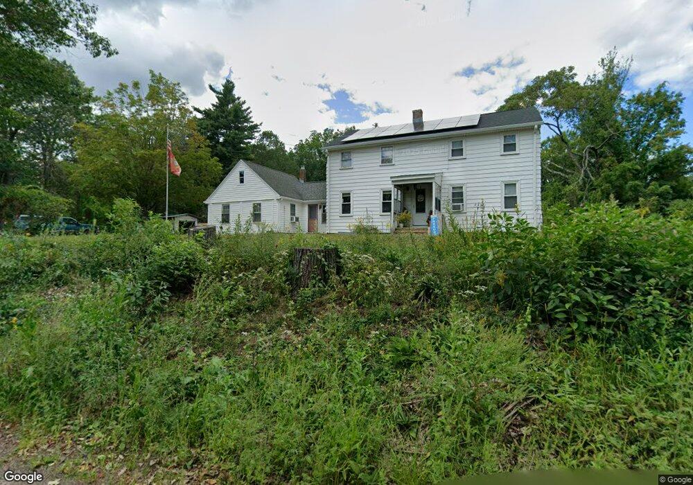
This home is located at 55 Bernhardt Rd, Ashby, MA 01431 and is currently estimated at $479,236, approximately $212 per square foot. 55 Bernhardt Rd is a home located in Middlesex County with nearby schools including North Middlesex Regional High School.
Ownership History
Date
Name
Owned For
Owner Type
Purchase Details
Closed on
Oct 26, 2004
Sold by
Johnson Eleanor I and Johnson Garnett C
Bought by
Johnson Daniel W and Johnson Sheryl Ann
Current Estimated Value
Create a Home Valuation Report for This Property
The Home Valuation Report is an in-depth analysis detailing your home's value as well as a comparison with similar homes in the area
Home Values in the Area
Average Home Value in this Area
Purchase History
| Date | Buyer | Sale Price | Title Company |
|---|---|---|---|
| Johnson Daniel W | -- | -- |
Source: Public Records
Tax History
| Year | Tax Paid | Tax Assessment Tax Assessment Total Assessment is a certain percentage of the fair market value that is determined by local assessors to be the total taxable value of land and additions on the property. | Land | Improvement |
|---|---|---|---|---|
| 2025 | $4,345 | $285,300 | $67,200 | $218,100 |
| 2024 | $4,050 | $260,800 | $64,800 | $196,000 |
| 2023 | $3,859 | $235,000 | $60,000 | $175,000 |
| 2022 | $3,694 | $208,800 | $68,000 | $140,800 |
| 2021 | $15,464 | $173,300 | $68,000 | $105,300 |
| 2020 | $0 | $166,900 | $68,000 | $98,900 |
| 2019 | $3,594 | $163,900 | $68,000 | $95,900 |
| 2018 | $3,149 | $156,100 | $54,400 | $101,700 |
| 2017 | $3,037 | $145,800 | $50,400 | $95,400 |
| 2016 | $2,931 | $145,800 | $50,400 | $95,400 |
| 2015 | $2,869 | $145,800 | $50,400 | $95,400 |
| 2014 | $2,632 | $137,800 | $50,400 | $87,400 |
Source: Public Records
Map
Nearby Homes
- 2 W Meadow Rd
- 1 W Meadow Rd
- 86 W Elm Lunenburg Rd Blood Rd
- 531 Mason Rd
- 1578 Greenville Rd
- 632 Main St
- 662 Main St
- 44.5 Allen Rd
- 149 New Ipswich Rd
- 0 Tract of Land Unit 73451879
- 804 Main St
- 66 New Ipswich Rd
- 0 Frost Rd
- 74 Wright Rd
- 9 Kaneohe Ct
- 600 New Ipswich Rd
- 544 South Rd
- 90 Log Cabin Rd
- Lot 3 Old Northfield Rd
- 137 Deer Bay Rd
- 1074 Foster Rd
- 70 Bernhardt Rd
- 79 Bernhardt Rd
- 18 Bernhardt Rd
- 603 Wheeler Rd
- 1058 Foster Rd
- 1068 Turnpike Rd
- 1071 Foster Rd
- 1034 Turnpike Rd
- 40 Wheeler Rd
- 1053 Turnpike Rd
- 1041 Turnpike Rd
- 1065 Turnpike Rd
- 1033 Turnpike Rd
- 1031 Foster Rd
- 1031 Foster Rd Unit Rd
- 1006 Foster Rd
- 994 Turnpike Rd
- 30 Wheeler Rd
- 169 Bernhardt Rd
Your Personal Tour Guide
Ask me questions while you tour the home.