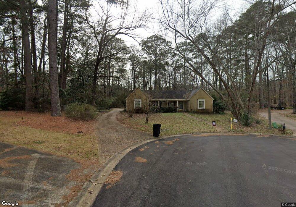
55 Briar Ct Brandon, MS 39042
Estimated Value: $261,893 - $289,000
3
Beds
2
Baths
2,071
Sq Ft
$132/Sq Ft
Est. Value
About This Home
This home is located at 55 Briar Ct, Brandon, MS 39042 and is currently estimated at $272,723, approximately $131 per square foot. 55 Briar Ct is a home located in Rankin County with nearby schools including Rouse Elementary School, Brandon Elementary School, and Stonebridge Elementary School.
Ownership History
Date
Name
Owned For
Owner Type
Purchase Details
Closed on
Aug 17, 2009
Sold by
Robert F Robert F and Dearie Pamela G
Bought by
Cartus Financial Corporation
Current Estimated Value
Purchase Details
Closed on
May 29, 2009
Bought by
Nnix John Wayne and Fuller Jeanette Ann
Home Financials for this Owner
Home Financials are based on the most recent Mortgage that was taken out on this home.
Original Mortgage
$194,904
Interest Rate
5.05%
Mortgage Type
New Conventional
Create a Home Valuation Report for This Property
The Home Valuation Report is an in-depth analysis detailing your home's value as well as a comparison with similar homes in the area
Home Values in the Area
Average Home Value in this Area
Purchase History
| Date | Buyer | Sale Price | Title Company |
|---|---|---|---|
| Cartus Financial Corporation | -- | -- | |
| Nnix John Wayne | -- | -- |
Source: Public Records
Mortgage History
| Date | Status | Borrower | Loan Amount |
|---|---|---|---|
| Previous Owner | Nnix John Wayne | $194,904 |
Source: Public Records
Tax History
| Year | Tax Paid | Tax Assessment Tax Assessment Total Assessment is a certain percentage of the fair market value that is determined by local assessors to be the total taxable value of land and additions on the property. | Land | Improvement |
|---|---|---|---|---|
| 2025 | $1,910 | $16,699 | $0 | $0 |
| 2024 | $1,880 | $16,699 | $0 | $0 |
| 2023 | $1,695 | $14,133 | $0 | $0 |
| 2022 | $1,673 | $14,133 | $0 | $0 |
| 2021 | $1,673 | $14,133 | $0 | $0 |
| 2020 | $1,673 | $14,133 | $0 | $0 |
| 2019 | $1,525 | $12,713 | $0 | $0 |
| 2018 | $1,500 | $12,713 | $0 | $0 |
| 2017 | $1,500 | $12,713 | $0 | $0 |
| 2016 | $1,341 | $12,341 | $0 | $0 |
| 2015 | $1,341 | $12,341 | $0 | $0 |
| 2014 | $1,314 | $12,341 | $0 | $0 |
| 2013 | -- | $12,341 | $0 | $0 |
Source: Public Records
Map
Nearby Homes
- 69 Summit Ridge Dr
- 1228 Crossview Ct
- 123 Woodgate Dr
- 177 Woodgate Dr
- 122 Woodgate Dr
- 146 Forest Ridge Dr
- 501 Asbury Lane Dr
- 92 Fern Valley Rd
- 100 Fairdale Place
- 45 Stonegate Dr
- 0 Quail Hill Rd Unit 4137695
- 43 Stonegate Dr
- 0 Asbury Lane Dr Unit 4124886
- 204 Village Place
- 705 Heartwood Ln
- 104 Shelby Mae Cir
- 36 Pebble Hill Dr
- 29 Stonegate Dr
- 132 Pleasant Grove Dr
- 1012 Stonehendge Dr
Your Personal Tour Guide
Ask me questions while you tour the home.